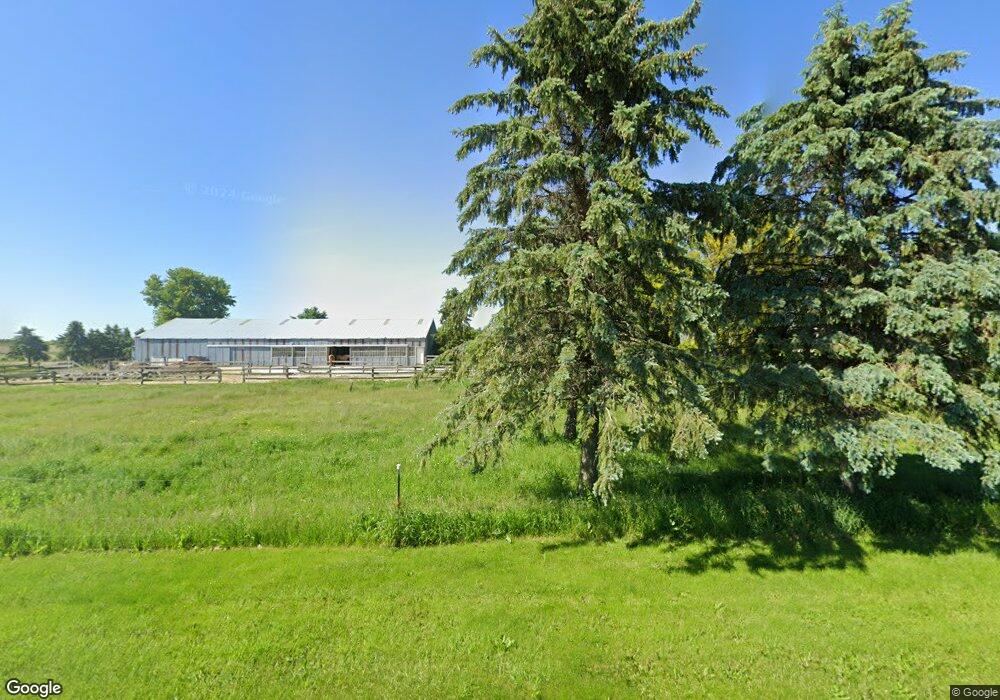
W1950 Rock Rd Iron Ridge, WI 53035
Estimated Value: $329,000 - $452,000
--
Bed
--
Bath
--
Sq Ft
5
Acres
About This Home
This home is located at W1950 Rock Rd, Iron Ridge, WI 53035 and is currently estimated at $383,577. W1950 Rock Rd is a home located in Dodge County with nearby schools including Hartford High School.
Ownership History
Date
Name
Owned For
Owner Type
Purchase Details
Closed on
Oct 6, 2004
Sold by
Pfaff Wendy and Pfaff Wendy N
Bought by
Pfaff Aaron K
Current Estimated Value
Home Financials for this Owner
Home Financials are based on the most recent Mortgage that was taken out on this home.
Original Mortgage
$30,000
Interest Rate
6.49%
Mortgage Type
New Conventional
Create a Home Valuation Report for This Property
The Home Valuation Report is an in-depth analysis detailing your home's value as well as a comparison with similar homes in the area
Home Values in the Area
Average Home Value in this Area
Purchase History
| Date | Buyer | Sale Price | Title Company |
|---|---|---|---|
| Pfaff Aaron K | -- | -- |
Source: Public Records
Mortgage History
| Date | Status | Borrower | Loan Amount |
|---|---|---|---|
| Closed | Pfaff Aaron K | $30,000 |
Source: Public Records
Tax History Compared to Growth
Tax History
| Year | Tax Paid | Tax Assessment Tax Assessment Total Assessment is a certain percentage of the fair market value that is determined by local assessors to be the total taxable value of land and additions on the property. | Land | Improvement |
|---|---|---|---|---|
| 2024 | $3,497 | $232,800 | $73,300 | $159,500 |
| 2023 | $3,124 | $232,800 | $73,300 | $159,500 |
| 2022 | $3,224 | $232,800 | $73,300 | $159,500 |
| 2021 | $3,354 | $232,800 | $73,300 | $159,500 |
| 2020 | $3,432 | $232,800 | $73,300 | $159,500 |
| 2019 | $3,506 | $232,800 | $73,300 | $159,500 |
| 2018 | $3,442 | $232,800 | $73,300 | $159,500 |
| 2017 | $3,635 | $235,500 | $73,300 | $162,200 |
| 2016 | $3,517 | $235,500 | $73,300 | $162,200 |
| 2015 | $3,781 | $235,500 | $73,300 | $162,200 |
| 2014 | $4,113 | $235,500 | $73,300 | $162,200 |
Source: Public Records
Map
Nearby Homes
- Lt0 E Neda Rd
- 234 Watertower Cir
- 202 East Ave
- 0 Burkwald Ave
- N5413 County Rd S
- N7575 Doyle Rd
- Lt1 Hi View Ct
- 725 Green Bay Dr
- Montrose Manor Plan at Grandview Heights
- Isabelle II Plan at Grandview Heights
- Simen Plan at Grandview Heights
- Sarah III Plan at Grandview Heights
- Balmore II Plan at Grandview Heights
- Edinburgh Plan at Grandview Heights
- 502 Janssen Ave
- 274 S Walnut St
- N6436 County Road Tw
- Lt2 S Clark St
- Lt13 Eagle View Dr
- Lt1 Eagle View Dr
- Lt2 Rock Rd
- W1687 Rock Rd
- W1880 Rock Rd
- W1872 Rock Rd
- W1829 Rock Rd
- N6455 County Road Ay
- N6565 County Road Ay
- N6352 County Road Ay
- W1755 Rock Rd
- N6495 Pierce Rd
- N6254 County Road Ay
- N6602 Pierce Rd
- N6364 Pierce Rd
- W1757 State Road 33
- N6703 County Road Ay
- W1753 State Road 33
- W1852 W Iowa Rd
- N6275 Pierce Rd
- W1821 State Road 33
- N6241 Pierce Rd