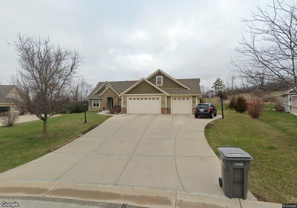
W210S8275 Fireside Ct Muskego, WI 53150
Estimated Value: $556,000 - $701,000
3
Beds
2
Baths
2,146
Sq Ft
$303/Sq Ft
Est. Value
About This Home
This home is located at W210S8275 Fireside Ct, Muskego, WI 53150 and is currently estimated at $649,512, approximately $302 per square foot. W210S8275 Fireside Ct is a home with nearby schools including Mill Valley Elementary School, Muskego Lakes Middle School, and Creative and Performing Arts.
Ownership History
Date
Name
Owned For
Owner Type
Purchase Details
Closed on
Feb 22, 2013
Sold by
Hansen Paula R and Weber Lynn M
Bought by
Tom Jonathan
Current Estimated Value
Purchase Details
Closed on
Oct 27, 2010
Sold by
Location 3 Corp
Bought by
Zalewski Gregory H and Zalewski Debra M
Purchase Details
Closed on
Jun 4, 2002
Sold by
Hess Oscar R
Bought by
Hansen Paula R and Weber Lynn M
Create a Home Valuation Report for This Property
The Home Valuation Report is an in-depth analysis detailing your home's value as well as a comparison with similar homes in the area
Home Values in the Area
Average Home Value in this Area
Purchase History
| Date | Buyer | Sale Price | Title Company |
|---|---|---|---|
| Tom Jonathan | $168,000 | None Available | |
| Zalewski Gregory H | $80,000 | None Available | |
| Hansen Paula R | -- | -- | |
| Hess Oscar R | -- | -- |
Source: Public Records
Tax History Compared to Growth
Tax History
| Year | Tax Paid | Tax Assessment Tax Assessment Total Assessment is a certain percentage of the fair market value that is determined by local assessors to be the total taxable value of land and additions on the property. | Land | Improvement |
|---|---|---|---|---|
| 2024 | $5,707 | $492,200 | $120,100 | $372,100 |
| 2023 | $5,647 | $492,200 | $120,100 | $372,100 |
| 2022 | $5,509 | $492,200 | $120,100 | $372,100 |
| 2021 | $5,467 | $492,200 | $120,100 | $372,100 |
| 2020 | $5,921 | $420,000 | $104,600 | $315,400 |
| 2019 | $5,890 | $420,000 | $104,600 | $315,400 |
| 2018 | $5,952 | $420,000 | $104,600 | $315,400 |
| 2017 | $5,919 | $420,000 | $104,600 | $315,400 |
| 2016 | $6,348 | $399,200 | $99,100 | $300,100 |
| 2015 | $6,397 | $399,200 | $99,100 | $300,100 |
| 2014 | $6,965 | $399,200 | $99,100 | $300,100 |
| 2013 | $6,965 | $399,200 | $99,100 | $300,100 |
Source: Public Records
Map
Nearby Homes
- S82W21018 Fireside Dr
- W210S8293 Fireside Ct
- S82W21013 Fireside Dr
- S82W21010 Fireside Dr
- W210S8321 Fireside Ct
- S82W21005 Fireside Dr
- W210S8322 Fireside Ct
- S82W21002 Fireside Dr
- W210S8349 Fireside Ct
- W210S8346 Fireside Ct
- W210S8357 Fireside Ct
- W210S8354 Fireside Ct
- S81W20871 Russet Ct
- S81W20871 Russett Ct
- S82W20901 Fireside Dr
- W208S8369 Hillendale Dr
- W208S8307 Hillendale Dr
- W208S8285 Hillendale Dr
- Lt 4 Russet Ct
- Lt 6 Russet Ct