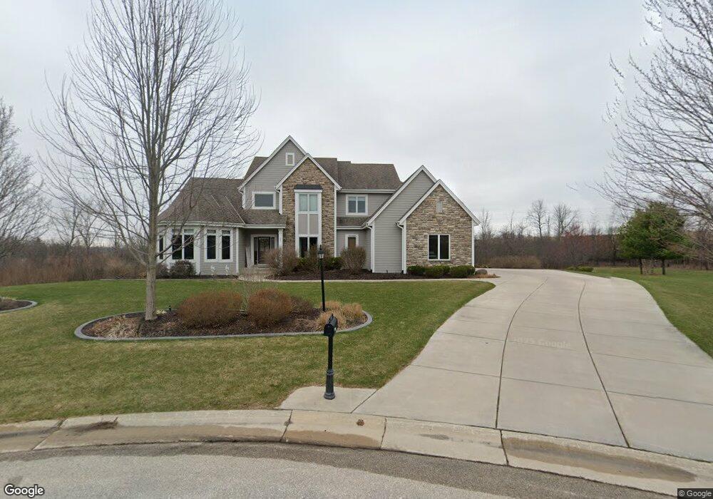
W210S8357 Fireside Ct Muskego, WI 53150
Estimated Value: $726,900 - $818,000
4
Beds
3
Baths
2,789
Sq Ft
$270/Sq Ft
Est. Value
About This Home
This home is located at W210S8357 Fireside Ct, Muskego, WI 53150 and is currently estimated at $754,225, approximately $270 per square foot. W210S8357 Fireside Ct is a home located in Waukesha County with nearby schools including Mill Valley Elementary School, Muskego Lakes Middle School, and Creative and Performing Arts.
Ownership History
Date
Name
Owned For
Owner Type
Purchase Details
Closed on
Sep 28, 2007
Sold by
Location3 Corp
Bought by
Zabkowicz John D and Zabkowicz Rachel L
Current Estimated Value
Home Financials for this Owner
Home Financials are based on the most recent Mortgage that was taken out on this home.
Original Mortgage
$450,000
Interest Rate
6.62%
Mortgage Type
Construction
Create a Home Valuation Report for This Property
The Home Valuation Report is an in-depth analysis detailing your home's value as well as a comparison with similar homes in the area
Home Values in the Area
Average Home Value in this Area
Purchase History
| Date | Buyer | Sale Price | Title Company |
|---|---|---|---|
| Zabkowicz John D | $98,900 | Land Title Services Inc |
Source: Public Records
Mortgage History
| Date | Status | Borrower | Loan Amount |
|---|---|---|---|
| Previous Owner | Zabkowicz John D | $450,000 |
Source: Public Records
Tax History Compared to Growth
Tax History
| Year | Tax Paid | Tax Assessment Tax Assessment Total Assessment is a certain percentage of the fair market value that is determined by local assessors to be the total taxable value of land and additions on the property. | Land | Improvement |
|---|---|---|---|---|
| 2024 | $5,957 | $513,000 | $121,400 | $391,600 |
| 2023 | $5,897 | $513,000 | $121,400 | $391,600 |
| 2022 | $5,751 | $513,000 | $121,400 | $391,600 |
| 2021 | $5,590 | $502,800 | $121,400 | $381,400 |
| 2020 | $6,415 | $453,900 | $105,700 | $348,200 |
| 2019 | $6,384 | $453,900 | $105,700 | $348,200 |
| 2018 | $6,450 | $453,900 | $105,700 | $348,200 |
| 2017 | $6,411 | $453,900 | $105,700 | $348,200 |
| 2016 | $6,527 | $410,100 | $100,100 | $310,000 |
| 2015 | $6,577 | $410,100 | $100,100 | $310,000 |
| 2014 | $7,129 | $410,100 | $100,100 | $310,000 |
| 2013 | $7,129 | $408,300 | $100,100 | $308,200 |
Source: Public Records
Map
Nearby Homes
- W210S8349 Fireside Ct
- W210S8354 Fireside Ct
- W210S8321 Fireside Ct
- W210S8346 Fireside Ct
- W210S8322 Fireside Ct
- W210S8293 Fireside Ct
- S82W21013 Fireside Dr
- S82W21005 Fireside Dr
- W210S8275 Fireside Ct
- W208S8369 Hillendale Dr
- S82W21018 Fireside Dr
- S84W20884 Janesville Rd
- S82W21010 Fireside Dr
- S82W21002 Fireside Dr
- S84W20858 Janesville Rd
- S82W20901 Fireside Dr
- W208S8381 Hillendale Dr
- W208S8357 Hillendale Dr
- W208S8343 Hillendale Dr
- W208S8307 Hillendale Dr