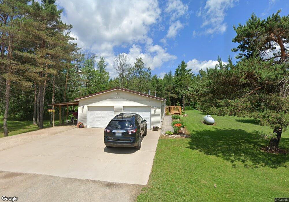
W2238 Old Highway 2 41 Wilson, MI 49896
Estimated Value: $220,657 - $291,000
3
Beds
2
Baths
1,568
Sq Ft
$167/Sq Ft
Est. Value
About This Home
This home is located at W2238 Old Highway 2 41, Wilson, MI 49896 and is currently estimated at $261,886, approximately $167 per square foot. W2238 Old Highway 2 41 is a home located in Menominee County with nearby schools including North Central Elementary School and North Central Area Junior/Senior High School.
Ownership History
Date
Name
Owned For
Owner Type
Purchase Details
Closed on
Sep 7, 2012
Sold by
Parrish Evangelina
Bought by
Deno Tyler R
Current Estimated Value
Purchase Details
Closed on
Sep 14, 2010
Sold by
Parrish Eva
Bought by
Parrish Eva
Purchase Details
Closed on
Jun 1, 2009
Sold by
Parrish Arnold C and Parrish Sharon M
Bought by
Parrish Evangelina
Purchase Details
Closed on
May 5, 2009
Sold by
Parrish Arnold C and Parrish Sharon M
Bought by
Parrish Evangelina
Create a Home Valuation Report for This Property
The Home Valuation Report is an in-depth analysis detailing your home's value as well as a comparison with similar homes in the area
Home Values in the Area
Average Home Value in this Area
Purchase History
| Date | Buyer | Sale Price | Title Company |
|---|---|---|---|
| Deno Tyler R | $100 | -- | |
| Parrish Eva | -- | -- | |
| Parrish Evangelina | $100 | -- | |
| Parrish Evangelina | -- | -- |
Source: Public Records
Tax History Compared to Growth
Tax History
| Year | Tax Paid | Tax Assessment Tax Assessment Total Assessment is a certain percentage of the fair market value that is determined by local assessors to be the total taxable value of land and additions on the property. | Land | Improvement |
|---|---|---|---|---|
| 2025 | $1,345 | $87,500 | $2,700 | $84,800 |
| 2024 | $1,161 | $76,000 | $3,400 | $72,600 |
| 2023 | $450 | $60,042 | $60,042 | $0 |
| 2022 | $450 | $60,042 | $60,042 | $0 |
| 2021 | $450 | $54,200 | $3,100 | $51,100 |
| 2020 | $450 | $59,225 | $0 | $0 |
| 2019 | -- | $43,565 | $0 | $0 |
| 2018 | -- | $53,740 | $53,740 | $0 |
| 2017 | -- | $54,116 | $54,116 | $0 |
| 2016 | -- | $52,234 | $0 | $0 |
| 2015 | -- | $52,234 | $0 | $0 |
| 2014 | -- | $44,978 | $44,978 | $0 |
| 2013 | $450 | $44,978 | $0 | $0 |
Source: Public Records
Map
Nearby Homes
- W3657 Greenwood Ave
- N16072 Maple St
- TBD E Labelle Rd
- 3930 E East Rd Rd
- N11962 29 60 Ln
- 703 Michigan Ave
- 4047 D Rd
- 4484 D 15
- 3549 D Rd
- W3711 Co 380 Rd
- 3143 D Rd
- W699 State Highway M-69 G30 Rd
- W715 Rd
- 0 Vega Road O 1
- W5783 Co 388 Rd
- 1907 17th Rd
- W3966 #32 Rd
- 18856 Vega Rd
- W2813 3-1 Ln
- N17375 County Road 579
- W2238 Old Hwy 2 & Us41
- W2224 Old Highway 2 41
- W2282 Old Us2&41
- W2198 Old Highway 2 41
- W2282 Old Highway 2 41
- W2172 Old Highway 2 41
- W2227 Us Highway 2 41
- W2288 Old Highway 2 41
- N16500 Vincent Lane F 3
- W2288 Old Highway 2 41
- N16331 Trout Pond Lane F 2
- N16404 Vincent Ln
- N16335 D-Road
- W2295 Us Highway 2 41
- N16410 Vincent Lane F 3
- W2306 Old Highway 2 41
- W2160 Old Highway 2 41
- W2160 Old Highway 2 41
- W2160 Old Highway 2 41
- N16315 Trout Pond Lane F 2