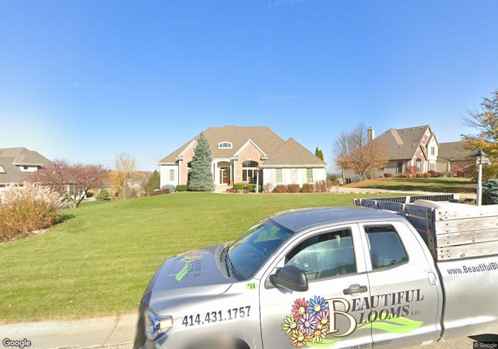
W226N3564 Wethersfield Rd Pewaukee, WI 53072
Estimated Value: $732,000 - $1,003,000
--
Bed
--
Bath
--
Sq Ft
0.51
Acres
About This Home
This home is located at W226N3564 Wethersfield Rd, Pewaukee, WI 53072 and is currently estimated at $924,649. W226N3564 Wethersfield Rd is a home located in Waukesha County with nearby schools including Pewaukee Lake Elementary School, Asa Clark Middle School, and Pewaukee High School.
Ownership History
Date
Name
Owned For
Owner Type
Purchase Details
Closed on
Aug 9, 2019
Sold by
Brennan John M and Brennan Judith E
Bought by
Winkle Gregory N Van and Vanwinkle Mariann Van
Current Estimated Value
Purchase Details
Closed on
Jan 18, 2006
Sold by
Schnettler Kurt N and Schnettler Kathleen M
Bought by
Brennan John M and Brennan Judith E
Purchase Details
Closed on
Feb 22, 2002
Sold by
Rawski James J and Rawski Diane L
Bought by
Schnettler Kurt N and Schnettler Kathleen M
Purchase Details
Closed on
Dec 22, 1999
Sold by
Siepmann Development Co Ltd Partnership
Bought by
Bodus Patrick A and Bodus Brenda L
Home Financials for this Owner
Home Financials are based on the most recent Mortgage that was taken out on this home.
Original Mortgage
$68,800
Interest Rate
7.89%
Mortgage Type
Purchase Money Mortgage
Create a Home Valuation Report for This Property
The Home Valuation Report is an in-depth analysis detailing your home's value as well as a comparison with similar homes in the area
Home Values in the Area
Average Home Value in this Area
Purchase History
| Date | Buyer | Sale Price | Title Company |
|---|---|---|---|
| Winkle Gregory N Van | $675,000 | None Available | |
| Brennan John M | $645,000 | None Available | |
| Schnettler Kurt N | $105,000 | -- | |
| Bodus Patrick A | $86,000 | -- |
Source: Public Records
Mortgage History
| Date | Status | Borrower | Loan Amount |
|---|---|---|---|
| Previous Owner | Bodus Patrick A | $68,800 |
Source: Public Records
Tax History Compared to Growth
Tax History
| Year | Tax Paid | Tax Assessment Tax Assessment Total Assessment is a certain percentage of the fair market value that is determined by local assessors to be the total taxable value of land and additions on the property. | Land | Improvement |
|---|---|---|---|---|
| 2024 | $7,978 | $684,300 | $156,200 | $528,100 |
| 2023 | $7,957 | $684,300 | $156,200 | $528,100 |
| 2022 | $8,254 | $684,300 | $156,200 | $528,100 |
| 2021 | $8,224 | $684,300 | $156,200 | $528,100 |
| 2020 | $8,655 | $579,000 | $134,400 | $444,600 |
| 2019 | $8,446 | $579,000 | $134,400 | $444,600 |
| 2018 | $8,400 | $579,000 | $134,400 | $444,600 |
| 2017 | $9,366 | $579,000 | $134,400 | $444,600 |
| 2016 | $8,663 | $579,000 | $134,400 | $444,600 |
| 2015 | $8,769 | $579,000 | $134,400 | $444,600 |
| 2014 | $9,269 | $579,000 | $134,400 | $444,600 |
| 2013 | $9,269 | $579,000 | $134,400 | $444,600 |
Source: Public Records
Map
Nearby Homes
- W229N3655 Sterling Ct
- N42W22833 Beacon Ct
- W233N3088 Oakmont Ct E Unit B
- N28W22352 Foxwood Ln
- 21445 Gumina Rd
- N35W23701 Auburn Ct Unit 1
- W221N4524 Timber Dr
- N26W22577 Oakwood Ln
- W220N4551 Timber Dr
- W220N4599 Timber Dr
- W220N4600 Timber Dr
- W220N4606 Timber Dr
- 2550 Harmony Cir
- N48W21601 Martha Ln
- N48W21629 Martha Ln
- N48W21577 Martha Ln
- W215N4855 Kathleen Dr
- 21710 Astolat Dr
- W215N4905 Kathleen Dr
- W214N4894 Casey Ct
- W226N3598 Wethersfield Rd
- W226N3548 Wethersfield Rd
- W226N3612 Wethersfield Rd
- W226N3563 Wethersfield Rd
- W226N3559 Wethersfield Rd
- W227N3575 Wethersfield Rd
- W226N3551 Wethersfield Rd
- W227N3587 Wethersfield Rd
- W225N3536 Wethersfield Rd
- W227N3601 Wethersfield Rd
- N36W22641 Long Valley Rd
- N36W22615 Long Valley Rd
- W226N3660 Wethersfield Rd
- N36W22663 Long Valley Rd
- N35W22498 Capitol Dr
- W227N3647 Wethersfield Rd
- N36W22591 Long Valley Rd
- W225N3524 Wethersfield Rd
- W227N3596 Wyndemere Ct
- W227N3554 Wyndemere Ct