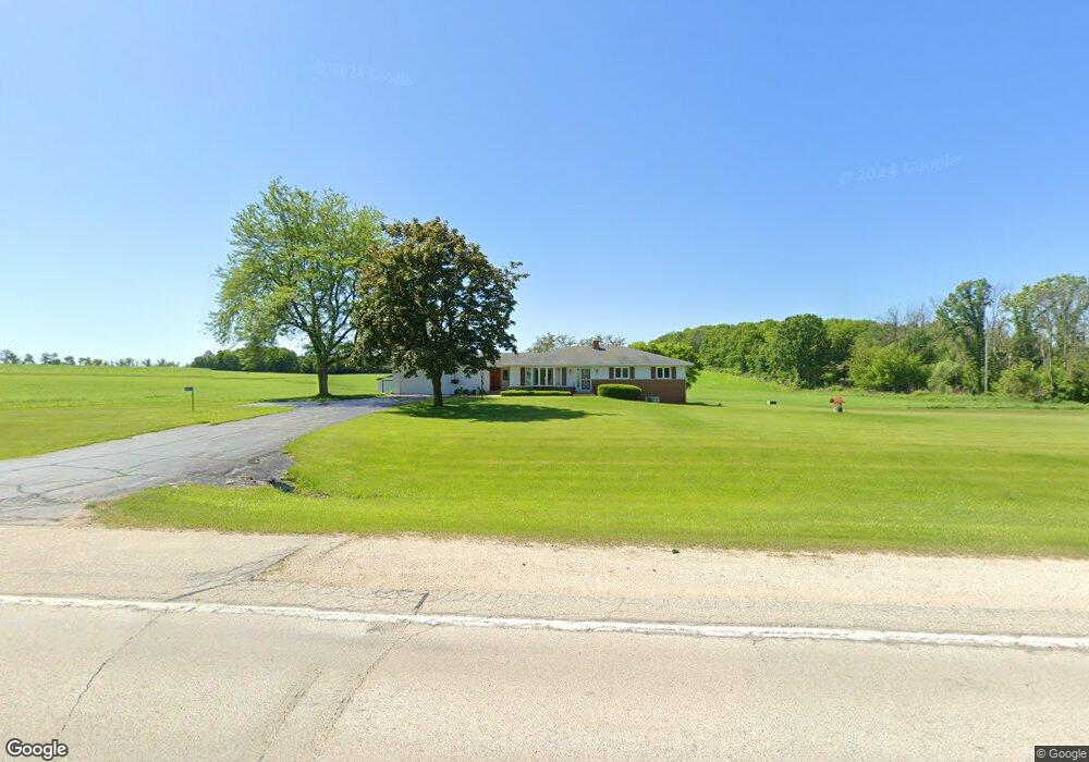
W2277 State Road 67 28 Mayville, WI 53050
Estimated Value: $404,537 - $504,000
--
Bed
--
Bath
--
Sq Ft
2
Acres
About This Home
This home is located at W2277 State Road 67 28, Mayville, WI 53050 and is currently estimated at $440,179. W2277 State Road 67 28 is a home with nearby schools including Parkview Elementary School, Mayville Elementary School, and Mayville Junior/Senior High School.
Ownership History
Date
Name
Owned For
Owner Type
Purchase Details
Closed on
May 27, 2025
Sold by
Reuben R Pribnow R and Reuben Arlene A
Bought by
Pribnow Randall and Pribnow Anita
Current Estimated Value
Purchase Details
Closed on
May 19, 2025
Sold by
Reuben R Pribnow R and Reuben Arlene A
Bought by
Da12 Properties Llc
Purchase Details
Closed on
May 12, 2021
Sold by
Arlene A Pribnow Family Trust and Pribnow Fmtr Arlene
Bought by
Da12 Properties Llc
Home Financials for this Owner
Home Financials are based on the most recent Mortgage that was taken out on this home.
Original Mortgage
$472,000
Interest Rate
3.1%
Mortgage Type
New Conventional
Purchase Details
Closed on
Apr 14, 2010
Sold by
Pribnow Reuben R and Pribnow Arlene A
Bought by
Pribnow Reuben R and Fa Arlene A Pribnow
Create a Home Valuation Report for This Property
The Home Valuation Report is an in-depth analysis detailing your home's value as well as a comparison with similar homes in the area
Home Values in the Area
Average Home Value in this Area
Purchase History
| Date | Buyer | Sale Price | Title Company |
|---|---|---|---|
| Pribnow Randall | $400,000 | Guaranty Title | |
| Da12 Properties Llc | $3,500 | None Listed On Document | |
| Da12 Properties Llc | $415,000 | Schuessler Thomas | |
| Pribnow Reuben R | -- | None Available |
Source: Public Records
Mortgage History
| Date | Status | Borrower | Loan Amount |
|---|---|---|---|
| Previous Owner | Da12 Properties Llc | $472,000 |
Source: Public Records
Tax History Compared to Growth
Tax History
| Year | Tax Paid | Tax Assessment Tax Assessment Total Assessment is a certain percentage of the fair market value that is determined by local assessors to be the total taxable value of land and additions on the property. | Land | Improvement |
|---|---|---|---|---|
| 2024 | $4,455 | $248,800 | $36,900 | $211,900 |
| 2023 | $3,819 | $248,800 | $36,900 | $211,900 |
| 2022 | $3,819 | $248,800 | $36,900 | $211,900 |
| 2021 | $4,261 | $257,200 | $45,300 | $211,900 |
| 2020 | $4,172 | $257,200 | $45,300 | $211,900 |
| 2019 | $4,169 | $256,800 | $44,900 | $211,900 |
| 2018 | $4,587 | $241,100 | $47,000 | $194,100 |
| 2017 | $4,844 | $241,100 | $47,000 | $194,100 |
| 2016 | $4,352 | $241,100 | $47,000 | $194,100 |
| 2015 | $4,779 | $241,100 | $47,000 | $194,100 |
| 2014 | $4,811 | $241,100 | $47,000 | $194,100 |
Source: Public Records
Map
Nearby Homes
- 117 Taylor St
- Lt1 Hi View Ct
- 329 Grove St
- 274 S Walnut St
- 725 Green Bay Dr
- 502 Janssen Ave
- 1155 Breckenridge St
- 326 Brookside Dr Unit 6
- 318 Brookside Dr Unit 1
- Lt2 S Clark St
- 306 S Milwaukee St
- 337 S Menomonee St
- N10035 N Bluemound Rd
- 206 Forest St
- 601 Sycamore Place
- N9234 Dohrman Rd
- Montrose Manor Plan at Grandview Heights
- Isabelle II Plan at Grandview Heights
- Simen Plan at Grandview Heights
- Sarah III Plan at Grandview Heights
- W2274 State Road 67 28
- W2300 State Road 28 & 67
- W2303 State Road 67 28
- W2244 State Road 67 28
- W2203 State Road 67 28
- W2220 Hwy 28 & 67
- N8936 County Road Wt
- N8938 County Road Wt
- W2139 State Road 67 28
- W2431 State Road 67 28
- N9000 Kamrath Rd
- N9000 Kamrath Rd Unit N9000
- W2093 State Road 67 28
- W2081 State Road 67 28
- N9094 County Road Wt
- W2071 State Road 67 28
- N8990 Sunnyview Rd
- W2408 Mcarthur Rd
- W2002 State Road 67 28
- W2410 Mcarthur Rd