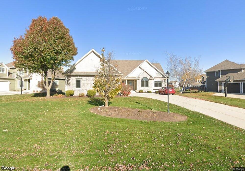
W243N2732 Single Tree Dr Pewaukee, WI 53072
Estimated Value: $707,426 - $903,000
Studio
--
Bath
--
Sq Ft
13,939
Sq Ft Lot
About This Home
This home is located at W243N2732 Single Tree Dr, Pewaukee, WI 53072 and is currently estimated at $819,142. W243N2732 Single Tree Dr is a home located in Waukesha County with nearby schools including Pewaukee Lake Elementary School, Asa Clark Middle School, and Pewaukee High School.
Ownership History
Date
Name
Owned For
Owner Type
Purchase Details
Closed on
Oct 3, 2022
Sold by
Eisenhardt Gregg B and Eisenhardt Christina A
Bought by
Gregg B Eisenhardt B and Gregg Christina A
Current Estimated Value
Purchase Details
Closed on
Jun 22, 2006
Sold by
Mcdonald Morgan P
Bought by
Eisenhardt Gregg B and Eisenhardt Christina A
Home Financials for this Owner
Home Financials are based on the most recent Mortgage that was taken out on this home.
Original Mortgage
$95,000
Interest Rate
7.25%
Mortgage Type
Purchase Money Mortgage
Purchase Details
Closed on
Apr 25, 2005
Sold by
Creekside Preserve Llc
Bought by
Mcdonald Morgan P
Home Financials for this Owner
Home Financials are based on the most recent Mortgage that was taken out on this home.
Original Mortgage
$408,800
Interest Rate
6.06%
Mortgage Type
Purchase Money Mortgage
Create a Home Valuation Report for This Property
The Home Valuation Report is an in-depth analysis detailing your home's value as well as a comparison with similar homes in the area
Home Values in the Area
Average Home Value in this Area
Purchase History
| Date | Buyer | Sale Price | Title Company |
|---|---|---|---|
| Gregg B Eisenhardt B | -- | None Listed On Document | |
| Eisenhardt Gregg B | $508,000 | None Available | |
| Mcdonald Morgan P | $124,000 | -- |
Source: Public Records
Mortgage History
| Date | Status | Borrower | Loan Amount |
|---|---|---|---|
| Previous Owner | Eisenhardt Gregg B | $95,000 | |
| Previous Owner | Mcdonald Morgan P | $408,800 |
Source: Public Records
Tax History
| Year | Tax Paid | Tax Assessment Tax Assessment Total Assessment is a certain percentage of the fair market value that is determined by local assessors to be the total taxable value of land and additions on the property. | Land | Improvement |
|---|---|---|---|---|
| 2024 | $6,142 | $515,600 | $153,700 | $361,900 |
| 2023 | $6,153 | $515,600 | $153,700 | $361,900 |
| 2022 | $6,372 | $515,600 | $153,700 | $361,900 |
| 2021 | $7,179 | $515,600 | $153,700 | $361,900 |
| 2020 | $6,692 | $440,400 | $115,700 | $324,700 |
| 2019 | $6,552 | $440,400 | $115,700 | $324,700 |
Source: Public Records
Map
Nearby Homes
- N28W24239 Watertown Rd
- W241N2507 E Parkway Meadow Cir Unit 6
- N24W24050 Brandon Oaks Dr Unit A
- W240N2532 E Parkway Meadow Cir Unit 5
- W240N2524 E Parkway Meadow Cir Unit 5
- 1013 Waterstone Ct
- 1044 Waterstone Ct
- 1106 Oxbow Ct
- N22 W24122 Cloister Cir Unit 5 E
- N28W25285 Parkway Ridge Cir Unit C
- N21W24202 Cumberland Dr Unit 23 I
- W240N2192 Dorchester Dr Unit 10A
- N21W24045 Garden Cir Unit F
- N28W25285 Madeline Blvd Unit A Bldg 14 Unit 52
- 359 Lexington Ct Unit B
- W248N2151 Kettle Cove Ct
- 809 Ridgeway Dr
- W251N2413 Valleyview Cir
- W251N2437 Valleyview Cir
- W251N2371 Valleyview Cir
- W243N2736 Single Tree Dr
- N27W24340 Single Tree Dr
- W243N2725 Creekside Dr
- W244N2748 Single Tree Dr
- W242N2731 N Single Tree Dr
- W243N2731 Single Tree Dr
- W243N2719 Creekside Ct
- W244N2750 Single Tree Dr
- W243N2727 Creekside Dr
- W244N2733 Single Tree Dr
- W243N2720 Creekside Ct
- W244N2739 Single Tree Dr
- W244N2758 Single Tree Dr
- W244N2737 Single Tree Dr
- W245N2741 Single Tree Dr
- W243N2715 Creekside Ct
- W245N2749 Single Tree Dr
- W243N2728 Creekside Dr
- W243N2716 Creekside Ct
- N28W24329 Single Tree Ct
Your Personal Tour Guide
Ask me questions while you tour the home.