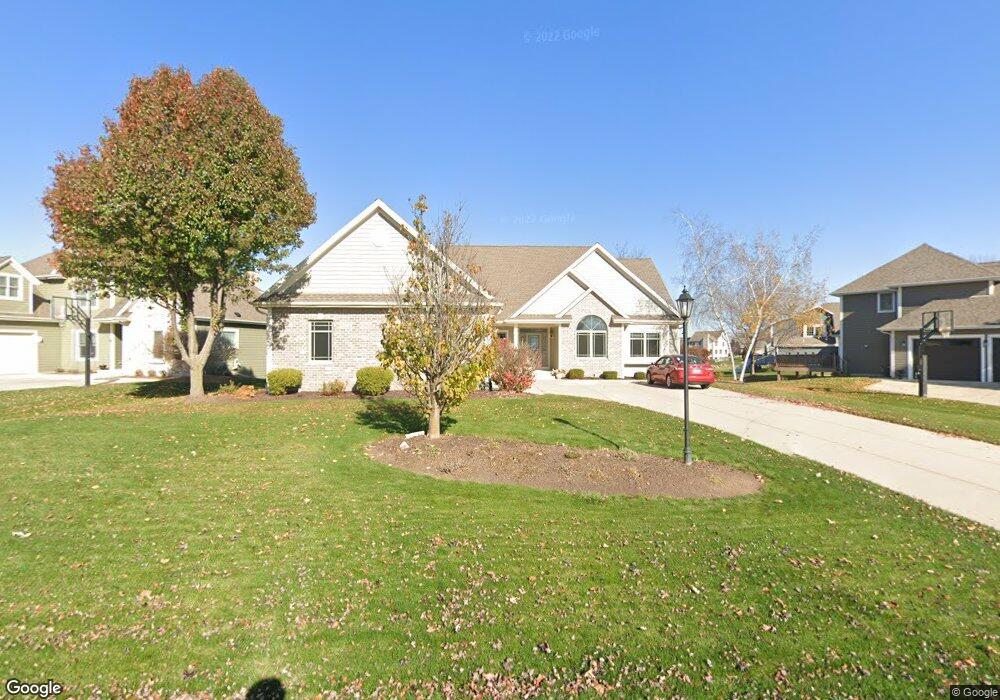
W243N2732 Single Tree Dr Pewaukee, WI 53072
Pewaukee AreaEstimated Value: $738,314 - $914,000
About This Home
This home is located at W243N2732 Single Tree Dr, Pewaukee, WI 53072 and is currently estimated at $837,079. W243N2732 Single Tree Dr is a home located in Waukesha County with nearby schools including Pewaukee Lake Elementary School, Horizon Elementary School, and Asa Clark Middle School.
Ownership History
We collect this data history from publicly available records. To have your information removed, we recommend requesting removal directly through your county’s website.
Purchase Details
Purchase Details
Home Financials for this Owner
Home Financials are based on the most recent Mortgage that was taken out on this home.Purchase Details
Home Financials for this Owner
Home Financials are based on the most recent Mortgage that was taken out on this home.Home Values in the Area
Average Home Value in this Area
Purchase History
We collect this data history from publicly available records. To have your information removed, we recommend requesting removal directly through your county’s website.
| Date | Buyer | Sale Price | Title Company |
|---|---|---|---|
| -- | None Listed On Document | ||
| $508,000 | None Available | ||
| $124,000 | -- |
Mortgage History
We collect this data history from publicly available records. To have your information removed, we recommend requesting removal directly through your county’s website.
| Date | Status | Borrower | Loan Amount |
|---|---|---|---|
| Previous Owner | $95,000 | ||
| Previous Owner | $408,800 |
Tax History
We collect this data history from publicly available records. To have your information removed, we recommend requesting removal directly through your county’s website.
| Year | Tax Paid | Tax Assessment Tax Assessment Total Assessment is a certain percentage of the fair market value that is determined by local assessors to be the total taxable value of land and additions on the property. | Land | Improvement |
|---|---|---|---|---|
| 2025 | $6,123 | $659,800 | $173,400 | $486,400 |
| 2024 | $6,142 | $515,600 | $153,700 | $361,900 |
| 2023 | $6,153 | $515,600 | $153,700 | $361,900 |
| 2022 | $6,372 | $515,600 | $153,700 | $361,900 |
| 2021 | $7,179 | $515,600 | $153,700 | $361,900 |
| 2020 | $6,692 | $440,400 | $115,700 | $324,700 |
| 2019 | $6,552 | $440,400 | $115,700 | $324,700 |
| 2018 | $6,129 | $440,400 | $115,700 | $324,700 |
| 2017 | $6,238 | $440,400 | $115,700 | $324,700 |
| 2016 | $6,332 | $440,400 | $115,700 | $324,700 |
| 2015 | $6,410 | $440,400 | $115,700 | $324,700 |
| 2014 | $7,001 | $440,400 | $115,700 | $324,700 |
| 2013 | $7,001 | $440,400 | $115,700 | $324,700 |
Map
- W245N2799 Single Tree Dr
- W241N2533 E Parkway Meadow Cir Unit 2
- W240N2550 E Parkway Meadow Cir Unit 2
- W240N2365 E Parkway Meadow Cir Unit A
- 1044 Waterstone Ct
- 1106 Oxbow Ct
- N28W25172 Parkway Ridge Cir Unit B
- W243N2205 Deer Park Ct Unit B
- 1031 Waterstone Ct
- 1360 Meadowcreek Dr Unit F
- N28W25285 Parkway Ridge Cir Unit C
- 250 Morris St
- W251N2437 Valleyview Cir
- W251N2399 Valleyview Cir
- W251N2385 Valleyview Cir
- W251N2469 Valleyview Cir
- W251N2371 Valleyview Cir
- W251N2459 Valleyview Cir
- W251N2413 Valleyview Cir
- N30W23511 Greenfield Ct
- W243N2736 Single Tree Dr
- N27W24340 Single Tree Dr
- W243N2725 Creekside Dr
- W244N2748 Single Tree Dr
- W242N2731 N Single Tree Dr
- W243N2731 Single Tree Dr
- W243N2719 Creekside Ct
- W244N2750 Single Tree Dr
- W243N2727 Creekside Dr
- W244N2733 Single Tree Dr
- W243N2720 Creekside Ct
- W244N2739 Single Tree Dr
- W244N2758 Single Tree Dr
- W244N2737 Single Tree Dr
- W245N2741 Single Tree Dr
- W243N2715 Creekside Ct
- W245N2749 Single Tree Dr
- W243N2728 Creekside Dr
- W243N2716 Creekside Ct
- N28W24329 Single Tree Ct
Ask me questions while you tour the home.