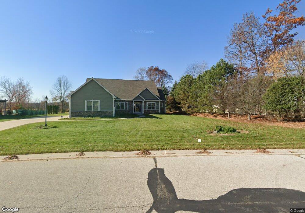
W245N2799 Single Tree Dr Pewaukee, WI 53072
Estimated Value: $731,000 - $808,000
--
Bed
--
Bath
--
Sq Ft
0.62
Acres
About This Home
This home is located at W245N2799 Single Tree Dr, Pewaukee, WI 53072 and is currently estimated at $757,548. W245N2799 Single Tree Dr is a home with nearby schools including Pewaukee Lake Elementary School, Asa Clark Middle School, and Pewaukee High School.
Ownership History
Date
Name
Owned For
Owner Type
Purchase Details
Closed on
Mar 31, 2017
Sold by
Luedke Lee A and Luedke Jennifer A
Bought by
Roberson Richard and Roberson Barbara A
Current Estimated Value
Home Financials for this Owner
Home Financials are based on the most recent Mortgage that was taken out on this home.
Original Mortgage
$422,422
Outstanding Balance
$351,037
Interest Rate
4.16%
Mortgage Type
VA
Estimated Equity
$406,511
Create a Home Valuation Report for This Property
The Home Valuation Report is an in-depth analysis detailing your home's value as well as a comparison with similar homes in the area
Home Values in the Area
Average Home Value in this Area
Purchase History
| Date | Buyer | Sale Price | Title Company |
|---|---|---|---|
| Roberson Richard | $415,000 | None Available |
Source: Public Records
Mortgage History
| Date | Status | Borrower | Loan Amount |
|---|---|---|---|
| Open | Roberson Richard | $422,422 |
Source: Public Records
Tax History Compared to Growth
Tax History
| Year | Tax Paid | Tax Assessment Tax Assessment Total Assessment is a certain percentage of the fair market value that is determined by local assessors to be the total taxable value of land and additions on the property. | Land | Improvement |
|---|---|---|---|---|
| 2024 | $6,052 | $524,200 | $144,800 | $379,400 |
| 2023 | $6,027 | $524,200 | $144,800 | $379,400 |
| 2022 | $6,254 | $524,200 | $144,800 | $379,400 |
| 2021 | $6,229 | $524,200 | $144,800 | $379,400 |
| 2020 | $6,868 | $462,600 | $141,400 | $321,200 |
| 2019 | $6,886 | $462,600 | $141,400 | $321,200 |
| 2018 | $6,322 | $442,600 | $141,400 | $301,200 |
| 2017 | $5,934 | $420,200 | $141,400 | $278,800 |
| 2016 | $6,162 | $420,200 | $141,400 | $278,800 |
| 2015 | $6,219 | $420,200 | $141,400 | $278,800 |
| 2014 | -- | $420,200 | $141,400 | $278,800 |
Source: Public Records
Map
Nearby Homes
- W241N2573 E Parkway Meadow Cir Unit 3
- N25W24117 River Park Dr Unit 2
- 1136 Oxbow Ct
- W241N2545 E Parkway Meadow Cir Unit 7
- 377 Briar Ct
- 1019 Waterstone Ct
- 1343 Meadowcreek Dr Unit B
- 1039 Waterstone Ct
- W240N2532 E Parkway Meadow Cir Unit 4
- 1261 Timber Ridge
- N24W24030 Brandon Oaks Dr Unit A
- W240N2500 E Parkway Meadow Cir Unit 8
- N28W25285 Parkway Ridge Cir Unit C Bldg 14 Unit 49
- N28W25285 Parkway Ridge Cir Unit D Bldg 14 Unit 50
- N28W25273 Parkway Ridge Cir Unit A Bldg 13 Unit 48
- N24W24041 Stillwater Ln Unit A
- 1002 Lilac Ln
- N28W25285 Madeline Blvd Unit A Bldg 14 Unit 52
- W243N2280 Deer Park Dr Unit A
- 1322 Greenhedge Rd Unit 5
- W245N2793 Single Tree Dr
- W245N2787 Single Tree Dr
- N28W24399 Single Tree Ct
- N28W24400 Single Tree Ct
- W245N2773 Single Tree Dr
- N28W24389 Single Tree Ct
- N28W24390 Single Tree Ct
- W244N2780 Single Tree Dr
- W242N2731 Single Tree Dr
- W245N2761 Single Tree Dr
- N28W24380 Single Tree Ct
- N28W24369 Single Tree Ct
- W244N2766 Single Tree Dr
- N29W24543 Watertown Rd
- N28W24370 Single Tree Ct
- W245N2753 Single Tree Dr
- N28W24359 Single Tree Ct
- W244N2758 Single Tree Dr
- N28W24398 Watertown Rd
- N28W24360 Single Tree Ct