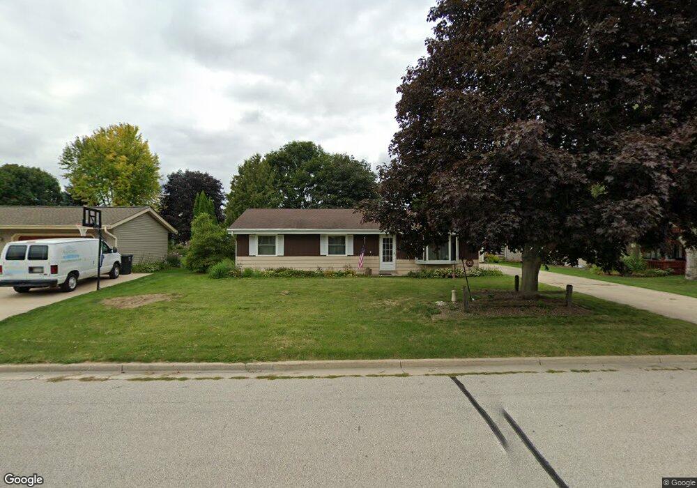
W245N6603 Grogan Dr Sussex, WI 53089
Estimated Value: $367,000 - $403,000
3
Beds
2
Baths
1,242
Sq Ft
$309/Sq Ft
Est. Value
About This Home
This home is located at W245N6603 Grogan Dr, Sussex, WI 53089 and is currently estimated at $384,388, approximately $309 per square foot. W245N6603 Grogan Dr is a home located in Waukesha County with nearby schools including Maple Avenue Elementary School, Templeton Middle School, and Hamilton High School.
Ownership History
Date
Name
Owned For
Owner Type
Purchase Details
Closed on
Aug 13, 2013
Sold by
Schkeryantz Michelle A
Bought by
Mercer Johnnie and Mercer Julie K
Current Estimated Value
Home Financials for this Owner
Home Financials are based on the most recent Mortgage that was taken out on this home.
Original Mortgage
$163,250
Outstanding Balance
$122,078
Interest Rate
4.53%
Mortgage Type
New Conventional
Estimated Equity
$262,310
Create a Home Valuation Report for This Property
The Home Valuation Report is an in-depth analysis detailing your home's value as well as a comparison with similar homes in the area
Home Values in the Area
Average Home Value in this Area
Purchase History
| Date | Buyer | Sale Price | Title Company |
|---|---|---|---|
| Mercer Johnnie | $160,000 | None Available |
Source: Public Records
Mortgage History
| Date | Status | Borrower | Loan Amount |
|---|---|---|---|
| Open | Mercer Johnnie | $163,250 |
Source: Public Records
Tax History Compared to Growth
Tax History
| Year | Tax Paid | Tax Assessment Tax Assessment Total Assessment is a certain percentage of the fair market value that is determined by local assessors to be the total taxable value of land and additions on the property. | Land | Improvement |
|---|---|---|---|---|
| 2024 | $3,734 | $310,400 | $89,500 | $220,900 |
| 2023 | $3,779 | $307,100 | $89,500 | $217,600 |
| 2022 | $3,534 | $256,100 | $78,000 | $178,100 |
| 2021 | $3,152 | $226,500 | $65,500 | $161,000 |
| 2020 | $3,236 | $217,000 | $65,500 | $151,500 |
| 2019 | $2,947 | $192,000 | $63,500 | $128,500 |
| 2018 | $2,644 | $174,700 | $46,200 | $128,500 |
| 2017 | $2,577 | $172,400 | $46,200 | $126,200 |
| 2016 | $2,565 | $166,800 | $46,200 | $120,600 |
| 2015 | $2,616 | $166,800 | $46,200 | $120,600 |
| 2014 | $2,838 | $160,000 | $46,200 | $113,800 |
| 2013 | $2,838 | $174,500 | $46,200 | $128,300 |
Source: Public Records
Map
Nearby Homes
- Lt0 Maple Ave
- N63W23954 Terrace Dr
- N71W24818 Wildwood Way
- W253N6628 Heavenly Ct
- W253N6563 Heavenly Ct
- W247N5929 Grouse Ct
- N66W25720 Big Sky Dr
- N67W25396 Vail Ln
- N67W25502 Vail Ln
- W238N7214 Michele Ln
- N67W25606 Vail Ln
- N63w23524 Silver Spring Dr
- The Lily Plan at Vista Run
- The Clare Plan at Vista Run
- The Savannah Plan at Vista Run
- The Sycamore Plan at Vista Run
- The Evergreen Plan at Vista Run
- The Kendall Plan at Vista Run
- The Walnut Plan at Vista Run
- The Marigold Plan at Vista Run
- W245N6615 Grogan Dr
- W245N6591 Grogan Dr
- W245N6604 Bowling Green St
- W245N6590 Bowling Green St Unit A
- W245N6625 Grogan Dr
- W245N6579 Grogan Dr
- W245N6616 Bowling Green St
- W245N6602 Bowling Green St
- W244N6586 Grogan Dr
- W244N6598 Grogan Dr
- W244N6608 Grogan Dr
- W245N6576 Bowling Green St
- W245N6630 Bowling Green St
- W244N6620 Grogan Dr
- W245N6637 Grogan Dr
- W245N6567 Grogan Dr
- W245N6632 Bowling Green St
- W244N6574 Grogan Dr
- W244N6632 Grogan Dr
- W245N6564 Bowling Green St