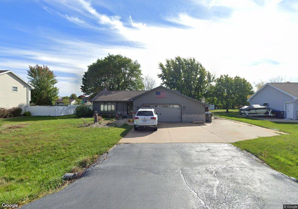
W2537 Frontier Dr Appleton, WI 54915
Estimated Value: $321,567 - $382,000
Studio
--
Bath
--
Sq Ft
0.41
Acres Lot
About This Home
This home is located at W2537 Frontier Dr, Appleton, WI 54915 and is currently estimated at $345,892. W2537 Frontier Dr is a home located in Outagamie County with nearby schools including Sunrise Elementary School, J.R. Gerritts Middle School, and Mapleview Intermediate School.
Ownership History
Date
Name
Owned For
Owner Type
Purchase Details
Closed on
Feb 18, 2022
Sold by
Deering Cody J
Bought by
Dcering Cody J and Seidl Taylor Jurdan
Current Estimated Value
Home Financials for this Owner
Home Financials are based on the most recent Mortgage that was taken out on this home.
Original Mortgage
$195,300
Outstanding Balance
$179,605
Interest Rate
3.69%
Mortgage Type
New Conventional
Estimated Equity
$166,287
Purchase Details
Closed on
May 29, 2019
Sold by
Deering Joseph R and Deering Diane E
Bought by
Deering Cody J
Create a Home Valuation Report for This Property
The Home Valuation Report is an in-depth analysis detailing your home's value as well as a comparison with similar homes in the area
Home Values in the Area
Average Home Value in this Area
Purchase History
We collect this data history from publicly available records. To have your information removed, we recommend requesting removal directly through your county’s website.
| Date | Buyer | Sale Price | Title Company |
|---|---|---|---|
| Dcering Cody J | -- | None Listed On Document | |
| Dcering Cody J | -- | None Listed On Document | |
| Deering Cody J | $195,000 | -- |
Source: Public Records
Mortgage History
We collect this data history from publicly available records. To have your information removed, we recommend requesting removal directly through your county’s website.
| Date | Status | Borrower | Loan Amount |
|---|---|---|---|
| Open | Dcering Cody J | $195,300 |
Source: Public Records
Tax History
| Year | Tax Paid | Tax Assessment Tax Assessment Total Assessment is a certain percentage of the fair market value that is determined by local assessors to be the total taxable value of land and additions on the property. | Land | Improvement |
|---|---|---|---|---|
| 2024 | $3,342 | $302,300 | $46,800 | $255,500 |
| 2023 | $3,162 | $280,500 | $46,800 | $233,700 |
| 2022 | $3,164 | $260,800 | $46,800 | $214,000 |
| 2021 | $3,309 | $228,700 | $35,900 | $192,800 |
| 2020 | $3,536 | $216,400 | $35,900 | $180,500 |
| 2019 | $3,320 | $200,300 | $35,900 | $164,400 |
| 2018 | $3,014 | $184,600 | $35,900 | $148,700 |
| 2017 | $3,028 | $173,500 | $31,600 | $141,900 |
| 2016 | $3,187 | $173,500 | $31,600 | $141,900 |
| 2015 | $3,137 | $173,500 | $31,600 | $141,900 |
| 2014 | $3,188 | $173,500 | $31,600 | $141,900 |
| 2013 | $3,176 | $173,500 | $31,600 | $141,900 |
Source: Public Records
Map
Nearby Homes
- N190 Hopfensperger Rd
- W2572 Colonial Ct
- N288 Candlelite Way
- N9678 Hopfensperger Rd
- W2689 Buchanan Rd
- 253 County Hwy N
- W2286 Valleywood Ln
- 657 Hideaway Ct
- N362 Rogers Ln
- N9581 Hartford Ln
- 535 Coonen Dr
- W2944 Northbrook Ct
- N9376 Dusty Dr
- N9259 Anton St
- 512 Jeffrey St
- N9265 Anton St
- W5997 Garnet Dr
- 445 Riverview Ridge Place
- 431 Riverview Ridge Place
- 114 Shalimar Ct
- W2529 Frontier Dr
- W2545 Frontier Dr
- W2534 Pioneer Ct
- W2540 Pioneer Ct
- W2521 Frontier Dr
- W2528 Pioneer Ct
- W2553 Frontier Dr
- W2538 Frontier Dr
- 2521 Frontier Dr
- W2530 Frontier Dr
- W2546 Frontier Dr
- W2522 Pioneer Ct
- W2544 Pioneer Ct
- 2540 Pioneer Ct
- W2522 Frontier Dr
- W2513 Frontier Dr
- W2554 Frontier Dr
- W2514 Pioneer Ct
- N210 Liberty Ln
- N202 Liberty Ln
Your Personal Tour Guide
Ask me questions while you tour the home.