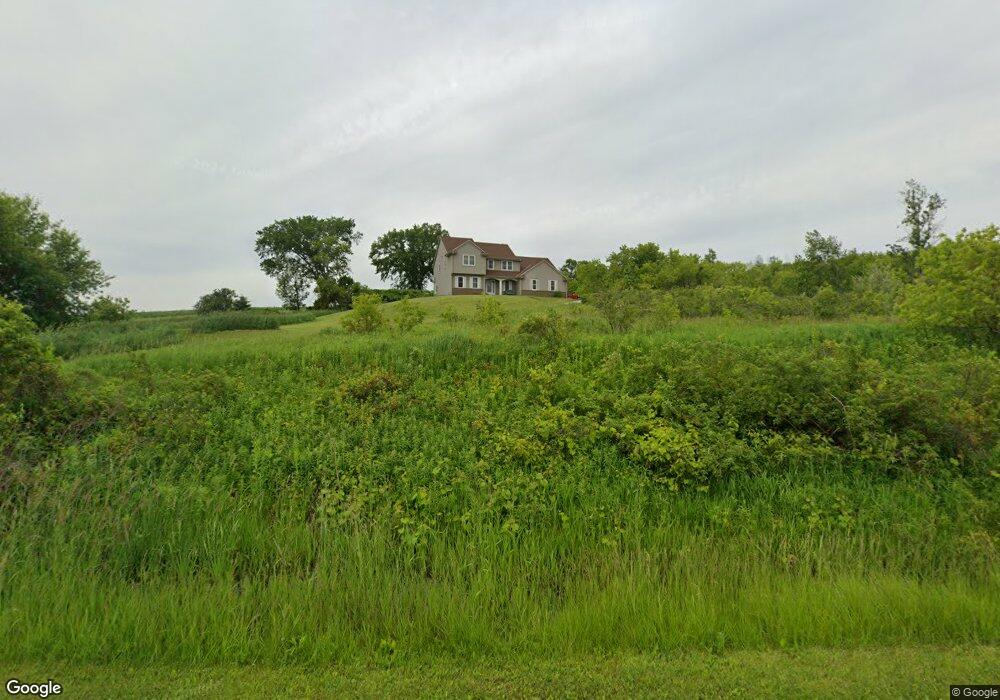
W2542 Butler Rd Iron Ridge, WI 53035
Estimated Value: $279,000 - $512,000
--
Bed
--
Bath
--
Sq Ft
1
Acres
About This Home
This home is located at W2542 Butler Rd, Iron Ridge, WI 53035 and is currently estimated at $413,092. W2542 Butler Rd is a home located in Dodge County with nearby schools including Hartford High School and St. Matthew Lutheran School.
Ownership History
Date
Name
Owned For
Owner Type
Purchase Details
Closed on
Oct 6, 2006
Sold by
Nakielski Michael R
Bought by
Wedemayer Jennifer L
Current Estimated Value
Home Financials for this Owner
Home Financials are based on the most recent Mortgage that was taken out on this home.
Original Mortgage
$248,177
Outstanding Balance
$148,419
Interest Rate
6.5%
Mortgage Type
New Conventional
Estimated Equity
$264,673
Purchase Details
Closed on
Feb 27, 2006
Sold by
Nakielski Michael W and Nakielski Loretta I
Bought by
Nakielski Michael R
Purchase Details
Closed on
Feb 2, 2006
Sold by
Nakielski Michael W and Nakielski Loretta I
Bought by
Nakielski Michael R
Create a Home Valuation Report for This Property
The Home Valuation Report is an in-depth analysis detailing your home's value as well as a comparison with similar homes in the area
Home Values in the Area
Average Home Value in this Area
Purchase History
| Date | Buyer | Sale Price | Title Company |
|---|---|---|---|
| Wedemayer Jennifer L | $47,000 | -- | |
| Nakielski Michael R | -- | -- | |
| Nakielski Michael R | -- | -- |
Source: Public Records
Mortgage History
| Date | Status | Borrower | Loan Amount |
|---|---|---|---|
| Open | Wedemayer Jennifer L | $248,177 |
Source: Public Records
Tax History Compared to Growth
Tax History
| Year | Tax Paid | Tax Assessment Tax Assessment Total Assessment is a certain percentage of the fair market value that is determined by local assessors to be the total taxable value of land and additions on the property. | Land | Improvement |
|---|---|---|---|---|
| 2024 | $4,104 | $327,900 | $40,000 | $287,900 |
| 2023 | $3,781 | $327,900 | $40,000 | $287,900 |
| 2022 | $3,821 | $327,900 | $40,000 | $287,900 |
| 2021 | $3,598 | $246,300 | $37,000 | $209,300 |
| 2020 | $3,746 | $246,300 | $37,000 | $209,300 |
| 2019 | $3,723 | $246,300 | $37,000 | $209,300 |
| 2018 | $3,765 | $246,300 | $37,000 | $209,300 |
| 2017 | $3,874 | $246,300 | $37,000 | $209,300 |
| 2016 | $3,509 | $218,400 | $37,000 | $181,400 |
| 2015 | $3,582 | $218,400 | $37,000 | $181,400 |
| 2014 | $3,748 | $218,400 | $37,000 | $181,400 |
Source: Public Records
Map
Nearby Homes
- N4946 County Road Ws
- N5413 County Rd S
- 222 E Lehman St
- W1517 Woodland Rd
- N3220 Hale Rd
- Lt2 Grant Rd
- W1974 Pond Rd
- N4120 County Road P
- 0 Burkwald Ave
- N5689 Astor Rd
- 140 East Ave
- 123 Westgate Dr
- Lt2 Rolling Hills Dr
- N4510 & N4504 Anthony Island
- N4510 Anthony Island -
- Lt51 Anthony Island -
- .68 Acre Parcel Anthony Island
- 244 S Ridge St
- W1025 Kelly Dr
- 252 S Hustis St
- W2518 Butler Rd
- W2506 Butler Rd
- W2524 Butler Rd
- W2610 Butler Rd
- W2466 Butler Rd
- W2629 Butler Rd
- N4256 Butler Rd
- W2421 Butler Rd
- N4310 State Road 67
- W2361 Butler Rd
- W2358 Butler Rd
- N4282 State Road 67
- N4575 State Road 67
- W2337 Grant Rd
- W2316 Grant Rd
- N4583 State Road 67
- W2319 Grant Rd
- N4593 Moss Rd
- N4220 State Road 67
- N4600 Moss Rd