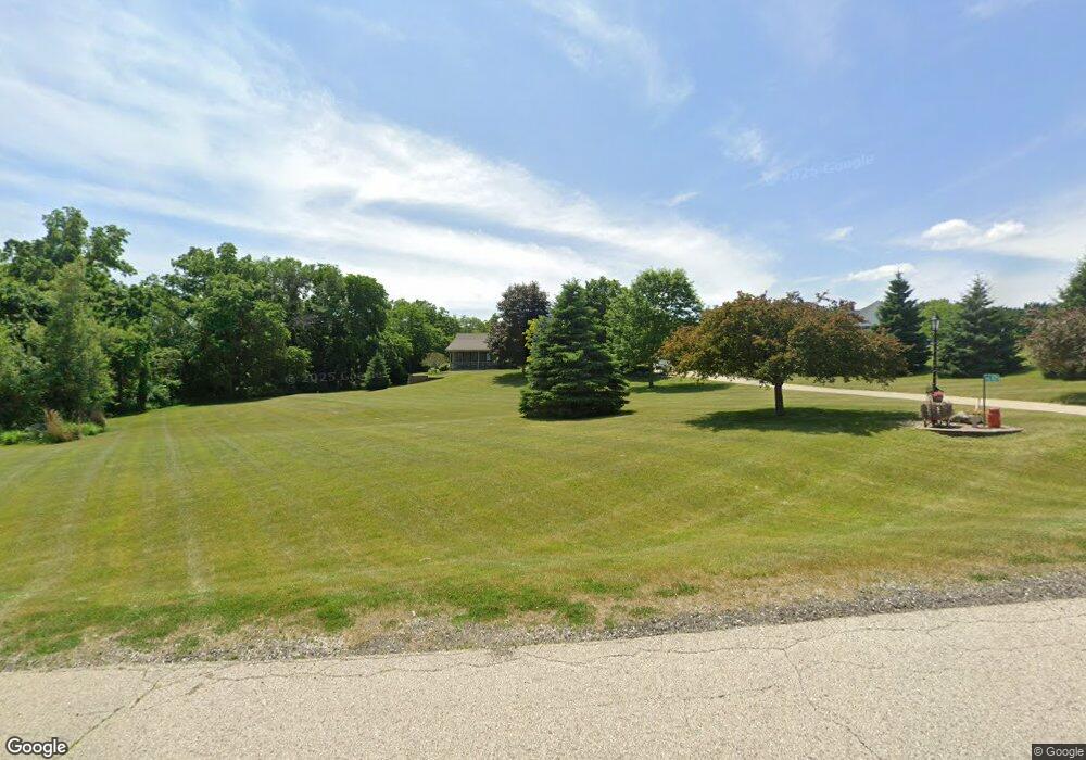
W256S10255 Sandhill Ridge Mukwonago, WI 53149
Estimated Value: $665,000 - $791,000
--
Bed
--
Bath
--
Sq Ft
2.16
Acres
About This Home
This home is located at W256S10255 Sandhill Ridge, Mukwonago, WI 53149 and is currently estimated at $719,252. W256S10255 Sandhill Ridge is a home located in Waukesha County with nearby schools including Big Bend Elementary School, Park View Middle School, and Mukwonago High School.
Ownership History
Date
Name
Owned For
Owner Type
Purchase Details
Closed on
Jul 24, 2017
Sold by
Repka Timothy J and Repka Wendy S
Bought by
Rand Kevin B
Current Estimated Value
Home Financials for this Owner
Home Financials are based on the most recent Mortgage that was taken out on this home.
Original Mortgage
$398,000
Outstanding Balance
$330,852
Interest Rate
3.91%
Mortgage Type
New Conventional
Estimated Equity
$388,400
Purchase Details
Closed on
Feb 9, 2007
Sold by
Dernek Andrea and Repka Andrea
Bought by
Repka Timothy
Create a Home Valuation Report for This Property
The Home Valuation Report is an in-depth analysis detailing your home's value as well as a comparison with similar homes in the area
Home Values in the Area
Average Home Value in this Area
Purchase History
| Date | Buyer | Sale Price | Title Company |
|---|---|---|---|
| Rand Kevin B | $458,000 | None Available | |
| Repka Timothy | -- | None Available |
Source: Public Records
Mortgage History
| Date | Status | Borrower | Loan Amount |
|---|---|---|---|
| Open | Rand Kevin B | $398,000 |
Source: Public Records
Tax History Compared to Growth
Tax History
| Year | Tax Paid | Tax Assessment Tax Assessment Total Assessment is a certain percentage of the fair market value that is determined by local assessors to be the total taxable value of land and additions on the property. | Land | Improvement |
|---|---|---|---|---|
| 2024 | $4,804 | $591,600 | $126,800 | $464,800 |
| 2023 | $4,679 | $591,600 | $126,800 | $464,800 |
| 2022 | $5,198 | $470,200 | $115,300 | $354,900 |
| 2021 | $5,142 | $470,200 | $115,300 | $354,900 |
| 2020 | $5,201 | $470,200 | $115,300 | $354,900 |
| 2019 | $5,065 | $409,600 | $100,200 | $309,400 |
| 2018 | $4,646 | $373,900 | $100,200 | $273,700 |
| 2017 | $4,596 | $373,900 | $100,200 | $273,700 |
| 2016 | $4,595 | $373,900 | $100,200 | $273,700 |
| 2015 | $4,499 | $373,900 | $100,200 | $273,700 |
| 2014 | $4,945 | $0 | $0 | $0 |
| 2013 | $4,945 | $379,300 | $103,000 | $276,300 |
Source: Public Records
Map
Nearby Homes
- W240S10240 Castle Rd
- 1625 Grey Fox Trail Unit F
- 1617 Grey Fox Trail Unit C
- 1629 Grey Fox Trail Unit B
- 1629 Grey Fox Trail Unit C
- 1629 Grey Fox Trail Unit D
- 1633 Grey Fox Trail Unit E
- 1730 Cardinal Ct
- 1760 Cardinal Ct
- 915 Cardinal Ln
- 1725 Cardinal Ct
- Floor 2 Plan at Edgewood Meadows
- 1st Floor Plan at Edgewood Meadows
- The Wingra Plan at Cardinal Ridge
- The Windsor Plan at Cardinal Ridge
- The Siena Plan at Cardinal Ridge
- The Sheridan Plan at Cardinal Ridge
- The Saybrook Plan at Cardinal Ridge
- The McKinley Plan at Cardinal Ridge
- The Hudson Plan at Cardinal Ridge
- W256S10245 Sandhill Ridge
- W256S10235 Sandhill Ridge
- W256S10235 Sandhill Ridge Rd
- W256S10260 Sandhill Ridge
- W256S10395 Sandhill Ridge
- W256S10240 Sandhill Ridge
- W256S10399 Sandhill Ridge
- W256S10215 Sandhill Ridge
- W256S10220 Sandhill Ridge
- W256S10330 Sandhill Ridge
- W256S10350 Sandhill Ridge
- W256S10400 Sandhill Ridge
- W256S10160 Sandhill Ridge
- S101W25545 Maple Ave
- W256S10370 Sandhill Ridge
- S101W25450 Maple Ave
- W257S10510 Horseshoe Ln
- S102W25985 Maple Ave
- W257S10525 Horseshoe Ln
- W257S10525 Horseshoe Ln Unit Lt12 Landmark Estate
