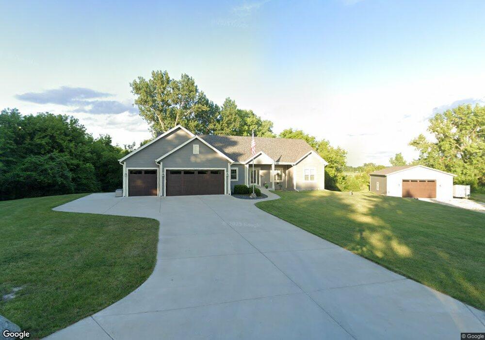
W261N4256 High St Pewaukee, WI 53072
Estimated Value: $535,000 - $786,000
--
Bed
--
Bath
--
Sq Ft
3.08
Acres
About This Home
This home is located at W261N4256 High St, Pewaukee, WI 53072 and is currently estimated at $645,247. W261N4256 High St is a home with nearby schools including Pewaukee Lake Elementary School, Asa Clark Middle School, and Pewaukee High School.
Ownership History
Date
Name
Owned For
Owner Type
Purchase Details
Closed on
Apr 13, 2016
Sold by
Mk Field Three Llc
Bought by
Rachoner Ryan A
Current Estimated Value
Home Financials for this Owner
Home Financials are based on the most recent Mortgage that was taken out on this home.
Original Mortgage
$332,300
Outstanding Balance
$265,626
Interest Rate
3.87%
Mortgage Type
Adjustable Rate Mortgage/ARM
Estimated Equity
$379,621
Purchase Details
Closed on
Dec 30, 2009
Sold by
Field Leslie A and Field Brian M
Bought by
Mk Field Three Llc
Purchase Details
Closed on
Dec 29, 2009
Sold by
Mk Field Five Llc
Bought by
Field Leslie A and Field Brian M
Create a Home Valuation Report for This Property
The Home Valuation Report is an in-depth analysis detailing your home's value as well as a comparison with similar homes in the area
Home Values in the Area
Average Home Value in this Area
Purchase History
| Date | Buyer | Sale Price | Title Company |
|---|---|---|---|
| Rachoner Ryan A | $78,000 | None Available | |
| Mk Field Three Llc | -- | None Available | |
| Field Leslie A | -- | None Available |
Source: Public Records
Mortgage History
| Date | Status | Borrower | Loan Amount |
|---|---|---|---|
| Open | Rachoner Ryan A | $332,300 |
Source: Public Records
Tax History Compared to Growth
Tax History
| Year | Tax Paid | Tax Assessment Tax Assessment Total Assessment is a certain percentage of the fair market value that is determined by local assessors to be the total taxable value of land and additions on the property. | Land | Improvement |
|---|---|---|---|---|
| 2024 | $5,267 | $428,200 | $97,000 | $331,200 |
| 2023 | $5,236 | $428,200 | $97,000 | $331,200 |
| 2022 | $5,389 | $428,200 | $97,000 | $331,200 |
| 2021 | $5,355 | $428,200 | $97,000 | $331,200 |
| 2020 | $5,479 | $351,400 | $91,400 | $260,000 |
| 2019 | $5,330 | $351,400 | $91,400 | $260,000 |
| 2018 | $5,139 | $351,400 | $91,400 | $260,000 |
| 2017 | $5,107 | $351,400 | $91,400 | $260,000 |
| 2016 | $1,855 | $125,100 | $125,100 | $0 |
| 2015 | $1,872 | $125,100 | $125,100 | $0 |
| 2014 | $2,047 | $125,100 | $125,100 | $0 |
| 2013 | $2,047 | $125,100 | $125,100 | $0 |
Source: Public Records
Map
Nearby Homes
- 403 Sandy Cir
- 407 Sandy Cir
- 411 Sandy Cir
- 394 Sandy Cir
- 436 Sandy Cir
- The Willow Plan at The Glen at Pewaukee Lake
- The Laurel Plan at The Glen at Pewaukee Lake
- The Juniper Plan at The Glen at Pewaukee Lake
- The Holly Plan at The Glen at Pewaukee Lake
- The Hawthorne Plan at The Glen at Pewaukee Lake
- The Cypress Plan at The Glen at Pewaukee Lake
- The Birch Plan at The Glen at Pewaukee Lake
- The Aspen Plan at The Glen at Pewaukee Lake
- 331 Sandy Cir
- 327 Sandy Cir
- 368 Park Hill Dr Unit H
- 527 W Wisconsin Ave
- 823 Quinlan Dr
- 1055 Quinlan Dr Unit A
- 521 W Wisconsin Ave
- W261N4310 High St
- W261N4267 High St
- W261N4297 High St
- W261N4321 High St
- W261N4340 High St
- W261N4341 High St
- W261N4367 High St
- W261N4388 High St
- W261N4389 High St
- N43W26055 Lindsay Rd
- 554 High St
- W261N4408 High St
- 555 High St
- 549 High St
- 548 High St
- N44W26074 Lindsay Rd
- 536 High St
- 411 Cheshire Ln
- N43W26009 Lindsay Rd
- Lt0 Ryan St