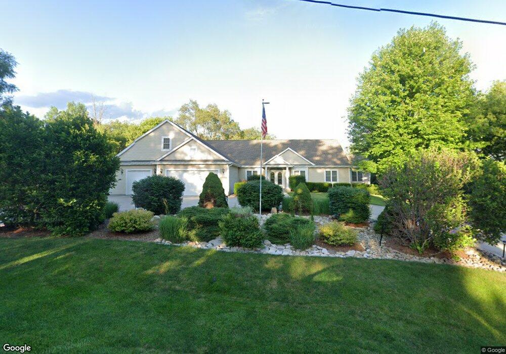
W261N4388 High St Pewaukee, WI 53072
Estimated Value: $568,000 - $971,000
--
Bed
--
Bath
--
Sq Ft
2.02
Acres
About This Home
This home is located at W261N4388 High St, Pewaukee, WI 53072 and is currently estimated at $788,080. W261N4388 High St is a home with nearby schools including Pewaukee Lake Elementary School, Asa Clark Middle School, and Pewaukee High School.
Ownership History
Date
Name
Owned For
Owner Type
Purchase Details
Closed on
May 18, 2004
Sold by
Drath Scott R and Drath Billie
Bought by
Weyker Gordon J and Sramek Weyker Sandra A
Current Estimated Value
Create a Home Valuation Report for This Property
The Home Valuation Report is an in-depth analysis detailing your home's value as well as a comparison with similar homes in the area
Home Values in the Area
Average Home Value in this Area
Purchase History
| Date | Buyer | Sale Price | Title Company |
|---|---|---|---|
| Weyker Gordon J | $130,000 | Gatewood Title Services |
Source: Public Records
Tax History Compared to Growth
Tax History
| Year | Tax Paid | Tax Assessment Tax Assessment Total Assessment is a certain percentage of the fair market value that is determined by local assessors to be the total taxable value of land and additions on the property. | Land | Improvement |
|---|---|---|---|---|
| 2024 | $7,443 | $597,100 | $132,400 | $464,700 |
| 2023 | $7,416 | $597,100 | $132,400 | $464,700 |
| 2022 | $7,643 | $597,100 | $132,400 | $464,700 |
| 2021 | $7,604 | $597,100 | $132,400 | $464,700 |
| 2020 | $7,105 | $448,000 | $109,200 | $338,800 |
| 2019 | $6,926 | $448,000 | $109,200 | $338,800 |
| 2018 | $6,678 | $448,000 | $109,200 | $338,800 |
| 2017 | $6,646 | $448,000 | $109,200 | $338,800 |
| 2016 | $6,889 | $448,000 | $109,200 | $338,800 |
| 2015 | $6,892 | $448,000 | $109,200 | $338,800 |
| 2014 | $7,126 | $448,000 | $109,200 | $338,800 |
| 2013 | $7,126 | $448,000 | $109,200 | $338,800 |
Source: Public Records
Map
Nearby Homes
- 403 Sandy Cir
- 407 Sandy Cir
- 411 Sandy Cir
- 394 Sandy Cir
- 436 Sandy Cir
- The Willow Plan at The Glen at Pewaukee Lake
- The Laurel Plan at The Glen at Pewaukee Lake
- The Juniper Plan at The Glen at Pewaukee Lake
- The Holly Plan at The Glen at Pewaukee Lake
- The Hawthorne Plan at The Glen at Pewaukee Lake
- The Cypress Plan at The Glen at Pewaukee Lake
- The Birch Plan at The Glen at Pewaukee Lake
- The Aspen Plan at The Glen at Pewaukee Lake
- 1055 Quinlan Dr Unit A
- 823 Quinlan Dr
- 331 Sandy Cir
- 327 Sandy Cir
- 527 W Wisconsin Ave
- 368 Park Hill Dr Unit H
- 521 W Wisconsin Ave
- W261N4389 High St
- W261N4408 High St
- W261N4340 High St
- W261N4367 High St
- W261N4341 High St
- W261N4310 High St
- W261N4321 High St
- N43W26055 Lindsay Rd
- W261N4297 High St
- W261N4267 High St
- N44W26074 Lindsay Rd
- W261N4256 High St
- W261N4490 High St
- N43W26009 Lindsay Rd
- W262N4521 Ryan St
- N44W26030 Lindsay Rd
- N43W25911 Lindsay Rd
- N44W25940 Lindsay Rd
- N44W25910 Lindsay Rd
- 620 Ryan St