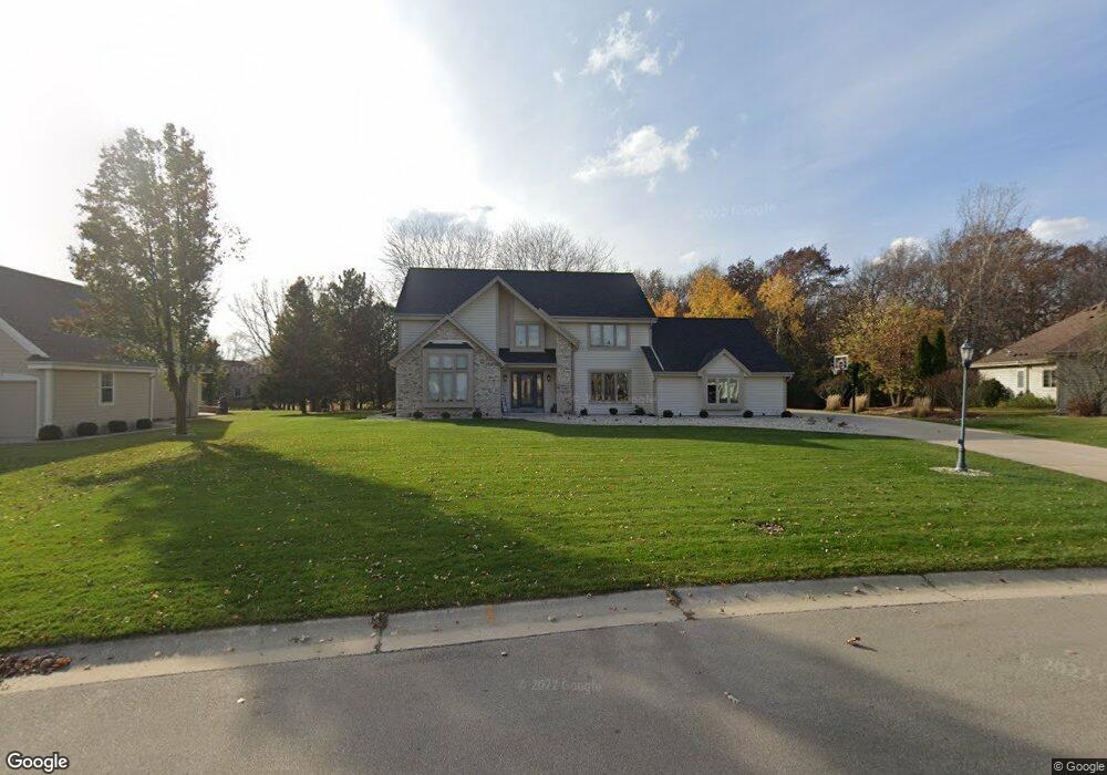
W264N2309 Wilderness Way Pewaukee, WI 53072
Estimated Value: $717,439 - $820,000
--
Bed
--
Bath
--
Sq Ft
0.59
Acres
About This Home
This home is located at W264N2309 Wilderness Way, Pewaukee, WI 53072 and is currently estimated at $780,860. W264N2309 Wilderness Way is a home located in Waukesha County with nearby schools including Pewaukee Lake Elementary School, Asa Clark Middle School, and Pewaukee High School.
Ownership History
Date
Name
Owned For
Owner Type
Purchase Details
Closed on
May 21, 2021
Sold by
Jacobs Robert R and Jacobs Marcie R
Bought by
Wehking Logan W and Wehking Kari A
Current Estimated Value
Home Financials for this Owner
Home Financials are based on the most recent Mortgage that was taken out on this home.
Original Mortgage
$447,200
Outstanding Balance
$404,001
Interest Rate
2.9%
Mortgage Type
New Conventional
Estimated Equity
$376,859
Create a Home Valuation Report for This Property
The Home Valuation Report is an in-depth analysis detailing your home's value as well as a comparison with similar homes in the area
Home Values in the Area
Average Home Value in this Area
Purchase History
| Date | Buyer | Sale Price | Title Company |
|---|---|---|---|
| Wehking Logan W | $559,000 | None Available |
Source: Public Records
Mortgage History
| Date | Status | Borrower | Loan Amount |
|---|---|---|---|
| Open | Wehking Logan W | $447,200 |
Source: Public Records
Tax History Compared to Growth
Tax History
| Year | Tax Paid | Tax Assessment Tax Assessment Total Assessment is a certain percentage of the fair market value that is determined by local assessors to be the total taxable value of land and additions on the property. | Land | Improvement |
|---|---|---|---|---|
| 2024 | $6,210 | $537,300 | $167,700 | $369,600 |
| 2023 | $6,185 | $537,300 | $167,700 | $369,600 |
| 2022 | $6,418 | $537,300 | $167,700 | $369,600 |
| 2021 | $6,151 | $517,900 | $167,700 | $350,200 |
| 2020 | $6,454 | $435,600 | $139,500 | $296,100 |
| 2019 | $6,290 | $435,600 | $139,500 | $296,100 |
| 2018 | $6,331 | $435,600 | $139,500 | $296,100 |
| 2017 | $7,046 | $435,600 | $139,500 | $296,100 |
| 2016 | $6,261 | $435,600 | $139,500 | $296,100 |
| 2015 | $6,338 | $435,600 | $139,500 | $296,100 |
| 2014 | $6,923 | $435,600 | $139,500 | $296,100 |
| 2013 | $6,923 | $435,600 | $139,500 | $296,100 |
Source: Public Records
Map
Nearby Homes
- W263N2345 Deer Haven Dr
- N19W26672 Milkweed Ln Unit A
- W265N2666 Meadowbrook Rd
- N26W26388 Quail Hollow Rd Unit A
- N16W26549 Wild Oats Dr Unit 25-C
- N16W26549 Tall Reeds Ln Unit A
- N16W26573 Tall Reeds Ln Unit A
- N16W26583 Wild Oats Dr Unit C
- N16W26571 Tall Reeds Ln Unit B
- N16W26539 Tall Reeds Ln Unit D
- N15W26518 Tall Reeds Ln Unit C
- W269N2762 Lelah Ave
- W271N2631 Orchard Ln
- N28W26972 Woodland Dr
- N27W27152 Woodland Dr
- 2912 N University Dr Unit 305
- N28W27558 Peninsula Dr
- N28W27564 Peninsula Dr
- W251N2437 Valleyview Cir
- W251N2425 Valleyview Cir
- W264N2303 Deer Haven Dr
- W264N2323 Wilderness Way
- N22W26492 Shooting Star Rd Unit 2
- N22W26492 Shooting Star Rd Unit 1
- W263N2310 Wilderness Way
- N22W26496 Shooting Star Rd Unit 1
- N22W26496 Shooting Star Rd Unit 2
- W264N2337 Wilderness Way
- W263N2322 Wilderness Way
- W263N2300 Deer Haven Dr
- N22W26500 Shooting Star Rd
- W263N2321 Deer Haven Dr
- N22W26454 Shooting Star Ct
- N22W26520 Shooting Star Rd
- W263N2338 Wilderness Way
- W264N2341 Wilderness Way
- N20W26473 Shooting Star Rd Unit 1
- N20W26473 Shooting Star Rd Unit 2
- W263N2333 Deer Haven Dr
- W263N2312 Deer Haven Dr