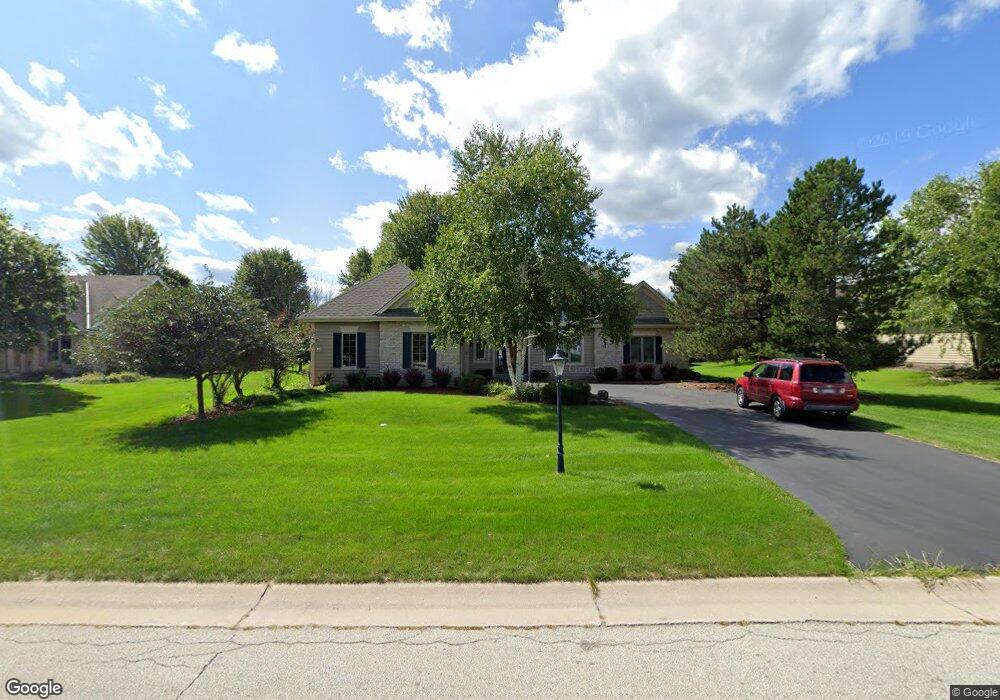
W265N2227 Sawgrass Ln Pewaukee, WI 53072
Estimated Value: $624,000 - $669,000
--
Bed
--
Bath
--
Sq Ft
0.46
Acres
About This Home
This home is located at W265N2227 Sawgrass Ln, Pewaukee, WI 53072 and is currently estimated at $649,246. W265N2227 Sawgrass Ln is a home located in Waukesha County with nearby schools including Meadowbrook Elementary School, Butler Middle School, and North High School.
Ownership History
Date
Name
Owned For
Owner Type
Purchase Details
Closed on
Jan 14, 1999
Sold by
Woodhaven Homes & Realty Inc
Bought by
Mann William A and Mann Amy L
Current Estimated Value
Home Financials for this Owner
Home Financials are based on the most recent Mortgage that was taken out on this home.
Original Mortgage
$230,000
Interest Rate
6.83%
Purchase Details
Closed on
Mar 19, 1997
Sold by
Riverview Associates Ltd Partnership
Bought by
Woodhaven Homes & Realty Inc
Home Financials for this Owner
Home Financials are based on the most recent Mortgage that was taken out on this home.
Original Mortgage
$271,200
Interest Rate
7.73%
Create a Home Valuation Report for This Property
The Home Valuation Report is an in-depth analysis detailing your home's value as well as a comparison with similar homes in the area
Home Values in the Area
Average Home Value in this Area
Purchase History
| Date | Buyer | Sale Price | Title Company |
|---|---|---|---|
| Mann William A | $335,000 | -- | |
| Woodhaven Homes & Realty Inc | $53,900 | -- |
Source: Public Records
Mortgage History
| Date | Status | Borrower | Loan Amount |
|---|---|---|---|
| Previous Owner | Mann William A | $230,000 | |
| Previous Owner | Woodhaven Homes & Realty Inc | $271,200 |
Source: Public Records
Tax History Compared to Growth
Tax History
| Year | Tax Paid | Tax Assessment Tax Assessment Total Assessment is a certain percentage of the fair market value that is determined by local assessors to be the total taxable value of land and additions on the property. | Land | Improvement |
|---|---|---|---|---|
| 2024 | $4,881 | $491,100 | $141,300 | $349,800 |
| 2023 | $5,266 | $491,100 | $141,300 | $349,800 |
| 2022 | $5,077 | $491,100 | $141,300 | $349,800 |
| 2021 | $5,457 | $491,100 | $141,300 | $349,800 |
| 2020 | $5,535 | $398,400 | $119,900 | $278,500 |
| 2019 | $5,382 | $398,400 | $119,900 | $278,500 |
| 2018 | $5,096 | $398,400 | $119,900 | $278,500 |
| 2017 | $5,047 | $398,400 | $119,900 | $278,500 |
| 2016 | $5,352 | $398,400 | $119,900 | $278,500 |
| 2015 | $5,153 | $398,400 | $119,900 | $278,500 |
| 2014 | $5,307 | $398,400 | $119,900 | $278,500 |
| 2013 | $5,307 | $398,400 | $119,900 | $278,500 |
Source: Public Records
Map
Nearby Homes
- N19W26672 Milkweed Ln Unit A
- W263N2345 Deer Haven Dr
- N16W26549 Wild Oats Dr Unit 25-C
- N16W26549 Tall Reeds Ln Unit A
- N16W26573 Tall Reeds Ln Unit A
- N16W26583 Wild Oats Dr Unit C
- N16W26571 Tall Reeds Ln Unit B
- N16W26539 Tall Reeds Ln Unit D
- N15W26518 Tall Reeds Ln Unit C
- W265N2666 Meadowbrook Rd
- N26W26388 Quail Hollow Rd Unit A
- W271N2631 Orchard Ln
- W269N2762 Lelah Ave
- N28W26972 Woodland Dr
- N27W27152 Woodland Dr
- 2912 N University Dr Unit 305
- N16W27601 Pheasant Ln
- W276N1728 Spring Creek Dr
- 2735 Coventry Ln
- N28W27558 Peninsula Dr
- N22W26579 Shooting Star Rd
- W265N2197 Sawgrass Ln
- N22W26593 Shooting Star Rd
- W265N2179 Sawgrass Ln
- W266N2150 Cattail Ct
- W265N2224 Sawgrass Ln
- W265N2196 Sawgrass Ln
- N22W26515 Shooting Star Rd
- N22W26619 Shooting Star Rd
- N21W26622 Cattail Ct
- W265N2184 Sawgrass Ln
- N22W26570 Shooting Star Rd
- N22W26550 Shooting Star Rd
- W265N2145 Sawgrass Ln
- W266N2138 Cattail Ct
- N22W26520 Shooting Star Rd
- N22W26590 Shooting Star Rd
- N22W26649 Shooting Star Rd
- W265N2144 Sawgrass Ln
- N22W26500 Shooting Star Rd