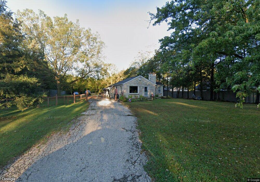
W266N2627 Meadowbrook Rd Pewaukee, WI 53072
Estimated Value: $348,000 - $535,000
--
Bed
--
Bath
--
Sq Ft
0.93
Acres
About This Home
This home is located at W266N2627 Meadowbrook Rd, Pewaukee, WI 53072 and is currently estimated at $420,363. W266N2627 Meadowbrook Rd is a home located in Waukesha County with nearby schools including Pewaukee Lake Elementary School, Asa Clark Middle School, and Pewaukee High School.
Ownership History
Date
Name
Owned For
Owner Type
Purchase Details
Closed on
Jun 17, 2009
Sold by
Shores Johnny D and Shores Linda T
Bought by
Garvey Daniel R
Current Estimated Value
Home Financials for this Owner
Home Financials are based on the most recent Mortgage that was taken out on this home.
Original Mortgage
$168,000
Outstanding Balance
$107,114
Interest Rate
4.94%
Mortgage Type
Purchase Money Mortgage
Estimated Equity
$313,249
Purchase Details
Closed on
Aug 16, 2001
Sold by
Marrari John
Bought by
Shores Johnny D and Shores Linda T
Home Financials for this Owner
Home Financials are based on the most recent Mortgage that was taken out on this home.
Original Mortgage
$133,000
Interest Rate
7.03%
Mortgage Type
Purchase Money Mortgage
Create a Home Valuation Report for This Property
The Home Valuation Report is an in-depth analysis detailing your home's value as well as a comparison with similar homes in the area
Home Values in the Area
Average Home Value in this Area
Purchase History
| Date | Buyer | Sale Price | Title Company |
|---|---|---|---|
| Garvey Daniel R | $210,000 | None Available | |
| Shores Johnny D | $145,000 | -- |
Source: Public Records
Mortgage History
| Date | Status | Borrower | Loan Amount |
|---|---|---|---|
| Open | Garvey Daniel R | $168,000 | |
| Previous Owner | Shores Johnny D | $133,000 |
Source: Public Records
Tax History Compared to Growth
Tax History
| Year | Tax Paid | Tax Assessment Tax Assessment Total Assessment is a certain percentage of the fair market value that is determined by local assessors to be the total taxable value of land and additions on the property. | Land | Improvement |
|---|---|---|---|---|
| 2024 | $2,549 | $233,000 | $103,700 | $129,300 |
| 2023 | $2,517 | $233,000 | $103,700 | $129,300 |
| 2022 | $2,616 | $233,000 | $103,700 | $129,300 |
| 2021 | $2,600 | $233,000 | $103,700 | $129,300 |
| 2020 | $2,916 | $205,100 | $91,100 | $114,000 |
| 2019 | $2,825 | $205,100 | $91,100 | $114,000 |
| 2018 | $2,733 | $205,100 | $91,100 | $114,000 |
| 2017 | $2,877 | $205,100 | $91,100 | $114,000 |
| 2016 | $2,843 | $205,100 | $91,100 | $114,000 |
| 2015 | $2,888 | $205,100 | $91,100 | $114,000 |
| 2014 | $3,151 | $205,100 | $91,100 | $114,000 |
| 2013 | $3,151 | $205,100 | $91,100 | $114,000 |
Source: Public Records
Map
Nearby Homes
- W265N2666 Meadowbrook Rd
- N26W26388 Quail Hollow Rd Unit A
- W269N2762 Lelah Ave
- W263N2345 Deer Haven Dr
- N28W26972 Woodland Dr
- W271N2631 Orchard Ln
- N27W27152 Woodland Dr
- N19W26672 Milkweed Ln Unit A
- N16W26573 Tall Reeds Ln Unit A
- N28W27558 Peninsula Dr
- N16W26549 Wild Oats Dr Unit 25-C
- N16W26583 Wild Oats Dr Unit C
- N16W26549 Tall Reeds Ln Unit A
- N28W27564 Peninsula Dr
- N16W26571 Tall Reeds Ln Unit B
- N16W26539 Tall Reeds Ln Unit D
- N15W26518 Tall Reeds Ln Unit C
- N28W25158 Parkway Ridge Cir Unit B
- W278N2920 Oak St
- Ashford Plan at Woodleaf Reserve
- N26W26631 Prospect Ave
- N26W26641 Prospect Ave
- W266N2649 Meadowbrook Rd
- W266N2646 Meadowbrook Rd
- W266N2600 Meadowbrook Rd
- N26W26661 Prospect Ave
- N26W26681 Prospect Ave
- W266N2547 Meadowbrook Rd
- N26W26711 Prospect Ave
- N26W26729 Prospect Ave
- N27W26676 Prospect Ave
- W265N2787 Prospect Ave
- W266N2640 Meadowbrook Rd
- N27W26694 Prospect Ave
- N26W26749 Prospect Ave
- N27W26741 Pompano Ct
- N26W26769 Prospect Ave
- N27W26673 Lauderdale Dr
- N27W26693 Lauderdale Dr
- N25W26483 Foxcroft Dr