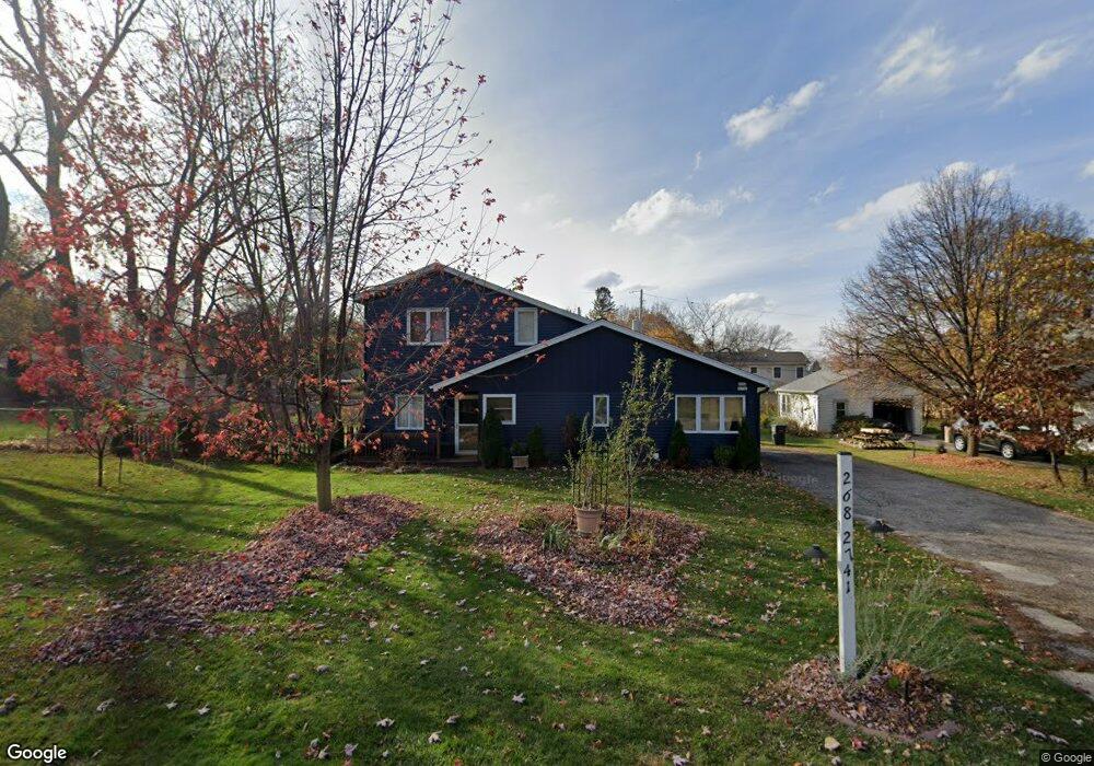
W268N2741 Platt St Pewaukee, WI 53072
Estimated Value: $380,000 - $455,000
--
Bed
--
Bath
--
Sq Ft
0.31
Acres
About This Home
This home is located at W268N2741 Platt St, Pewaukee, WI 53072 and is currently estimated at $412,045. W268N2741 Platt St is a home located in Waukesha County with nearby schools including Pewaukee Lake Elementary School, Asa Clark Middle School, and Pewaukee High School.
Ownership History
Date
Name
Owned For
Owner Type
Purchase Details
Closed on
May 21, 2014
Sold by
Fabry Karl W and Fabry Rebecca A
Bought by
Richer Daniel
Current Estimated Value
Home Financials for this Owner
Home Financials are based on the most recent Mortgage that was taken out on this home.
Original Mortgage
$157,102
Outstanding Balance
$119,506
Interest Rate
4.28%
Mortgage Type
FHA
Estimated Equity
$292,539
Purchase Details
Closed on
Aug 17, 2007
Sold by
Fabry Karl W and Fabry Rebecca A
Bought by
Karl W & Rebecca A Fabry Revocable Trust
Create a Home Valuation Report for This Property
The Home Valuation Report is an in-depth analysis detailing your home's value as well as a comparison with similar homes in the area
Home Values in the Area
Average Home Value in this Area
Purchase History
| Date | Buyer | Sale Price | Title Company |
|---|---|---|---|
| Richer Daniel | $160,000 | None Available | |
| Karl W & Rebecca A Fabry Revocable Trust | -- | None Available |
Source: Public Records
Mortgage History
| Date | Status | Borrower | Loan Amount |
|---|---|---|---|
| Open | Richer Daniel | $157,102 |
Source: Public Records
Tax History Compared to Growth
Tax History
| Year | Tax Paid | Tax Assessment Tax Assessment Total Assessment is a certain percentage of the fair market value that is determined by local assessors to be the total taxable value of land and additions on the property. | Land | Improvement |
|---|---|---|---|---|
| 2024 | $3,264 | $251,100 | $137,400 | $113,700 |
| 2023 | $3,265 | $251,100 | $137,400 | $113,700 |
| 2022 | $3,336 | $251,100 | $137,400 | $113,700 |
| 2021 | $3,319 | $251,100 | $137,400 | $113,700 |
| 2020 | $3,245 | $197,300 | $104,300 | $93,000 |
| 2019 | $3,138 | $197,300 | $104,300 | $93,000 |
| 2018 | $3,010 | $197,300 | $104,300 | $93,000 |
| 2017 | $2,975 | $197,300 | $104,300 | $93,000 |
| 2016 | $3,091 | $197,300 | $104,300 | $93,000 |
| 2015 | $3,126 | $197,300 | $104,300 | $93,000 |
| 2014 | $3,023 | $197,300 | $104,300 | $93,000 |
| 2013 | $3,023 | $197,300 | $104,300 | $93,000 |
Source: Public Records
Map
Nearby Homes
- W269N2762 Lelah Ave
- N28W26972 Woodland Dr
- W265N2666 Meadowbrook Rd
- W271N2631 Orchard Ln
- N27W27152 Woodland Dr
- N26W26388 Quail Hollow Rd Unit A
- W263N2345 Deer Haven Dr
- N28W27558 Peninsula Dr
- N28W27564 Peninsula Dr
- N19W26672 Milkweed Ln Unit A
- W278N2920 Oak St
- N16W26573 Tall Reeds Ln Unit A
- N16W26583 Wild Oats Dr Unit C
- N16W26549 Wild Oats Dr Unit 25-C
- N16W26549 Tall Reeds Ln Unit A
- N16W26571 Tall Reeds Ln Unit B
- N16W26539 Tall Reeds Ln Unit D
- N15W26518 Tall Reeds Ln Unit C
- N37W26687 Kopmeier Dr
- N28W25158 Parkway Ridge Cir Unit B
- W268N2759 Platt St
- W268N2769 Platt St
- W268N2750 Platt St
- W268N2752 Water St
- W268N2738 Water St
- W268N2717 Platt St
- W268N2710 Platt St
- W268N2778 Platt St
- W268N2780 Water St
- W268N2712 Water St
- N27W26851 Woodland Dr
- N27W26861 Woodland Dr
- LT2 Prospect Ave Unit LT2
- LT1 Prospect Ave Unit LT1
- N27W26873 Woodland Dr
- N27W26781 Lauderdale Dr
- N27W26761 Pompano Ct
- N27W26772 Pompano Ct
- N27W26883 Woodland Dr
- W268N2755 Water St