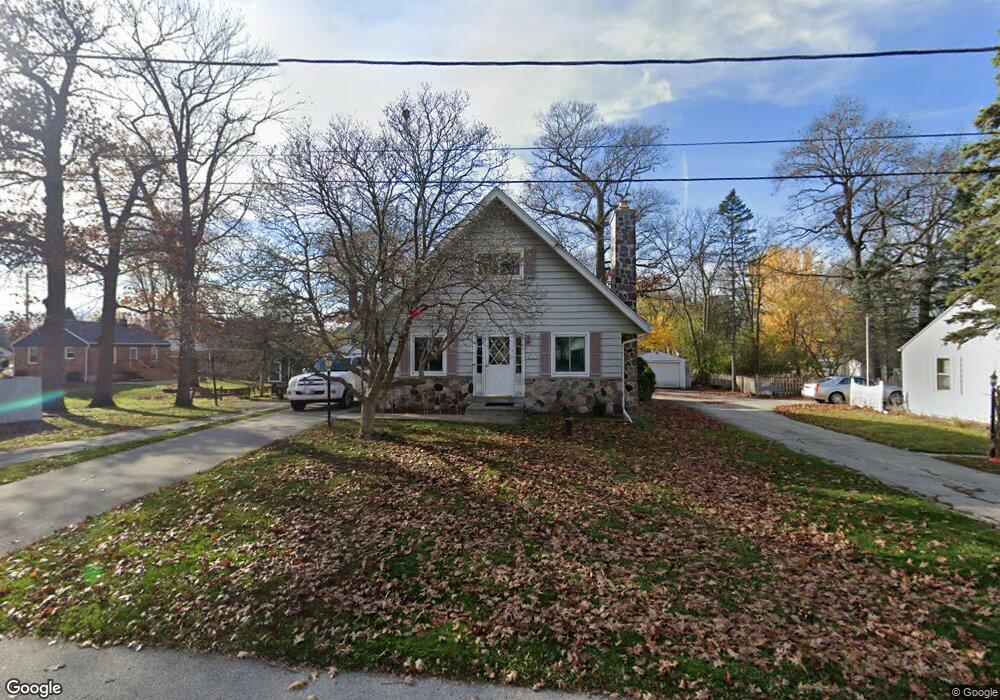
W273N2663 Maple St Pewaukee, WI 53072
Estimated Value: $337,000 - $391,000
--
Bed
--
Bath
--
Sq Ft
5,663
Sq Ft Lot
About This Home
This home is located at W273N2663 Maple St, Pewaukee, WI 53072 and is currently estimated at $369,597. W273N2663 Maple St is a home located in Waukesha County with nearby schools including Pewaukee Lake Elementary School, Asa Clark Middle School, and Pewaukee High School.
Ownership History
Date
Name
Owned For
Owner Type
Purchase Details
Closed on
Apr 30, 2018
Sold by
Semler Russell S and Semler Pamela J
Bought by
Sachse Stacey
Current Estimated Value
Home Financials for this Owner
Home Financials are based on the most recent Mortgage that was taken out on this home.
Original Mortgage
$153,300
Outstanding Balance
$129,531
Interest Rate
3.62%
Mortgage Type
Adjustable Rate Mortgage/ARM
Estimated Equity
$240,066
Purchase Details
Closed on
Jan 22, 2016
Sold by
Warp Barbara L
Bought by
Semler Russell S and Semler Pamela J
Create a Home Valuation Report for This Property
The Home Valuation Report is an in-depth analysis detailing your home's value as well as a comparison with similar homes in the area
Home Values in the Area
Average Home Value in this Area
Purchase History
| Date | Buyer | Sale Price | Title Company |
|---|---|---|---|
| Sachse Stacey | $200,000 | None Available | |
| Semler Russell S | $152,700 | None Available |
Source: Public Records
Mortgage History
| Date | Status | Borrower | Loan Amount |
|---|---|---|---|
| Open | Sachse Stacey | $153,300 |
Source: Public Records
Tax History Compared to Growth
Tax History
| Year | Tax Paid | Tax Assessment Tax Assessment Total Assessment is a certain percentage of the fair market value that is determined by local assessors to be the total taxable value of land and additions on the property. | Land | Improvement |
|---|---|---|---|---|
| 2024 | $2,422 | $197,200 | $82,700 | $114,500 |
| 2023 | $2,086 | $197,200 | $82,700 | $114,500 |
| 2022 | $2,663 | $197,200 | $82,700 | $114,500 |
| 2021 | $2,391 | $197,200 | $82,700 | $114,500 |
| 2020 | $2,462 | $164,800 | $63,100 | $101,700 |
| 2019 | $2,409 | $164,800 | $63,100 | $101,700 |
| 2018 | $2,312 | $164,800 | $63,100 | $101,700 |
| 2017 | $2,666 | $164,800 | $63,100 | $101,700 |
| 2016 | $2,375 | $164,800 | $63,100 | $101,700 |
| 2015 | $2,285 | $164,800 | $63,100 | $101,700 |
| 2014 | $2,492 | $164,800 | $63,100 | $101,700 |
| 2013 | $2,492 | $164,800 | $63,100 | $101,700 |
Source: Public Records
Map
Nearby Homes
- N27W27152 Woodland Dr
- W271N2631 Orchard Ln
- N28W27558 Peninsula Dr
- N28W26972 Woodland Dr
- W269N2762 Lelah Ave
- W278N2920 Oak St
- W265N2666 Meadowbrook Rd
- W268N1947 Shooting Star Rd Unit B
- N26W26388 Quail Hollow Rd Unit A
- N19W26672 Milkweed Ln Unit A
- W263N2345 Deer Haven Dr
- N16W27601 Pheasant Ln
- N20W28282 Oakton Rd
- N16W26583 Wild Oats Dr Unit C
- N16W26573 Tall Reeds Ln Unit A
- N16W26571 Tall Reeds Ln Unit B
- N16W26549 Wild Oats Dr Unit 25-C
- N16W26549 Tall Reeds Ln Unit A
- N16W26539 Tall Reeds Ln Unit D
- N15W26518 Tall Reeds Ln Unit C
- W273N2679 Maple St
- W273N2661 Maple St
- N26W27398 Prospect Ave
- W273N2682 Maple St
- N26W27368 Prospect Ave
- N26W27406 Prospect Ave
- N26W27385 Ash St
- W274N2666 Ash St
- N26W27409 Ash St
- W274N2658 Ash St
- N26W27421 Ash St
- N26W27352 Prospect Ave
- N26W27365 Ash St
- N26W27424 Prospect Ave
- N26W27336 Prospect Ave
- W274N2687 Ash St
- N26W27393 Prospect Ave
- N27W27391 Woodland Dr
- W274N2659 Ash St
- N27W27420 Ash St