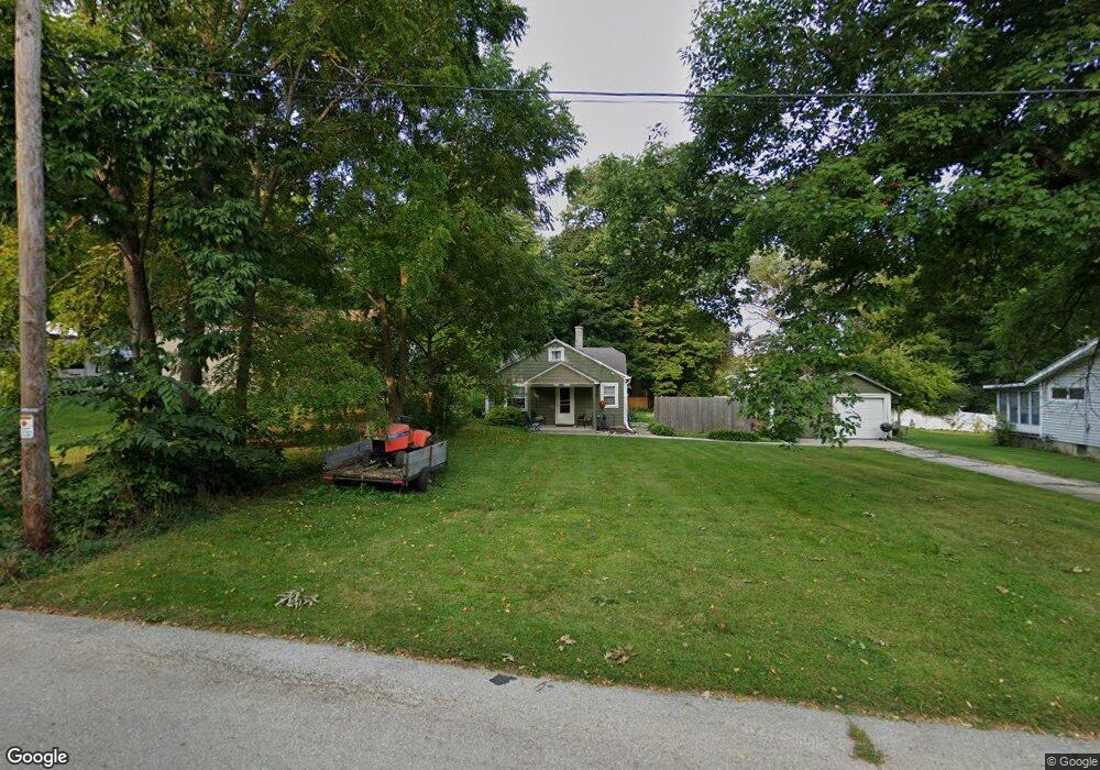
W274N2673 Ash St Pewaukee, WI 53072
Estimated Value: $274,000 - $395,000
Studio
--
Bath
--
Sq Ft
11,761
Sq Ft Lot
About This Home
This home is located at W274N2673 Ash St, Pewaukee, WI 53072 and is currently estimated at $313,809. W274N2673 Ash St is a home located in Waukesha County with nearby schools including Pewaukee Lake Elementary School, Asa Clark Middle School, and Pewaukee High School.
Ownership History
Date
Name
Owned For
Owner Type
Purchase Details
Closed on
Dec 20, 2016
Sold by
Gruber Jean E
Bought by
Jean E Gruber 2009 Living Trust
Current Estimated Value
Purchase Details
Closed on
Aug 15, 2011
Sold by
Bartley Keith John and Bartely Keith John
Bought by
Shong Peter and Gruber Jean
Purchase Details
Closed on
Oct 31, 2002
Sold by
Villarreal Daniel A and Villarreal Lorrie L
Bought by
Bartley Keith John
Home Financials for this Owner
Home Financials are based on the most recent Mortgage that was taken out on this home.
Original Mortgage
$106,400
Interest Rate
6.08%
Mortgage Type
Purchase Money Mortgage
Create a Home Valuation Report for This Property
The Home Valuation Report is an in-depth analysis detailing your home's value as well as a comparison with similar homes in the area
Home Values in the Area
Average Home Value in this Area
Purchase History
| Date | Buyer | Sale Price | Title Company |
|---|---|---|---|
| Jean E Gruber 2009 Living Trust | $42,500 | -- | |
| Shong Peter | $102,500 | None Available | |
| Bartley Keith John | $112,000 | -- |
Source: Public Records
Mortgage History
| Date | Status | Borrower | Loan Amount |
|---|---|---|---|
| Previous Owner | Bartley Keith John | $106,400 |
Source: Public Records
Tax History
| Year | Tax Paid | Tax Assessment Tax Assessment Total Assessment is a certain percentage of the fair market value that is determined by local assessors to be the total taxable value of land and additions on the property. | Land | Improvement |
|---|---|---|---|---|
| 2024 | $1,836 | $157,600 | $109,900 | $47,700 |
| 2023 | $1,838 | $157,600 | $109,900 | $47,700 |
| 2022 | $1,900 | $157,600 | $109,900 | $47,700 |
| 2021 | $1,897 | $157,600 | $109,900 | $47,700 |
| 2020 | $1,468 | $100,000 | $76,800 | $23,200 |
| 2019 | $1,435 | $100,000 | $76,800 | $23,200 |
| 2018 | $1,377 | $100,000 | $76,800 | $23,200 |
| 2017 | $1,360 | $100,000 | $76,800 | $23,200 |
| 2016 | $1,684 | $118,200 | $76,800 | $41,400 |
| 2015 | $1,943 | $118,200 | $76,800 | $41,400 |
| 2014 | $1,858 | $118,200 | $76,800 | $41,400 |
| 2013 | $1,858 | $118,200 | $76,800 | $41,400 |
Source: Public Records
Map
Nearby Homes
- W273N2420 Arlington Ct
- N27W27075 Woodland Dr
- W269N2723 Lelah Ave
- N17W27387 Lakefield Dr
- N21W26622 Cattail Ct
- N17W26887 E Fieldhack Dr Unit H
- N20W28482 Oakton Rd
- N16W26587 E Fieldhack Dr Unit E
- Lt16 Lakeside Ridge Ct
- 131 Maple Ave
- N17W26475 Meadowgrass Cir Unit G
- N16W26487 Meadowgrass Cir Unit D
- N39W27485 Hillside Grove Rd
- N35W28682 Old North Shore Dr
- 616 Kopmeier Dr
- 285 Cardinal Ridge Dr Unit 285
- 231 Prospect Ave
- W292N3296 Summerhill Rd
- 327 Sandy Cir
- 2912 N University Dr Unit 201
- W274N2659 Ash St
- W274N2687 Ash St
- W274N2656 Oak St
- W274N2666 Ash St
- W274N2658 Ash St
- W274N2648 Oak St
- W274N2668 Oak St
- W274N2682 Oak St
- N26W27421 Ash St
- W274N2680 Oak St
- W276N2821 Oak St
- Lt1 Oak St
- Lt1 Oak St Unit Lt1
- N26W27424 Prospect Ave
- N26W27409 Ash St
- N26W27406 Prospect Ave
- W274N2710 Oak St
- N27W27443 Woodland Dr
- N26W27398 Prospect Ave
- N26W27385 Ash St
Your Personal Tour Guide
Ask me questions while you tour the home.