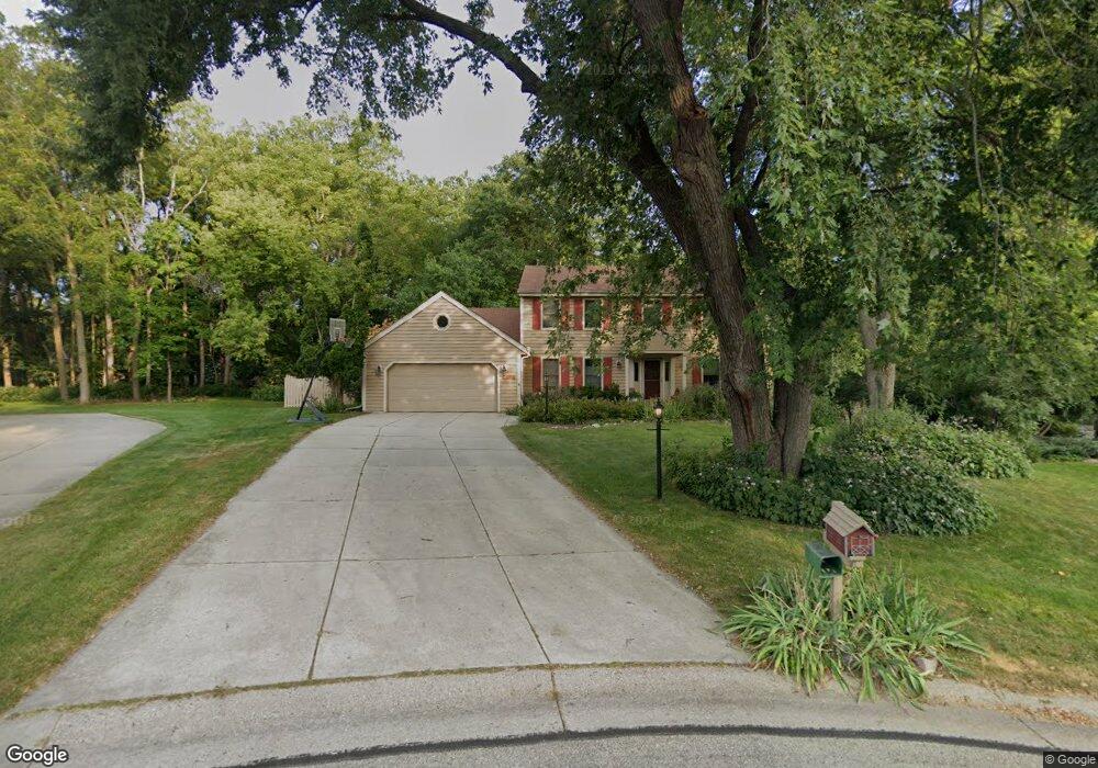
W277N2790 Chicory Ln Pewaukee, WI 53072
Estimated Value: $704,485 - $781,000
--
Bed
--
Bath
--
Sq Ft
1.27
Acres
About This Home
This home is located at W277N2790 Chicory Ln, Pewaukee, WI 53072 and is currently estimated at $749,621. W277N2790 Chicory Ln is a home located in Waukesha County with nearby schools including Pewaukee Lake Elementary School, Asa Clark Middle School, and Pewaukee High School.
Ownership History
Date
Name
Owned For
Owner Type
Purchase Details
Closed on
Mar 10, 2015
Sold by
Frank Michael O and Ocker Marci L
Bought by
Frank Ocker Family Trust
Current Estimated Value
Purchase Details
Closed on
May 17, 1999
Sold by
Frazee David M and Frazee Shelley R
Bought by
Frank Michael O and Ocker Marci L
Home Financials for this Owner
Home Financials are based on the most recent Mortgage that was taken out on this home.
Original Mortgage
$227,200
Outstanding Balance
$58,218
Interest Rate
6.94%
Mortgage Type
Purchase Money Mortgage
Estimated Equity
$691,403
Purchase Details
Closed on
Aug 24, 1998
Sold by
Kolbeck Timothy F and Kolbeck Rose A
Bought by
Frazee David M and Frazee Shelley R
Home Financials for this Owner
Home Financials are based on the most recent Mortgage that was taken out on this home.
Original Mortgage
$224,000
Interest Rate
6.87%
Mortgage Type
Purchase Money Mortgage
Create a Home Valuation Report for This Property
The Home Valuation Report is an in-depth analysis detailing your home's value as well as a comparison with similar homes in the area
Home Values in the Area
Average Home Value in this Area
Purchase History
| Date | Buyer | Sale Price | Title Company |
|---|---|---|---|
| Frank Ocker Family Trust | -- | None Available | |
| Frank Michael O | $284,000 | -- | |
| Frazee David M | $280,000 | -- |
Source: Public Records
Mortgage History
| Date | Status | Borrower | Loan Amount |
|---|---|---|---|
| Open | Frank Michael O | $227,200 | |
| Previous Owner | Frazee David M | $224,000 |
Source: Public Records
Tax History Compared to Growth
Tax History
| Year | Tax Paid | Tax Assessment Tax Assessment Total Assessment is a certain percentage of the fair market value that is determined by local assessors to be the total taxable value of land and additions on the property. | Land | Improvement |
|---|---|---|---|---|
| 2024 | $5,987 | $498,600 | $169,600 | $329,000 |
| 2023 | $5,969 | $498,600 | $169,600 | $329,000 |
| 2022 | $6,192 | $498,600 | $169,600 | $329,000 |
| 2021 | $6,176 | $498,600 | $169,600 | $329,000 |
| 2020 | $6,432 | $416,400 | $159,400 | $257,000 |
| 2019 | $6,044 | $400,600 | $159,400 | $241,200 |
| 2018 | $5,842 | $400,600 | $159,400 | $241,200 |
| 2017 | $5,964 | $400,600 | $159,400 | $241,200 |
| 2016 | $5,970 | $400,600 | $159,400 | $241,200 |
| 2015 | $5,814 | $400,600 | $159,400 | $241,200 |
| 2014 | $6,350 | $400,600 | $159,400 | $241,200 |
| 2013 | $6,350 | $400,600 | $159,400 | $241,200 |
Source: Public Records
Map
Nearby Homes
- W278N2920 Oak St
- N28W27558 Peninsula Dr
- N27W27152 Woodland Dr
- W271N2631 Orchard Ln
- N28W26972 Woodland Dr
- W269N2762 Lelah Ave
- Lt16 Lakeside Ridge Ct
- N20W28282 Oakton Rd
- N30W28853 W Lakeside Dr
- W283N3660 Yorkshire Trace
- W265N2666 Meadowbrook Rd
- N16W27601 Pheasant Ln
- W268N1947 Shooting Star Rd Unit B
- N39W27485 Hillside Grove Rd
- N26W26388 Quail Hollow Rd Unit A
- N19W26672 Milkweed Ln Unit A
- N40W27836 Glacier Rd
- W263N2345 Deer Haven Dr
- N37W26687 Kopmeier Dr
- N16W26583 Wild Oats Dr Unit C
- W277N2788 Chicory Ln
- W277N2799 Chicory Ln
- W277N2784 Chicory Ln
- W278N2855 Lincoln Ave
- W277N2789 Chicory Ln
- W277N2793 Chicory Ln
- W277N2844 Lincoln Ave
- W279N2818 Rocky Point Rd
- W277N2770 Chicory Ln
- W278N2798 Rocky Point Rd
- W277N2785 Chicory Ln
- W278N2881 Lincoln Ave
- W278N2780 Rocky Point Rd
- W277N2853 Chicago Ave
- W277N2777 Chicory Ln
- W278N2897 Lincoln Ave
- W277N2869 Oak St
- W277N2836 Chicago Ave
- W279N2862 Rocky Point Rd
- W277N2877 Oak St