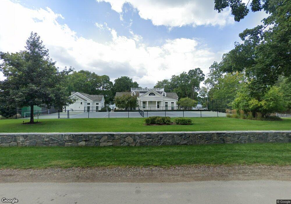
W279N2895 Rocky Point Rd Pewaukee, WI 53072
Estimated Value: $6,956,838
--
Bed
--
Bath
--
Sq Ft
2.12
Acres
About This Home
This home is located at W279N2895 Rocky Point Rd, Pewaukee, WI 53072 and is currently estimated at $6,956,838. W279N2895 Rocky Point Rd is a home located in Waukesha County with nearby schools including Arrowhead High School, Prairie Hill Waldorf School, and Christian Education Leadership Academy.
Ownership History
Date
Name
Owned For
Owner Type
Purchase Details
Closed on
Nov 28, 2018
Sold by
Rocky Point International Llc
Bought by
Rocky Point Lending Llc
Current Estimated Value
Purchase Details
Closed on
Apr 17, 2003
Sold by
Plesha Dennis A and Plesha Shirley A
Bought by
Plesha Dennis A and Plesha Shirley A
Home Financials for this Owner
Home Financials are based on the most recent Mortgage that was taken out on this home.
Original Mortgage
$166,600
Interest Rate
4.87%
Mortgage Type
Purchase Money Mortgage
Create a Home Valuation Report for This Property
The Home Valuation Report is an in-depth analysis detailing your home's value as well as a comparison with similar homes in the area
Home Values in the Area
Average Home Value in this Area
Purchase History
| Date | Buyer | Sale Price | Title Company |
|---|---|---|---|
| Rocky Point Lending Llc | $3,529,973 | None Available | |
| Plesha Dennis A | -- | -- |
Source: Public Records
Mortgage History
| Date | Status | Borrower | Loan Amount |
|---|---|---|---|
| Previous Owner | Plesha Dennis A | $166,600 |
Source: Public Records
Tax History Compared to Growth
Tax History
| Year | Tax Paid | Tax Assessment Tax Assessment Total Assessment is a certain percentage of the fair market value that is determined by local assessors to be the total taxable value of land and additions on the property. | Land | Improvement |
|---|---|---|---|---|
| 2024 | $59,417 | $4,944,200 | $1,530,000 | $3,414,200 |
| 2023 | $59,532 | $4,944,200 | $1,530,000 | $3,414,200 |
| 2022 | $61,695 | $4,944,200 | $1,530,000 | $3,414,200 |
| 2021 | $61,506 | $4,940,600 | $1,530,000 | $3,410,600 |
| 2020 | $77,342 | $5,043,600 | $1,167,400 | $3,876,200 |
| 2019 | $70,056 | $4,645,800 | $1,167,400 | $3,478,400 |
| 2018 | $67,779 | $4,645,800 | $1,167,400 | $3,478,400 |
| 2017 | $51,676 | $3,567,600 | $1,167,400 | $2,400,200 |
| 2016 | $53,228 | $3,567,600 | $1,167,400 | $2,400,200 |
| 2015 | $47,321 | $3,147,400 | $1,167,400 | $1,980,000 |
| 2014 | $19,101 | $2,167,400 | $1,167,400 | $1,000,000 |
| 2013 | $19,101 | $1,167,400 | $1,167,400 | $0 |
Source: Public Records
Map
Nearby Homes
- W278N2920 Oak St
- N28W27558 Peninsula Dr
- Lt16 Lakeside Ridge Ct
- N27W27152 Woodland Dr
- W271N2631 Orchard Ln
- N30W28853 W Lakeside Dr
- N28W26972 Woodland Dr
- W269N2762 Lelah Ave
- N20W28282 Oakton Rd
- W283N3660 Yorkshire Trace
- N39W27485 Hillside Grove Rd
- N16W27601 Pheasant Ln
- N33W29204 Millridge Rd
- W265N2666 Meadowbrook Rd
- N40W27836 Glacier Rd
- W268N1947 Shooting Star Rd Unit B
- N18W28978 Golf Ridge S Unit A
- N26W26388 Quail Hollow Rd Unit A
- N37W26687 Kopmeier Dr
- N19W26672 Milkweed Ln Unit A
- W279N2865 Rocky Point Rd
- W279N2907 Rocky Point Rd
- W279N2903 Rocky Point Rd
- W279N2855 Rocky Point Rd
- W279N2917 Rocky Point Rd
- W279N2862 Rocky Point Rd
- W279N2821 Rocky Point Rd
- W279N2819 Rocky Point Rd
- W278N2926 Rocky Point Rd
- W278N2927 Rocky Point Rd
- W278N2945 Rocky Point Rd
- W278N2931 Rocky Point Rd
- W279N2818 Rocky Point Rd
- W279N2815 Rocky Point Rd
- W278N2935 Rocky Point Rd
- W278N2946 Rocky Point Rd
- W278N2955 Rocky Point Rd
- W278N2771 Rocky Point Rd
- W278N2968 Rocky Point Rd
- W278N2798 Rocky Point Rd