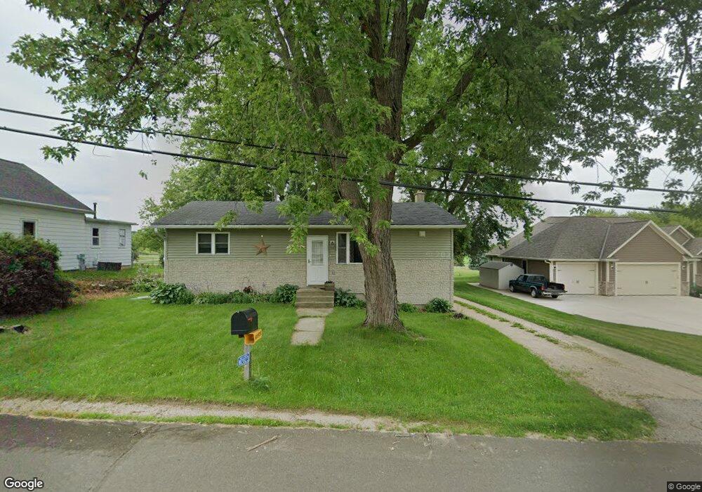
W2823 W Neda Rd Iron Ridge, WI 53035
Estimated Value: $195,000 - $244,000
2
Beds
1
Bath
960
Sq Ft
$227/Sq Ft
Est. Value
About This Home
This home is located at W2823 W Neda Rd, Iron Ridge, WI 53035 and is currently estimated at $218,003, approximately $227 per square foot. W2823 W Neda Rd is a home located in Dodge County with nearby schools including Parkview Elementary School, Mayville Elementary School, and Mayville Junior/Senior High School.
Ownership History
Date
Name
Owned For
Owner Type
Purchase Details
Closed on
Dec 30, 2016
Sold by
Anderson Denise M and Anderson Jacob Daniel
Bought by
Anderson Denise M and Anderson Jacob Da
Current Estimated Value
Home Financials for this Owner
Home Financials are based on the most recent Mortgage that was taken out on this home.
Original Mortgage
$82,500
Outstanding Balance
$39,907
Interest Rate
3.34%
Mortgage Type
New Conventional
Estimated Equity
$178,096
Purchase Details
Closed on
Sep 25, 2009
Sold by
Schweiger Dennis S
Bought by
Lang Denise M
Home Financials for this Owner
Home Financials are based on the most recent Mortgage that was taken out on this home.
Original Mortgage
$4,000
Interest Rate
5.19%
Mortgage Type
Unknown
Create a Home Valuation Report for This Property
The Home Valuation Report is an in-depth analysis detailing your home's value as well as a comparison with similar homes in the area
Home Values in the Area
Average Home Value in this Area
Purchase History
| Date | Buyer | Sale Price | Title Company |
|---|---|---|---|
| Anderson Denise M | -- | None Available | |
| Lang Denise M | $94,900 | None Available |
Source: Public Records
Mortgage History
| Date | Status | Borrower | Loan Amount |
|---|---|---|---|
| Open | Anderson Denise M | $82,500 | |
| Closed | Lang Denise M | $4,000 | |
| Closed | Lang Denise M | $90,115 |
Source: Public Records
Tax History Compared to Growth
Tax History
| Year | Tax Paid | Tax Assessment Tax Assessment Total Assessment is a certain percentage of the fair market value that is determined by local assessors to be the total taxable value of land and additions on the property. | Land | Improvement |
|---|---|---|---|---|
| 2024 | $1,589 | $101,100 | $11,000 | $90,100 |
| 2023 | $1,381 | $101,100 | $11,000 | $90,100 |
| 2022 | $1,332 | $101,100 | $11,000 | $90,100 |
| 2021 | $1,439 | $101,100 | $11,000 | $90,100 |
| 2020 | $1,447 | $101,100 | $11,000 | $90,100 |
| 2019 | $1,389 | $101,100 | $11,000 | $90,100 |
| 2018 | $1,394 | $101,100 | $11,000 | $90,100 |
| 2017 | $1,544 | $101,100 | $11,000 | $90,100 |
| 2016 | $1,355 | $101,100 | $11,000 | $90,100 |
| 2015 | $1,491 | $101,100 | $11,000 | $90,100 |
| 2014 | $1,548 | $101,100 | $11,000 | $90,100 |
Source: Public Records
Map
Nearby Homes
- Lt0 E Neda Rd
- 202 East Ave
- 234 Watertower Cir
- 0 Burkwald Ave
- N5413 County Rd S
- N6436 County Road Tw
- W4069 Raasch Hill Rd
- 725 Green Bay Dr
- N4973 Lake Dr
- Lt1 Hi View Ct
- 300 Birchcrest Rd
- 502 Janssen Ave
- 274 S Walnut St
- Lt2 S Clark St
- Lt1 W Horseshoe Rd
- 401 N Hubbard St
- N4569 Hazelwood Rd
- 101 Valley St
- 406 N Hubbard St
- N4510 Anthony Island -
- W2827 W Neda Rd
- W2813 W Neda Rd
- W2822 W Neda Rd
- N6275 Neda Rd
- N6275 E Neda Rd Unit N6275
- W2810 W Neda Rd
- W2833 W Neda Rd
- N6280 Neda Rd
- N6294 Neda Rd
- W2830 W Neda Rd
- N6319 Mine Rd
- N6273 Neda Rd
- W2844 W Neda Rd
- N6323 Mine Rd
- N6326 Mine Rd
- W2839 W Neda Rd
- N6334 Mine Rd
- W2863 W Neda Rd
- N6355 Mine Rd
- N6354 Mine Rd