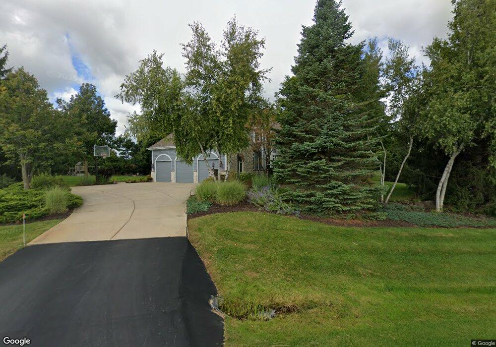
W289N3799 Huntsman Ct Pewaukee, WI 53072
Estimated Value: $977,000 - $1,022,000
--
Bed
--
Bath
--
Sq Ft
0.8
Acres
About This Home
This home is located at W289N3799 Huntsman Ct, Pewaukee, WI 53072 and is currently estimated at $1,002,716. W289N3799 Huntsman Ct is a home located in Waukesha County with nearby schools including Arrowhead High School, Zion Lutheran School, and St Charles Parish School.
Ownership History
Date
Name
Owned For
Owner Type
Purchase Details
Closed on
Jul 26, 2016
Sold by
Erdmann John F and Erdmann Lisa A
Bought by
Kliez Kevin R and Kliez Angela L
Current Estimated Value
Home Financials for this Owner
Home Financials are based on the most recent Mortgage that was taken out on this home.
Original Mortgage
$535,500
Outstanding Balance
$427,267
Interest Rate
3.48%
Mortgage Type
New Conventional
Estimated Equity
$575,449
Create a Home Valuation Report for This Property
The Home Valuation Report is an in-depth analysis detailing your home's value as well as a comparison with similar homes in the area
Home Values in the Area
Average Home Value in this Area
Purchase History
| Date | Buyer | Sale Price | Title Company |
|---|---|---|---|
| Kliez Kevin R | $595,000 | None Available |
Source: Public Records
Mortgage History
| Date | Status | Borrower | Loan Amount |
|---|---|---|---|
| Open | Kliez Kevin R | $535,500 |
Source: Public Records
Tax History Compared to Growth
Tax History
| Year | Tax Paid | Tax Assessment Tax Assessment Total Assessment is a certain percentage of the fair market value that is determined by local assessors to be the total taxable value of land and additions on the property. | Land | Improvement |
|---|---|---|---|---|
| 2024 | $6,729 | $624,000 | $130,000 | $494,000 |
| 2023 | $6,540 | $624,000 | $130,000 | $494,000 |
| 2022 | $7,302 | $624,000 | $130,000 | $494,000 |
| 2021 | $7,366 | $624,000 | $130,000 | $494,000 |
| 2020 | $6,510 | $624,000 | $130,000 | $494,000 |
| 2019 | $6,411 | $624,000 | $130,000 | $494,000 |
| 2018 | $6,975 | $624,000 | $130,000 | $494,000 |
| 2017 | $8,493 | $624,000 | $130,000 | $494,000 |
| 2016 | $8,155 | $624,000 | $130,000 | $494,000 |
| 2015 | $8,609 | $624,000 | $130,000 | $494,000 |
| 2014 | $8,471 | $624,000 | $130,000 | $494,000 |
| 2013 | $8,471 | $624,000 | $130,000 | $494,000 |
Source: Public Records
Map
Nearby Homes
- N35W28682 Old North Shore Dr
- Lt16 Lakeside Ridge Ct
- W282N4163 Somerset Ln
- 617 Coventry Ln
- 530 Manchester Ln
- N30W28853 W Lakeside Dr
- 1019 Wellington Way
- 732 River Reserve Dr
- W278N2920 Oak St
- 1702 E Juniper Way
- 1800 E Juniper Way
- W221N4564 Timber Hill Ct
- 345 Cottonwood Ave
- N28W30264 Red Hawk Ct
- 601 N Thornbush Cir
- 447 Merton Ave
- 1083 Quinlan Dr Unit C
- N21W29727 Glen Cove Rd
- N20W28282 Oakton Rd
- 1117 Sweetbriar Ln Unit 22
- N38W28927 Middlefield Rd
- W289N3795 Huntsman Ct
- N38W28902 Middlefield Rd
- W289N3792 Huntsman Ct
- N38W28878 Middlefield Rd
- N38W28908 Middlefield Rd
- W289N3781 Huntsman Ct
- N38W28914 Middlefield Rd
- W290N3866 Fox Field Ct
- W289N3764 Huntsman Ct
- W290N3808 Fox Field Ct
- N38W28938 Middlefield Rd
- N38W28846 Middlefield Rd
- N38W28835 Middlefield Rd
- W289N3752 Huntsman Ct
- W289N3763 Huntsman Ct
- N38W28992 Middlefield Rd
- W290N3815 Fox Field Ct
- W288N3759 Woodline Ct
- W290N3855 Fox Field Ct