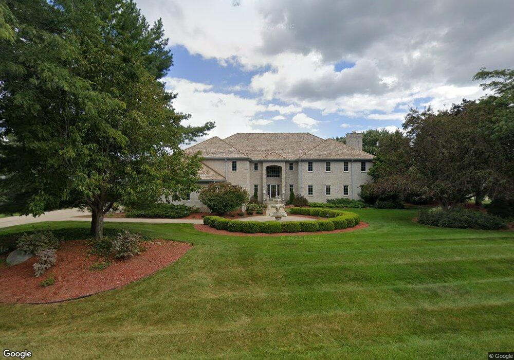
W308N1728 Westlake Cir Delafield, WI 53018
Estimated Value: $1,331,000 - $1,604,564
--
Bed
--
Bath
--
Sq Ft
1.09
Acres
About This Home
This home is located at W308N1728 Westlake Cir, Delafield, WI 53018 and is currently estimated at $1,489,855. W308N1728 Westlake Cir is a home located in Waukesha County with nearby schools including Arrowhead High School, KM Explore, and Prairie Hill Waldorf School.
Ownership History
Date
Name
Owned For
Owner Type
Purchase Details
Closed on
Dec 17, 1999
Sold by
Black Cheryl M and Mueller Cheryl M
Bought by
Braier Thomas and Braier Margaret J
Current Estimated Value
Home Financials for this Owner
Home Financials are based on the most recent Mortgage that was taken out on this home.
Original Mortgage
$750,000
Outstanding Balance
$220,222
Interest Rate
7.25%
Mortgage Type
Purchase Money Mortgage
Estimated Equity
$1,269,633
Create a Home Valuation Report for This Property
The Home Valuation Report is an in-depth analysis detailing your home's value as well as a comparison with similar homes in the area
Home Values in the Area
Average Home Value in this Area
Purchase History
| Date | Buyer | Sale Price | Title Company |
|---|---|---|---|
| Braier Thomas | $950,000 | -- |
Source: Public Records
Mortgage History
| Date | Status | Borrower | Loan Amount |
|---|---|---|---|
| Open | Braier Thomas | $750,000 |
Source: Public Records
Tax History Compared to Growth
Tax History
| Year | Tax Paid | Tax Assessment Tax Assessment Total Assessment is a certain percentage of the fair market value that is determined by local assessors to be the total taxable value of land and additions on the property. | Land | Improvement |
|---|---|---|---|---|
| 2024 | $14,271 | $1,337,000 | $150,000 | $1,187,000 |
| 2023 | $13,888 | $1,337,000 | $150,000 | $1,187,000 |
| 2022 | $13,668 | $1,337,000 | $150,000 | $1,187,000 |
| 2021 | $13,677 | $1,337,000 | $150,000 | $1,187,000 |
| 2020 | $13,903 | $1,337,000 | $150,000 | $1,187,000 |
| 2019 | $13,726 | $1,337,000 | $150,000 | $1,187,000 |
| 2018 | $14,939 | $1,337,000 | $150,000 | $1,187,000 |
| 2017 | $15,618 | $1,337,000 | $150,000 | $1,187,000 |
| 2016 | $17,453 | $1,337,000 | $150,000 | $1,187,000 |
| 2015 | $18,437 | $1,337,000 | $150,000 | $1,187,000 |
| 2014 | $18,372 | $1,337,000 | $150,000 | $1,187,000 |
| 2013 | $18,372 | $1,337,000 | $150,000 | $1,187,000 |
Source: Public Records
Map
Nearby Homes
- W304N2426 Maple Ave
- N25W30832 Overlook Ct
- 2357 Quail Hollow Ct Unit D
- 2215B Circle Ridge Unit D
- 2264 Circle Ridge Rd Unit E
- N21W29727 Glen Cove Rd
- N17W29663 Caldicot North Cir
- N16W29646 Caldicot South Cir
- N16W29672 Caldicot South Cir
- W318N1045 Huckleberry Way N
- N28W30264 Red Hawk Ct
- 1603 Milwaukee St
- 637 1st St
- N15W29521 S Caldicot Cir
- W221N4564 Timber Hill Ct
- 1001 Park Way
- 1026 Park Way
- 1025 Park Way
- 805 Wells St Unit 4
- 805 Wells St Unit 2
- W308N1808 Westlake Cir
- N17W30750 Woodland Hill Dr
- N17W30755 Woodland Hill Dr
- N17W30743 Woodland Hill Dr
- W308N1717 Westlake Cir
- W308N1759 Westlake Cir
- N17W30708 Woodland Hill Dr
- N17W30711 Woodland Hill Dr
- W308N1829 Westlake Cir
- W308N1801 Westlake Cir
- W307N1666 Shadowood Point
- N17W30694 Woodland Hill Dr
- W307N1677 Shadowood Point
- N17W30687 Woodland Hill Dr
- N16W30896 Woodland Hill Dr
- W307N1632 Shadowood Point
- N17W30656 Woodland Hill Dr
- W307N1627 Shadowood Point
- N17W30651 Woodland Hill Dr
- N16W30883 Woodland Hill Dr