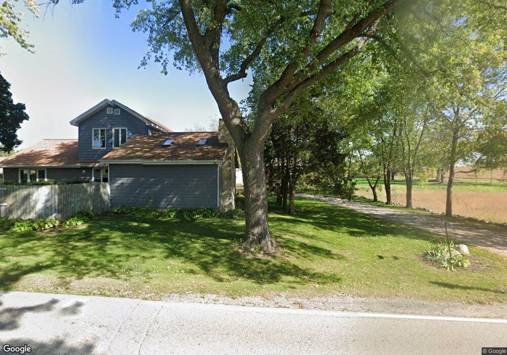
W309S8166 County Road I Mukwonago, WI 53149
Estimated Value: $524,602 - $541,000
--
Bed
--
Bath
--
Sq Ft
3.86
Acres
About This Home
This home is located at W309S8166 County Road I, Mukwonago, WI 53149 and is currently estimated at $532,801. W309S8166 County Road I is a home with nearby schools including Section Elementary School, Park View Middle School, and Mukwonago High School.
Ownership History
Date
Name
Owned For
Owner Type
Purchase Details
Closed on
Nov 15, 2007
Sold by
Sugden Stanley and Sugden Julie A
Bought by
Feyen Matthew F and Feyen Meg A
Current Estimated Value
Home Financials for this Owner
Home Financials are based on the most recent Mortgage that was taken out on this home.
Original Mortgage
$265,600
Outstanding Balance
$167,613
Interest Rate
6.33%
Mortgage Type
Purchase Money Mortgage
Estimated Equity
$365,188
Purchase Details
Closed on
May 3, 2007
Sold by
Sugden Dorothy
Bought by
Sugden Stanley R and Sugden Julie A
Home Financials for this Owner
Home Financials are based on the most recent Mortgage that was taken out on this home.
Original Mortgage
$528,000
Interest Rate
6.2%
Mortgage Type
Construction
Purchase Details
Closed on
Sep 5, 2006
Sold by
Sugden Dorothy J
Bought by
Sugden Stanley R and Sugden Julie A
Create a Home Valuation Report for This Property
The Home Valuation Report is an in-depth analysis detailing your home's value as well as a comparison with similar homes in the area
Home Values in the Area
Average Home Value in this Area
Purchase History
| Date | Buyer | Sale Price | Title Company |
|---|---|---|---|
| Feyen Matthew F | $332,000 | None Available | |
| Sugden Stanley R | -- | None Available | |
| Sugden Stanley R | -- | None Available |
Source: Public Records
Mortgage History
| Date | Status | Borrower | Loan Amount |
|---|---|---|---|
| Open | Feyen Matthew F | $265,600 | |
| Previous Owner | Sugden Stanley R | $528,000 |
Source: Public Records
Tax History Compared to Growth
Tax History
| Year | Tax Paid | Tax Assessment Tax Assessment Total Assessment is a certain percentage of the fair market value that is determined by local assessors to be the total taxable value of land and additions on the property. | Land | Improvement |
|---|---|---|---|---|
| 2024 | $3,764 | $404,000 | $166,900 | $237,100 |
| 2023 | $4,832 | $330,900 | $123,000 | $207,900 |
| 2022 | $4,756 | $330,900 | $123,000 | $207,900 |
| 2021 | $4,432 | $330,900 | $123,000 | $207,900 |
| 2020 | $4,395 | $330,900 | $123,000 | $207,900 |
| 2019 | $4,008 | $330,900 | $123,000 | $207,900 |
| 2018 | $4,157 | $330,900 | $123,000 | $207,900 |
| 2017 | $4,126 | $330,900 | $123,000 | $207,900 |
| 2016 | $4,207 | $330,900 | $123,000 | $207,900 |
| 2015 | $4,034 | $330,900 | $123,000 | $207,900 |
| 2014 | $4,476 | $330,900 | $123,000 | $207,900 |
| 2013 | $4,476 | $330,900 | $123,000 | $207,900 |
Source: Public Records
Map
Nearby Homes
- W309S8296 County Road I
- S81W30467 Bailey
- W312S8869 Cherokee Pass
- 365 Woods Edge Dr
- Lt24 Woods Edge Dr
- Lt28 Woods Edge Dr
- Lt26 Woods Edge Dr
- Lt25 Woods Edge Dr
- S91W31622 Marys Ct
- S75W32101 Paul Ln
- 1575 Fairwinds Blvd
- 1625 Fairwinds Blvd
- 1534 Fairwinds Blvd
- 1564 Fairwinds Blvd
- 1584 Fairwinds Blvd
- 1624 Fairwinds Blvd
- 1547 Sandhill Ln Unit 2002
- 1521 Sandhill Ln Unit 2101
- 1525 Sandhill Ln Unit 2102
- 1543 Sandhill Ln Unit 2001
- S79W31365 Green Meadows Dr
- W309S8050 County Road I
- S83W31105 Section Rd
- S79W30989 Romeo Ct
- S79W30979 Romeo Ct
- S79W30988 Romeo Ct
- W308S7973 Avon Dr
- W308S7980 Avon Dr
- S80W30731 Meadowlark Cir
- W308S7947 Avon Dr
- S79W30978 Romeo Ct
- S80W30718 Meadowlark Cir
- W308S7935 Avon Dr
- S80W30681 Meadowlark Cir
- S79W30960 Romeo Ct
- W308S7954 Avon Dr
- S79W30789 Juliet Ct
- S80W30754 Meadowlark Cir
- W308S7924 Avon Dr
- W309S7915 Avon Dr