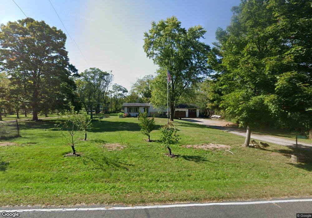
W315S7989 Whitmore Rd Mukwonago, WI 53149
Estimated Value: $407,367 - $473,000
--
Bed
--
Bath
--
Sq Ft
1
Acres
About This Home
This home is located at W315S7989 Whitmore Rd, Mukwonago, WI 53149 and is currently estimated at $434,092. W315S7989 Whitmore Rd is a home located in Waukesha County with nearby schools including Section Elementary School, Park View Middle School, and Mukwonago High School.
Ownership History
Date
Name
Owned For
Owner Type
Purchase Details
Closed on
Jan 19, 2018
Sold by
Krolski Susan L
Bought by
Pruszka Thomas J and Pruszka Jayme
Current Estimated Value
Home Financials for this Owner
Home Financials are based on the most recent Mortgage that was taken out on this home.
Original Mortgage
$232,655
Outstanding Balance
$196,283
Interest Rate
3.93%
Mortgage Type
New Conventional
Estimated Equity
$237,809
Purchase Details
Closed on
May 5, 2005
Sold by
Krolski Scott A and Krolski Susan L
Bought by
Krolski Susan L
Home Financials for this Owner
Home Financials are based on the most recent Mortgage that was taken out on this home.
Original Mortgage
$173,000
Interest Rate
6.05%
Mortgage Type
New Conventional
Create a Home Valuation Report for This Property
The Home Valuation Report is an in-depth analysis detailing your home's value as well as a comparison with similar homes in the area
Home Values in the Area
Average Home Value in this Area
Purchase History
| Date | Buyer | Sale Price | Title Company |
|---|---|---|---|
| Pruszka Thomas J | $245,900 | None Available | |
| Krolski Susan L | -- | -- |
Source: Public Records
Mortgage History
| Date | Status | Borrower | Loan Amount |
|---|---|---|---|
| Open | Pruszka Thomas J | $232,655 | |
| Previous Owner | Krolski Susan L | $173,000 |
Source: Public Records
Tax History Compared to Growth
Tax History
| Year | Tax Paid | Tax Assessment Tax Assessment Total Assessment is a certain percentage of the fair market value that is determined by local assessors to be the total taxable value of land and additions on the property. | Land | Improvement |
|---|---|---|---|---|
| 2024 | $2,670 | $291,600 | $100,000 | $191,600 |
| 2023 | $3,053 | $214,100 | $75,000 | $139,100 |
| 2022 | $3,012 | $214,100 | $75,000 | $139,100 |
| 2021 | $2,776 | $214,100 | $75,000 | $139,100 |
| 2020 | $2,775 | $214,100 | $75,000 | $139,100 |
| 2019 | $2,520 | $214,100 | $75,000 | $139,100 |
| 2018 | $2,623 | $214,100 | $75,000 | $139,100 |
| 2017 | $3,133 | $214,100 | $75,000 | $139,100 |
| 2016 | $2,662 | $214,100 | $75,000 | $139,100 |
| 2015 | $2,557 | $214,100 | $75,000 | $139,100 |
| 2014 | $2,838 | $214,100 | $75,000 | $139,100 |
| 2013 | $2,838 | $214,100 | $75,000 | $139,100 |
Source: Public Records
Map
Nearby Homes
- S75W32101 Paul Ln
- S77W29967 Crossgate Dr
- W331S7559 County Road Ee
- 365 Woods Edge Dr
- Lt28 Woods Edge Dr
- Lt26 Woods Edge Dr
- Lt25 Woods Edge Dr
- Lt24 Woods Edge Dr
- The Camille Plan at Chapman Farms
- The Bristol Plan at Chapman Farms
- The Arielle Plan at Chapman Farms
- The Alana Plan at Chapman Farms
- The Hannah Plan at Chapman Farms
- The Brianna Plan at Chapman Farms
- The Lauren Plan at Chapman Farms
- The Skylar Plan at Chapman Farms
- The Francesca Plan at Chapman Farms
- The Sophia Plan at Chapman Farms
- The Hailey Plan at Chapman Farms
- The Peyton Plan at Chapman Farms
- S79W31491 Green Meadows Dr
- S79W31492 Green Meadows Dr
- W315S8003 Whitmore Rd
- W314S8020 Whitmore Rd
- S79W31471 Green Meadows Dr
- S79W31480 Green Meadows Dr
- W314S7918 Whitmore Rd
- W314S8058 Whitmore Rd
- S79W31466 Green Meadows Dr
- S79W31451 Green Meadows Dr
- S78W31470 Sugden Rd
- S78W31555 Wingate Ct
- S78W31557 Wingate Ct
- S78W31450 Sugden Rd
- S79W31438 Green Meadows Dr
- S78W31577 Wingate Ct
- W314S7953 High View Cir
- W314S8021 High View Cir
- S78W31428 Sugden Rd
- W315S8129 Whitmore Rd