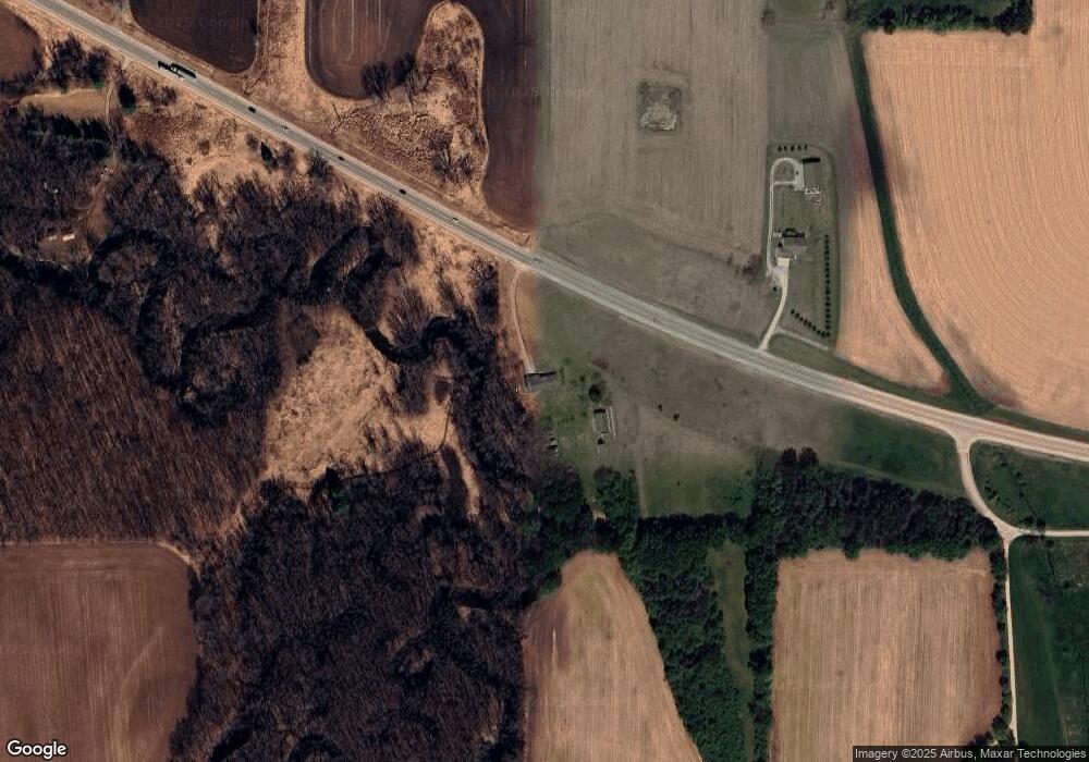
W3199 State Road 60 Neosho, WI 53059
Estimated Value: $465,000 - $483,661
--
Bed
--
Bath
--
Sq Ft
18.26
Acres
About This Home
This home is located at W3199 State Road 60, Neosho, WI 53059 and is currently estimated at $474,331. W3199 State Road 60 is a home located in Dodge County with nearby schools including John Hustis Elementary School, Hustisford High School, and Bethany Lutheran School.
Ownership History
Date
Name
Owned For
Owner Type
Purchase Details
Closed on
Aug 25, 2022
Sold by
Koch Joshua M
Bought by
Moore Andrew J
Current Estimated Value
Purchase Details
Closed on
Jan 29, 2010
Sold by
Uttech Frances
Bought by
Koch Joshua M
Home Financials for this Owner
Home Financials are based on the most recent Mortgage that was taken out on this home.
Original Mortgage
$118,000
Interest Rate
5.09%
Mortgage Type
New Conventional
Create a Home Valuation Report for This Property
The Home Valuation Report is an in-depth analysis detailing your home's value as well as a comparison with similar homes in the area
Home Values in the Area
Average Home Value in this Area
Purchase History
| Date | Buyer | Sale Price | Title Company |
|---|---|---|---|
| Moore Andrew J | $354,000 | Schuessler Thomas | |
| Koch Joshua M | $260,000 | None Available |
Source: Public Records
Mortgage History
| Date | Status | Borrower | Loan Amount |
|---|---|---|---|
| Previous Owner | Koch Joshua M | $118,000 |
Source: Public Records
Tax History Compared to Growth
Tax History
| Year | Tax Paid | Tax Assessment Tax Assessment Total Assessment is a certain percentage of the fair market value that is determined by local assessors to be the total taxable value of land and additions on the property. | Land | Improvement |
|---|---|---|---|---|
| 2024 | $3,956 | $236,800 | $88,200 | $148,600 |
| 2023 | $3,887 | $236,800 | $88,200 | $148,600 |
| 2022 | $4,122 | $236,800 | $88,200 | $148,600 |
| 2021 | $3,586 | $236,800 | $88,200 | $148,600 |
| 2020 | $3,857 | $236,800 | $88,200 | $148,600 |
| 2019 | $3,825 | $236,800 | $88,200 | $148,600 |
| 2018 | $3,660 | $223,000 | $87,100 | $135,900 |
| 2017 | $3,722 | $223,000 | $87,100 | $135,900 |
| 2016 | $3,801 | $223,000 | $87,100 | $135,900 |
| 2015 | $3,773 | $223,000 | $87,100 | $135,900 |
| 2014 | $4,000 | $223,000 | $87,100 | $135,900 |
Source: Public Records
Map
Nearby Homes
- N3220 Hale Rd
- 222 E Lehman St
- 244 S Ridge St
- .68 Acre Parcel Anthony Island
- N2680 Sleepy Hollow Rd
- 000 Lt0 Sleepy Hollow Rd
- 252 S Hustis St
- Lot 2 Sleepy Hollow
- N4510 & N4504 Anthony Island
- N4510 Anthony Island -
- Lt51 Anthony Island -
- 535 Island View Cir
- W1974 Pond Rd
- 727 E Lakeview Rd Unit 8
- N4946 County Road Ws
- W4436 E Lakeview Rd
- 827 E Lakeview Rd
- N4973 Lake Dr
- N5003 Mark Ln
- N5319 Nancy Ln
- N3700 Fish Rd
- W3066 State Road 60
- W3159 Lehman Rd
- W3155 Lehman Rd
- W3281 Lehman Rd
- W3097 Lehman Rd
- N3755 Scenic Ln
- N3745 Scenic Ln
- n 3745 Scenic Ln
- N3761 Scenic Ln
- N3731 Scenic Ln
- W2975 State Road 60
- W3041 Lehman Rd
- W3070 Lehman Rd
- N3499 Fish Rd
- N3530 County Road Ee
- W2986 Lehman Rd
- W3150 State Road 60
- W3842 State Road 60
- W3160 Lehman Rd
