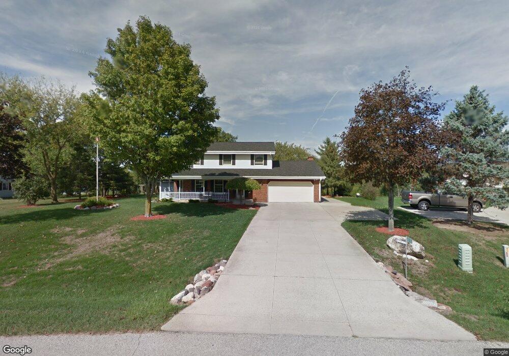
W322S1521 High Meadow Cir Delafield, WI 53018
Estimated Value: $546,000 - $628,000
--
Bed
--
Bath
--
Sq Ft
1
Acres
About This Home
This home is located at W322S1521 High Meadow Cir, Delafield, WI 53018 and is currently estimated at $589,770. W322S1521 High Meadow Cir is a home located in Waukesha County with nearby schools including Wales Elementary School, Kettle Moraine Middle School, and Kettle Moraine High School.
Ownership History
Date
Name
Owned For
Owner Type
Purchase Details
Closed on
Sep 21, 2020
Sold by
Tully Sandra M
Bought by
Stuber Thomas and Stuber Jennifer
Current Estimated Value
Home Financials for this Owner
Home Financials are based on the most recent Mortgage that was taken out on this home.
Original Mortgage
$248,850
Outstanding Balance
$220,838
Interest Rate
2.9%
Mortgage Type
New Conventional
Estimated Equity
$368,932
Purchase Details
Closed on
Mar 20, 2018
Sold by
Tull Sandra M
Bought by
Tully David C and Tully Michael S
Purchase Details
Closed on
Apr 23, 2001
Sold by
Tully Sandra M and Falk Duane W
Bought by
Tully Sandra M
Home Financials for this Owner
Home Financials are based on the most recent Mortgage that was taken out on this home.
Original Mortgage
$50,000
Interest Rate
7.16%
Create a Home Valuation Report for This Property
The Home Valuation Report is an in-depth analysis detailing your home's value as well as a comparison with similar homes in the area
Home Values in the Area
Average Home Value in this Area
Purchase History
| Date | Buyer | Sale Price | Title Company |
|---|---|---|---|
| Stuber Thomas | $395,000 | Frontier Title | |
| Tully David C | -- | None Available | |
| Tully Sandra M | -- | -- |
Source: Public Records
Mortgage History
| Date | Status | Borrower | Loan Amount |
|---|---|---|---|
| Open | Stuber Thomas | $248,850 | |
| Previous Owner | Tully Sandra M | $50,000 |
Source: Public Records
Tax History Compared to Growth
Tax History
| Year | Tax Paid | Tax Assessment Tax Assessment Total Assessment is a certain percentage of the fair market value that is determined by local assessors to be the total taxable value of land and additions on the property. | Land | Improvement |
|---|---|---|---|---|
| 2024 | $4,691 | $475,500 | $145,000 | $330,500 |
| 2023 | $4,289 | $465,500 | $135,000 | $330,500 |
| 2022 | $4,690 | $426,000 | $110,000 | $316,000 |
| 2021 | $3,541 | $253,000 | $55,000 | $198,000 |
| 2020 | $3,613 | $253,000 | $55,000 | $198,000 |
| 2019 | $3,403 | $253,000 | $55,000 | $198,000 |
| 2018 | $3,458 | $253,000 | $55,000 | $198,000 |
| 2017 | $3,819 | $253,000 | $55,000 | $198,000 |
| 2016 | $3,426 | $253,000 | $55,000 | $198,000 |
| 2015 | $3,425 | $253,000 | $55,000 | $198,000 |
| 2014 | $3,422 | $253,000 | $55,000 | $198,000 |
| 2013 | $3,422 | $253,000 | $55,000 | $198,000 |
Source: Public Records
Map
Nearby Homes
- S16W32109 High Meadow Cir
- S14W31855 High Meadow Ln
- 108 E Oak Crest Dr Unit 110
- W316S838 Hidden Hollow
- 215 Criglas Rd
- 116 W Main St
- 118 E Main St
- 329 Breck Rd
- 436 Thomas Rd
- 400 S Highland St Unit A
- W316S198 Wisconsin 83
- 205 Kummrow Ct
- 545 Thomas Rd
- 902 Meyers Ct
- 715 Lochtyn Ridge
- S13W33800 U S 18
- 327 Wakefield Downs
- 447 Dugan Rd
- 34100 Sunset Dr
- S23W30709 Brecon Way
- S15W32228 High Meadow Cir
- S15W32260 Moraine View Dr
- W322S1548 High Meadow Cir
- W322S1540 High Meadow Cir
- S15W32296 Moraine View Dr
- S15W32190 High Meadow Cir
- S15W32253 Moraine View Dr
- W322S1584 High Meadow Cir
- S15W32318 Moraine View Dr
- S15W32283 Moraine View Dr
- W322S1605 High Meadow Cir
- S15W32158 High Meadow Cir
- S15W32135 High Meadow Cir
- W323S1575 Moraine View Dr
- W323S1600 Moraine View Dr
- S16W32205 High Meadow Cir
- S15W32130 High Meadow Cir
- S16W32183 High Meadow Cir
- S16W32140 High Meadow Cir
- S14W32155 Boys School Rd