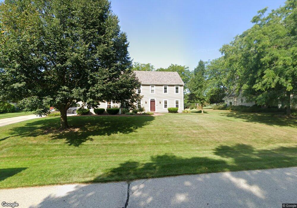
W327N4232 Portside Dr Nashotah, WI 53058
Estimated Value: $480,000 - $708,000
--
Bed
--
Bath
--
Sq Ft
0.58
Acres
About This Home
This home is located at W327N4232 Portside Dr, Nashotah, WI 53058 and is currently estimated at $629,794. W327N4232 Portside Dr is a home located in Waukesha County with nearby schools including Lake Country School, Arrowhead High School, and St. Joan of Arc Elementary School.
Ownership History
Date
Name
Owned For
Owner Type
Purchase Details
Closed on
May 23, 2003
Sold by
Kolacz Anthony P and Kolacz Bonnie L
Bought by
Maurer David E and Maurer Ellen L
Current Estimated Value
Home Financials for this Owner
Home Financials are based on the most recent Mortgage that was taken out on this home.
Original Mortgage
$258,400
Interest Rate
5.88%
Mortgage Type
Balloon
Create a Home Valuation Report for This Property
The Home Valuation Report is an in-depth analysis detailing your home's value as well as a comparison with similar homes in the area
Home Values in the Area
Average Home Value in this Area
Purchase History
| Date | Buyer | Sale Price | Title Company |
|---|---|---|---|
| Maurer David E | $323,000 | Wauwatosa Title & Closing Se |
Source: Public Records
Mortgage History
| Date | Status | Borrower | Loan Amount |
|---|---|---|---|
| Closed | Maurer David E | $258,400 |
Source: Public Records
Tax History Compared to Growth
Tax History
| Year | Tax Paid | Tax Assessment Tax Assessment Total Assessment is a certain percentage of the fair market value that is determined by local assessors to be the total taxable value of land and additions on the property. | Land | Improvement |
|---|---|---|---|---|
| 2024 | $5,747 | $455,100 | $91,200 | $363,900 |
| 2023 | $5,508 | $455,100 | $91,200 | $363,900 |
| 2022 | $5,599 | $455,100 | $91,200 | $363,900 |
| 2021 | $5,217 | $455,100 | $91,200 | $363,900 |
| 2020 | $5,165 | $455,100 | $91,200 | $363,900 |
| 2019 | $5,001 | $375,900 | $84,000 | $291,900 |
| 2018 | $4,870 | $375,900 | $84,000 | $291,900 |
| 2017 | $5,045 | $375,900 | $84,000 | $291,900 |
| 2016 | $5,150 | $375,900 | $84,000 | $291,900 |
| 2015 | $5,218 | $375,900 | $84,000 | $291,900 |
| 2014 | $5,366 | $375,900 | $84,000 | $291,900 |
| 2013 | $5,366 | $383,800 | $85,000 | $298,800 |
Source: Public Records
Map
Nearby Homes
- N45W32552 Watertown Plank Rd
- N40W33325 Woodsview Dr
- 1722 Journeys Dr Unit 15
- N42W33349 Glen View Ct
- 3757 Nagawicka Shores Dr
- 3826 Nagawicka Shores Dr Unit 3826
- 4779 Pine Meadows Ln
- N33W33201 Maplewood Rd
- 2927 Ridley Rd
- N33W33279 Maplewood Rd
- Lt1 - 3 County Road C
- 4848 Wisconsin 83
- 1823 W Shore Dr
- W332N5491 Solveson Dr
- 3911 Campbell Trace
- 2105 Nagawicka Rd
- 32683 Pheasant Dr
- W342N5150 Road P
- W335N5511 Island View Ln
- 623 Anthony Ct
- W327N4210 Portside Dr
- W327N4248 Portside Dr
- W327N4171 Portside Dr
- W327N4256 Anchor Rode Ln
- W327N4264 Portside Dr
- W326N4207 Portside Dr
- W327N4218 Anchor Rode Ln
- W327N4242 Anchor Rode Ln
- W326N4239 Portside Dr
- W326N4225 Portside Dr
- W326N4257 Regatta Ct
- W327N4180 Anchor Rode Ln
- W326N4257 Portside Dr
- N42W32777 Mooring Line Dr
- N41W32743 Neptune Bight
- W326N4161 Marina Dr
- W328N4239 Anchor Rode Ln
- N41W32775 Neptune Bight
- N42W32742 Mooring Line Dr
- N41W32727 Neptune Bight