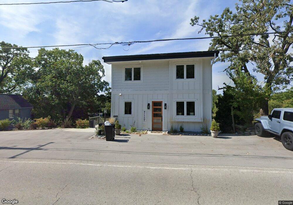
W332N6585 County Trunk Highway C Unit W332N6585 Nashotah, WI 53058
Estimated Value: $1,116,000 - $1,235,160
4
Beds
4
Baths
3,000
Sq Ft
$385/Sq Ft
Est. Value
About This Home
This home is located at W332N6585 County Trunk Highway C Unit W332N6585, Nashotah, WI 53058 and is currently estimated at $1,154,790, approximately $384 per square foot. W332N6585 County Trunk Highway C Unit W332N6585 is a home located in Waukesha County with nearby schools including Stone Bank Elementary School, Arrowhead High School, and Lake Country Montessori.
Ownership History
Date
Name
Owned For
Owner Type
Purchase Details
Closed on
Sep 15, 2025
Sold by
Befus John
Bought by
John J Befus Revocable Trust and Befus
Current Estimated Value
Purchase Details
Closed on
Jun 6, 2025
Sold by
Kastenholz Greg M
Bought by
Befus John
Purchase Details
Closed on
Nov 26, 2000
Sold by
Flannigan Phyllis J
Bought by
Flannigan Phyllis J and Phyllis J Flannigan Revocable Trust
Create a Home Valuation Report for This Property
The Home Valuation Report is an in-depth analysis detailing your home's value as well as a comparison with similar homes in the area
Home Values in the Area
Average Home Value in this Area
Purchase History
| Date | Buyer | Sale Price | Title Company |
|---|---|---|---|
| John J Befus Revocable Trust | -- | None Listed On Document | |
| Befus John | $1,115,000 | Focus Title | |
| Flannigan Phyllis J | -- | -- |
Source: Public Records
Tax History Compared to Growth
Tax History
| Year | Tax Paid | Tax Assessment Tax Assessment Total Assessment is a certain percentage of the fair market value that is determined by local assessors to be the total taxable value of land and additions on the property. | Land | Improvement |
|---|---|---|---|---|
| 2024 | $5,547 | $489,000 | $206,600 | $282,400 |
| 2023 | $5,424 | $489,000 | $206,600 | $282,400 |
| 2022 | $2,771 | $226,500 | $206,600 | $19,900 |
| 2021 | $3,429 | $314,100 | $206,600 | $107,500 |
| 2020 | $3,510 | $314,100 | $206,600 | $107,500 |
| 2019 | $3,589 | $276,200 | $171,500 | $104,700 |
| 2018 | $3,584 | $276,200 | $171,500 | $104,700 |
| 2017 | $3,635 | $276,200 | $171,500 | $104,700 |
| 2016 | $3,656 | $276,200 | $171,500 | $104,700 |
| 2015 | $3,669 | $276,200 | $171,500 | $104,700 |
| 2014 | $3,581 | $276,200 | $171,500 | $104,700 |
| 2013 | $3,581 | $284,300 | $171,500 | $112,800 |
Source: Public Records
Map
Nearby Homes
- Lt8 Road L
- Lt9-13 Road L
- Lt1-3 Road L
- W332n6481 County Road C
- L16,17,18 Road L -
- W329N6495 Forest Dr
- N68W33460 County Trunk Highway K
- W332N6211 County Road C
- N67W33863 Loghouse Ct
- W343N7303 N Pole Ln
- N66W34839 Baltic Pass
- W339N5333 Road O -
- N79W33915 Petersen Rd
- W351N5747 Westshore Rd
- N53W34956 Road b
- Lt41 Road b
- W354N5315 Coastal Ave
- N51W34861 Wisconsin Ave Unit 3119
- W359N6209 Margaret Ct
- W358N6271 Ennis Rd
- W332N6585 County Road C Unit W332N6585
- W332N6575 County Road C
- W332N6609 County Road C
- W332N6565 County Road C
- W332N6553 County Trunk Highway C
- W332N6553 County Road C
- W332N6629 County Road C
- W332N6629 County Road C Unit W332N6629
- W332N6543 County Road C
- W332N6543 County Trunk Highway C
- W332N6525 County Road C
- W332N6635 County Road C
- W332N6556 N Moose Ln
- Lt1-22 Road L Unit County Road K
- Lt22 Road L Unit Lt22
- Lt1-22 Road L Unit Lt1-22
- W332N6578 N Moose Ln
- W332N6515 County Road C
- W332N6590 N Moose Ln
- W332N6643 County Road C