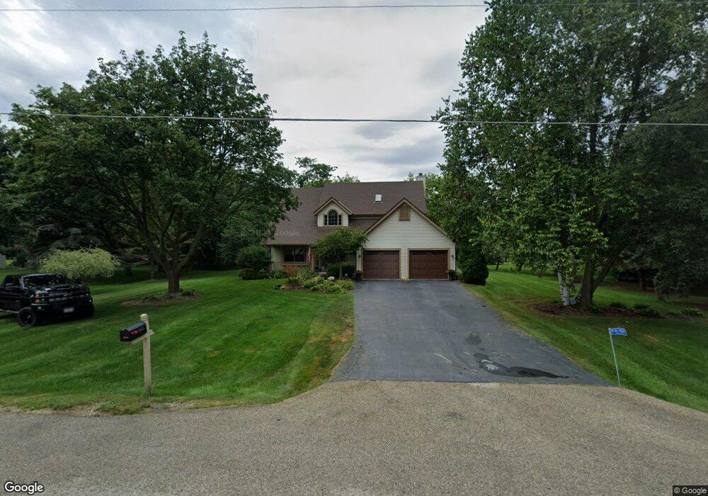
W340N6621 Breezy Point Rd Oconomowoc, WI 53066
Estimated Value: $539,000 - $710,000
--
Bed
--
Bath
--
Sq Ft
1.01
Acres
About This Home
This home is located at W340N6621 Breezy Point Rd, Oconomowoc, WI 53066 and is currently estimated at $602,817. W340N6621 Breezy Point Rd is a home located in Waukesha County with nearby schools including Stone Bank Elementary School and Arrowhead High School.
Ownership History
Date
Name
Owned For
Owner Type
Purchase Details
Closed on
Feb 22, 2010
Sold by
Sefert Schwind Jamie
Bought by
Knull Christopher E and Knull Lynn M
Current Estimated Value
Home Financials for this Owner
Home Financials are based on the most recent Mortgage that was taken out on this home.
Original Mortgage
$221,200
Outstanding Balance
$146,251
Interest Rate
5.01%
Mortgage Type
New Conventional
Estimated Equity
$456,566
Purchase Details
Closed on
Jul 11, 2005
Sold by
Schwind James T
Bought by
Sefert Schwind Jamie
Purchase Details
Closed on
May 21, 1999
Sold by
Soroczak Gerald and Soroczak Antoinette M
Bought by
Schwind James T and Sefert Schwind Jamie B
Home Financials for this Owner
Home Financials are based on the most recent Mortgage that was taken out on this home.
Original Mortgage
$140,000
Interest Rate
6.99%
Create a Home Valuation Report for This Property
The Home Valuation Report is an in-depth analysis detailing your home's value as well as a comparison with similar homes in the area
Home Values in the Area
Average Home Value in this Area
Purchase History
| Date | Buyer | Sale Price | Title Company |
|---|---|---|---|
| Knull Christopher E | $276,500 | None Available | |
| Sefert Schwind Jamie | -- | -- | |
| Schwind James T | $210,000 | -- |
Source: Public Records
Mortgage History
| Date | Status | Borrower | Loan Amount |
|---|---|---|---|
| Open | Knull Christopher E | $221,200 | |
| Previous Owner | Schwind James T | $140,000 |
Source: Public Records
Tax History Compared to Growth
Tax History
| Year | Tax Paid | Tax Assessment Tax Assessment Total Assessment is a certain percentage of the fair market value that is determined by local assessors to be the total taxable value of land and additions on the property. | Land | Improvement |
|---|---|---|---|---|
| 2024 | $3,589 | $362,500 | $71,500 | $291,000 |
| 2023 | $3,317 | $362,500 | $71,500 | $291,000 |
| 2022 | $3,341 | $362,500 | $71,500 | $291,000 |
| 2021 | $3,346 | $314,200 | $65,000 | $249,200 |
| 2020 | $3,483 | $314,200 | $65,000 | $249,200 |
| 2019 | $3,458 | $314,200 | $65,000 | $249,200 |
| 2018 | $3,344 | $282,400 | $65,000 | $217,400 |
| 2017 | $3,381 | $282,400 | $65,000 | $217,400 |
| 2016 | $3,343 | $262,100 | $63,000 | $199,100 |
| 2015 | $3,532 | $262,100 | $63,000 | $199,100 |
| 2014 | $3,585 | $262,100 | $63,000 | $199,100 |
| 2013 | $3,585 | $257,800 | $63,000 | $194,800 |
Source: Public Records
Map
Nearby Homes
- N67W33863 Loghouse Ct
- Lt8 Road L
- Lt9-13 Road L
- Lt1-3 Road L
- L16,17,18 Road L -
- W332n6481 County Road C
- W332N6211 County Road C
- N66W34839 Baltic Pass
- W343N7303 N Pole Ln
- W329N6495 Forest Dr
- W339N5333 Road O -
- W351N5747 Westshore Rd
- N79W33915 Petersen Rd
- N52W34404 Peterson Dr
- N53W34956 Road b
- W354N5315 Coastal Ave
- Lt41 Road b
- W358N6271 Ennis Rd
- W359N6209 Margaret Ct
- W358N6309 Ennis Rd
- W339N6614 Breezy Point Rd
- W339N6586 Breezy Point Rd
- W340N6615 Breezy Point Rd
- W339N6642 Breezy Point Rd
- N66W34001 Timberline Rd
- W340N6648 Timberline Rd
- W340N6585 Breezy Point Rd
- W339N6568 Breezy Point Rd
- W340N6620 Timberline Rd
- W339N6674 Breezy Point Rd
- W340N6509 Breezy Point Rd
- 6697 Timberline Rd
- W340N6586 Timberline Rd
- W340N6699 Timberline Rd
- W340N6525 Breezy Point Rd
- W340N6665 Timberline Rd
- W339N6587 Loghouse Cir
- W339N6615 Loghouse Cir
- W340N6637 Timberline Rd
- W339N6548 Loghouse Cir