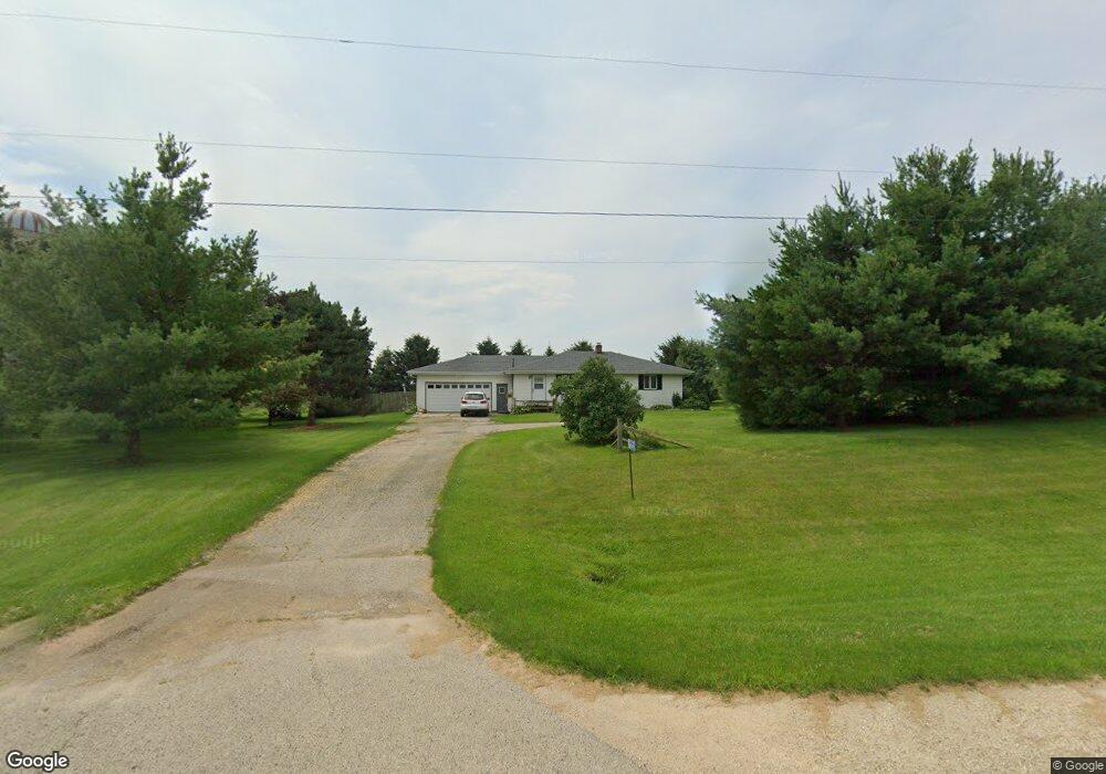
W3475 County Rd S Iron Ridge, WI 53035
Estimated Value: $233,235 - $355,000
--
Bed
--
Bath
--
Sq Ft
0.69
Acres
About This Home
This home is located at W3475 County Rd S, Iron Ridge, WI 53035 and is currently estimated at $305,309. W3475 County Rd S is a home located in Dodge County with nearby schools including Parkview Elementary School, Mayville Elementary School, and Mayville Junior/Senior High School.
Ownership History
Date
Name
Owned For
Owner Type
Purchase Details
Closed on
Jul 29, 2005
Sold by
Hookstead Christopher B
Bought by
Peterman Kale
Current Estimated Value
Home Financials for this Owner
Home Financials are based on the most recent Mortgage that was taken out on this home.
Original Mortgage
$99,000
Outstanding Balance
$52,006
Interest Rate
5.66%
Mortgage Type
New Conventional
Estimated Equity
$253,303
Create a Home Valuation Report for This Property
The Home Valuation Report is an in-depth analysis detailing your home's value as well as a comparison with similar homes in the area
Home Values in the Area
Average Home Value in this Area
Purchase History
| Date | Buyer | Sale Price | Title Company |
|---|---|---|---|
| Peterman Kale | $103,000 | -- |
Source: Public Records
Mortgage History
| Date | Status | Borrower | Loan Amount |
|---|---|---|---|
| Open | Peterman Kale | $99,000 |
Source: Public Records
Tax History Compared to Growth
Tax History
| Year | Tax Paid | Tax Assessment Tax Assessment Total Assessment is a certain percentage of the fair market value that is determined by local assessors to be the total taxable value of land and additions on the property. | Land | Improvement |
|---|---|---|---|---|
| 2024 | $2,192 | $133,900 | $31,800 | $102,100 |
| 2023 | $1,929 | $133,900 | $31,800 | $102,100 |
| 2022 | $1,856 | $133,900 | $31,800 | $102,100 |
| 2021 | $2,009 | $133,900 | $31,800 | $102,100 |
| 2020 | $1,991 | $133,900 | $31,800 | $102,100 |
| 2019 | $1,925 | $133,900 | $31,800 | $102,100 |
| 2018 | $1,925 | $133,900 | $31,800 | $102,100 |
| 2017 | $2,111 | $133,900 | $31,800 | $102,100 |
| 2016 | $1,850 | $133,900 | $31,800 | $102,100 |
| 2015 | $2,033 | $133,900 | $31,800 | $102,100 |
| 2014 | $2,050 | $133,900 | $31,800 | $102,100 |
Source: Public Records
Map
Nearby Homes
- N6436 County Road Tw
- Lt0 E Neda Rd
- 0 Burkwald Ave
- 202 East Ave
- 234 Watertower Cir
- N5413 County Rd S
- N4973 Lake Dr
- W4069 Raasch Hill Rd
- Lt1 W Horseshoe Rd
- 300 Birchcrest Rd
- Lt38 Sinissippi Point Rd
- 101 Valley St
- N4569 Hazelwood Rd
- 401 N Hubbard St
- 406 N Hubbard St
- N4510 Anthony Island -
- 129 Juneau St
- N4510 & N4504 Anthony Island
- 121 Juneau St
- 412 Columbia St
- W3464 County Rd S
- L0 County Rd S
- W3614 County Rd S
- W3657 County Rd S
- W3695 County Rd S
- N5901 N Strange Rd
- N6270 N Cedar Rd
- W3427 W Neda Rd
- N5958 Strange Rd
- W3751 County Rd S
- W3206 County Rd S
- W3750 County Rd S
- W3749 County Rd S
- W3270 W Neda Rd
- W3471 W Neda Rd
- N6330 N Cedar Rd
- W3370 W Neda Rd
- W3815 County Rd S
- N5767 Strange Rd
- W3837 County Rd S