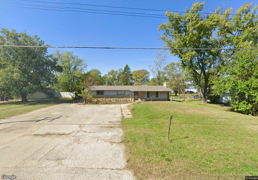
W359S1951 State Road 67 Dousman, WI 53118
Estimated Value: $276,000 - $416,663
--
Bed
--
Bath
--
Sq Ft
0.95
Acres
About This Home
This home is located at W359S1951 State Road 67, Dousman, WI 53118 and is currently estimated at $352,916. W359S1951 State Road 67 is a home located in Waukesha County with nearby schools including Dousman Elementary School, Kettle Moraine Middle School, and Kettle Moraine High School.
Ownership History
Date
Name
Owned For
Owner Type
Purchase Details
Closed on
Oct 28, 2010
Sold by
Federal National Mortgage Association
Bought by
Patnode Michael J
Current Estimated Value
Purchase Details
Closed on
Jan 27, 2010
Sold by
Kolafa Daniel J and Kolafa Catherine M
Bought by
Federal National Mortgage Association
Purchase Details
Closed on
Oct 29, 2004
Sold by
Kuecherer Kenneth R and Kuecherer Donna R
Bought by
Kolafa Daniel J and Kolafa Catherine M
Home Financials for this Owner
Home Financials are based on the most recent Mortgage that was taken out on this home.
Original Mortgage
$151,500
Interest Rate
4.67%
Mortgage Type
Purchase Money Mortgage
Create a Home Valuation Report for This Property
The Home Valuation Report is an in-depth analysis detailing your home's value as well as a comparison with similar homes in the area
Home Values in the Area
Average Home Value in this Area
Purchase History
| Date | Buyer | Sale Price | Title Company |
|---|---|---|---|
| Patnode Michael J | -- | None Available | |
| Federal National Mortgage Association | $189,562 | None Available | |
| Kolafa Daniel J | $202,000 | -- |
Source: Public Records
Mortgage History
| Date | Status | Borrower | Loan Amount |
|---|---|---|---|
| Previous Owner | Kolafa Daniel J | $151,500 |
Source: Public Records
Tax History Compared to Growth
Tax History
| Year | Tax Paid | Tax Assessment Tax Assessment Total Assessment is a certain percentage of the fair market value that is determined by local assessors to be the total taxable value of land and additions on the property. | Land | Improvement |
|---|---|---|---|---|
| 2024 | $2,081 | $210,000 | $126,000 | $84,000 |
| 2023 | $1,960 | $203,000 | $119,000 | $84,000 |
| 2022 | $2,175 | $194,000 | $113,000 | $81,000 |
| 2021 | $1,588 | $129,000 | $75,000 | $54,000 |
| 2020 | $1,716 | $129,000 | $75,000 | $54,000 |
| 2019 | $1,629 | $129,000 | $75,000 | $54,000 |
| 2018 | $1,587 | $129,000 | $75,000 | $54,000 |
| 2017 | $1,579 | $129,000 | $75,000 | $54,000 |
| 2016 | $1,542 | $129,000 | $75,000 | $54,000 |
| 2015 | $1,538 | $129,000 | $75,000 | $54,000 |
| 2014 | $1,704 | $129,000 | $75,000 | $54,000 |
| 2013 | $1,704 | $129,000 | $75,000 | $54,000 |
Source: Public Records
Map
Nearby Homes
- Lt1 E Ottawa Ave
- 148 Wolf Dr
- Lt8 Wolf Dr
- Lt7 Wolf Dr
- Lt6 Wolf Dr
- Lt5 Wolf Dr
- Lt4 Wolf Dr
- Lt2 Wolf Dr
- W361S2389 Scuppernong Dr
- 144 Evergreen St
- Lt50 W Ingleside Ct
- N62W35431 William Ct
- Lt38 W Ingleside Ct
- Lt49 Ingleside Ct
- Lt40 W Ingleside Ct
- Lt47 Ingleside Ct
- Lt42 W Ingleside Ct
- Lt58 W Talbots Woods Dr
- Lt39 W Ingleside Ct
- 109 Johnston Dr Unit 111
- W359S1971 State Road 67
- W359S1933 State Road 67
- W359S1921 State Road 67
- S18W36017 E Ottawa Ave
- W359S1901 State Road 67
- W359S1901 Wisconsin 67
- S18W35995 E Ottawa Ave
- 380 E Ottawa Ave
- W359S1970 State Road 67
- W359S1875 State Road 67
- 370 E Ottawa Ave
- W359S1902 State Road 67
- W359S1772 State Road 67
- W359S1850 State Road 67
- W359S1668 State Road 67
- W359S1771 State Road 67
- 310 E Ottawa Ave
- W359S1761 State Road 67
- W359S1745 State Road 67
- 171 Wolf Dr