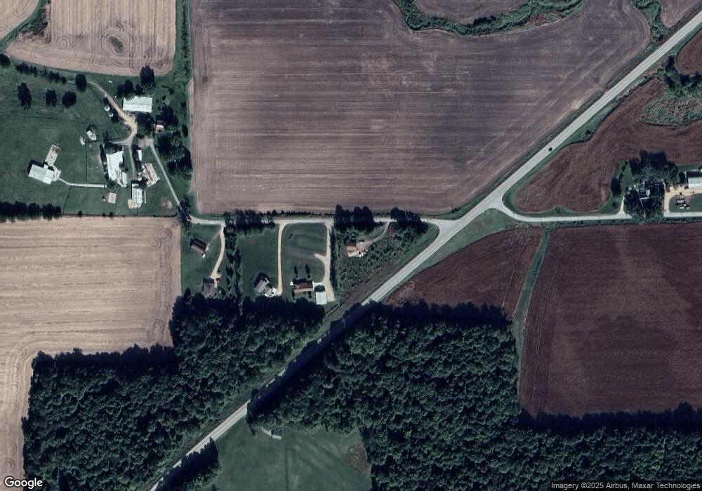
W3653 Sylvester Rd Monroe, WI 53566
Estimated Value: $103,824 - $358,000
--
Bed
--
Bath
--
Sq Ft
2.65
Acres
About This Home
This home is located at W3653 Sylvester Rd, Monroe, WI 53566 and is currently estimated at $258,275. W3653 Sylvester Rd is a home located in Green County.
Ownership History
Date
Name
Owned For
Owner Type
Purchase Details
Closed on
Jan 24, 2020
Sold by
Gutzmer Jeremy L
Bought by
Beautiful Borders Llp
Current Estimated Value
Home Financials for this Owner
Home Financials are based on the most recent Mortgage that was taken out on this home.
Original Mortgage
$30,000
Outstanding Balance
$26,572
Interest Rate
3.73%
Mortgage Type
Commercial
Estimated Equity
$231,703
Purchase Details
Closed on
Aug 31, 2009
Sold by
Vroman Edward W and Vroman Linda L
Bought by
Kammes Robert J and Kammes Elmira A
Purchase Details
Closed on
Sep 30, 2005
Sold by
Berra Howard R and Berra Lois I
Bought by
Vroman Edward W and Vroman Linda L
Create a Home Valuation Report for This Property
The Home Valuation Report is an in-depth analysis detailing your home's value as well as a comparison with similar homes in the area
Home Values in the Area
Average Home Value in this Area
Purchase History
| Date | Buyer | Sale Price | Title Company |
|---|---|---|---|
| Beautiful Borders Llp | $38,000 | None Available | |
| Kammes Robert J | $22,500 | None Available | |
| Vroman Edward W | $18,000 | None Available |
Source: Public Records
Mortgage History
| Date | Status | Borrower | Loan Amount |
|---|---|---|---|
| Open | Beautiful Borders Llp | $30,000 |
Source: Public Records
Tax History Compared to Growth
Tax History
| Year | Tax Paid | Tax Assessment Tax Assessment Total Assessment is a certain percentage of the fair market value that is determined by local assessors to be the total taxable value of land and additions on the property. | Land | Improvement |
|---|---|---|---|---|
| 2024 | $616 | $38,000 | $27,000 | $11,000 |
| 2023 | $658 | $38,000 | $27,000 | $11,000 |
| 2022 | $699 | $38,000 | $27,000 | $11,000 |
| 2021 | $591 | $38,000 | $27,000 | $11,000 |
| 2020 | $578 | $38,000 | $27,000 | $11,000 |
| 2019 | $554 | $38,000 | $27,000 | $11,000 |
| 2018 | $556 | $38,000 | $27,000 | $11,000 |
| 2017 | $411 | $26,400 | $16,400 | $10,000 |
| 2016 | $422 | $26,400 | $16,400 | $10,000 |
| 2014 | $378 | $26,400 | $16,400 | $10,000 |
Source: Public Records
Map
Nearby Homes
- 5.24 Acres Ringhand Rd
- 10.45 Acres Ringhand Rd
- 5.21 Acres Ringhand Rd
- Lot 17 Pembridge Trail
- Lot 1 Monroe Sylvester Rd
- Lot 2 Monroe Sylvester Rd
- Lot 8 Thunder Rd
- 150 +/- Acres County Road Dr
- N5080 Hyland Cir
- Lot 3 Horizon Ct
- W2940 Washington St
- N5038 Meadowlark Cir
- N2380 Clearview Dr
- 444+/- Acres County Highway Dr
- W5548 Sunset Hills Ln
- N3523 View Point Dr
- N2211 Richland Rd
- Lot 22 Orchid Ln
- 2411 5th St
- W2691 Zurfluh Rd
- W3667 Sylvester Rd
- W3669 Sylvester Rd
- W3689 Sylvester Rd
- W3704 Sylvester Rd
- N3904 State Road 59
- N3863 State Road 59
- N3845 State Road 59
- N3992 Balls Mill Rd
- N3802 State Road 59
- N3998 Balls Mill Rd
- N4002 Balls Mill Rd
- N3797 State Road 59
- 82 A Balls Mill Rd
- N3774 State Road 59
- N4142 Statz Rd
- N3708 Balls Mill Rd
- N4130 Statz Rd
- N3698 Hwy 59
- N3698 State Road 59
- 13.5 ac Balls Mill Rd
