Estimated Value: $175,946 - $242,000
3
Beds
--
Bath
1,550
Sq Ft
$139/Sq Ft
Est. Value
About This Home
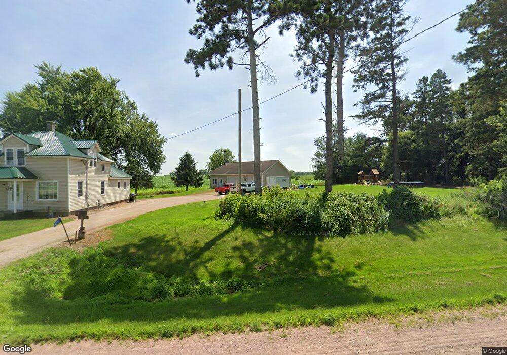
This home is located at W4289 State Highway 98, Loyal, WI 54446 and is currently estimated at $215,487, approximately $139 per square foot. W4289 State Highway 98 is a home located in Clark County with nearby schools including Loyal Elementary School, Loyal Middle School, and Loyal High School.
Ownership History
Date
Name
Owned For
Owner Type
Purchase Details
Closed on
May 17, 2010
Sold by
Wisconsin Housing And Economic Devel
Bought by
Wilke Bernard
Current Estimated Value
Purchase Details
Closed on
Jul 27, 2007
Sold by
Aumann Randy T and Aumann Eva A
Bought by
Lathrop Joshua
Home Financials for this Owner
Home Financials are based on the most recent Mortgage that was taken out on this home.
Original Mortgage
$120,000
Interest Rate
6.71%
Mortgage Type
Unknown
Create a Home Valuation Report for This Property
The Home Valuation Report is an in-depth analysis detailing your home's value as well as a comparison with similar homes in the area
Home Values in the Area
Average Home Value in this Area
Purchase History
| Date | Buyer | Sale Price | Title Company |
|---|---|---|---|
| Wilke Bernard | $78,500 | -- | |
| Lathrop Joshua | -- | Schuster Campman Abstract An |
Source: Public Records
Mortgage History
| Date | Status | Borrower | Loan Amount |
|---|---|---|---|
| Previous Owner | Lathrop Joshua | $120,000 |
Source: Public Records
Tax History Compared to Growth
Tax History
| Year | Tax Paid | Tax Assessment Tax Assessment Total Assessment is a certain percentage of the fair market value that is determined by local assessors to be the total taxable value of land and additions on the property. | Land | Improvement |
|---|---|---|---|---|
| 2024 | $2,844 | $135,000 | $4,000 | $131,000 |
| 2023 | $2,385 | $135,000 | $4,000 | $131,000 |
| 2022 | $2,109 | $135,000 | $4,000 | $131,000 |
| 2021 | $2,147 | $135,000 | $4,000 | $131,000 |
| 2020 | $2,085 | $102,700 | $6,100 | $96,600 |
| 2019 | $2,097 | $102,700 | $6,100 | $96,600 |
| 2018 | $2,061 | $102,700 | $6,100 | $96,600 |
| 2017 | $123 | $102,700 | $6,100 | $96,600 |
| 2016 | $2,043 | $102,700 | $6,100 | $96,600 |
| 2015 | -- | $102,700 | $6,100 | $96,600 |
| 2014 | -- | $102,700 | $6,100 | $96,600 |
| 2013 | -- | $102,700 | $6,100 | $96,600 |
| 2011 | -- | $102,700 | $6,100 | $96,600 |
Source: Public Records
Map
Nearby Homes
- 400 W Mill St
- 311 W South St
- 210 S Division St
- 211 Other
- 314 N Division St
- 501 S Main St
- 0 Chickadee Rd Unit 22505635
- 609 E Schofield Ave
- 311 S Eaton Ave Unit 1-12
- 203 S Crocker Ave
- 300 E Division St
- 300 E Miller St
- N10160 Sparrow Ave
- 219 N Main St
- 104 W Begley St
- 315 W Begley St
- N8296 River Ave
- W6126 Sladich Rd
- N6695 Pelsdorf Ave
- 42.610 acres County Road O
- 4289 State Highway 98
- W4354 State Highway 98
- 0 State Highway 98 Unit 1206610
- W4260 Chickadee Rd
- N8614 Cardinal Ave
- W4188 Chickadee Rd
- N8440 Cardinal Ave
- W4261 Chickadee Rd
- N8466A Cardinal Ave
- W4098 Willard Rd
- N8466 Miller Ave
- N8466 Miller Ave
- W3978 State Highway 98
- w 3971 State Highway 98
- N8413 Cardinal Ave
- N8413 Cardinal Ave
- W4334 Willard Rd