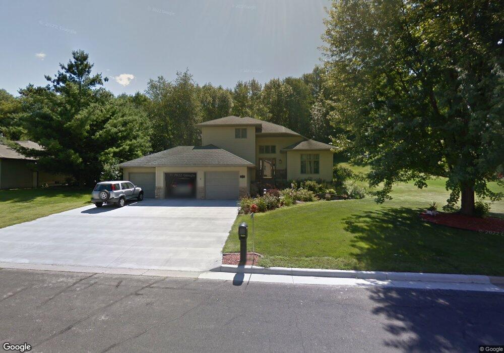
W5561 Southdale Dr La Crosse, WI 54601
Estimated Value: $532,000 - $716,000
--
Bed
--
Bath
--
Sq Ft
0.55
Acres
About This Home
This home is located at W5561 Southdale Dr, La Crosse, WI 54601 and is currently estimated at $602,921. W5561 Southdale Dr is a home located in La Crosse County with nearby schools including State Road Elementary School, Lincoln Middle School, and Central High School.
Ownership History
Date
Name
Owned For
Owner Type
Purchase Details
Closed on
May 21, 2008
Sold by
Leitgen Stephen R and Leitgen Christine M
Bought by
Hansen Peter A and Hansen Patricia L
Current Estimated Value
Home Financials for this Owner
Home Financials are based on the most recent Mortgage that was taken out on this home.
Original Mortgage
$337,500
Outstanding Balance
$205,097
Interest Rate
5.12%
Mortgage Type
Adjustable Rate Mortgage/ARM
Estimated Equity
$397,824
Create a Home Valuation Report for This Property
The Home Valuation Report is an in-depth analysis detailing your home's value as well as a comparison with similar homes in the area
Home Values in the Area
Average Home Value in this Area
Purchase History
| Date | Buyer | Sale Price | Title Company |
|---|---|---|---|
| Hansen Peter A | $375,000 | None Available |
Source: Public Records
Mortgage History
| Date | Status | Borrower | Loan Amount |
|---|---|---|---|
| Open | Hansen Peter A | $337,500 |
Source: Public Records
Tax History Compared to Growth
Tax History
| Year | Tax Paid | Tax Assessment Tax Assessment Total Assessment is a certain percentage of the fair market value that is determined by local assessors to be the total taxable value of land and additions on the property. | Land | Improvement |
|---|---|---|---|---|
| 2023 | $7,683 | $386,600 | $46,800 | $339,800 |
| 2022 | $7,340 | $386,600 | $46,800 | $339,800 |
| 2021 | $7,544 | $386,600 | $46,800 | $339,800 |
| 2020 | $7,417 | $386,600 | $46,800 | $339,800 |
| 2019 | $7,440 | $386,600 | $46,800 | $339,800 |
| 2018 | $7,268 | $386,600 | $46,800 | $339,800 |
| 2017 | $7,187 | $386,600 | $46,800 | $339,800 |
| 2016 | $7,504 | $386,600 | $46,800 | $339,800 |
| 2015 | $7,397 | $386,600 | $46,800 | $339,800 |
| 2014 | $7,558 | $386,600 | $46,800 | $339,800 |
| 2013 | $7,457 | $352,100 | $45,000 | $307,100 |
Source: Public Records
Map
Nearby Homes
- W5453 Pine Bluff Rd
- W4844 State Road 33
- W5522 Eagle Point Dr
- W5419 Pine Bluff Rd
- N2194 Valley Rd
- 3421 Greenbriar Ct
- 3121 Glendale Ave
- 3055 State Rd
- W4946 Battlestone Station Rd Unit 23
- W4952 Battlestone Station Rd Unit 25
- 3100 Lincoln Ave
- 2802 31st St S
- W4936 Battlestone Station Rd
- 1965 28th St S
- N2031 County Road F -
- 3324 Greenspire Ln
- 3026 33rd St S
- 2851 29th Ct S
- 2011 Strong Ave
- 3128 29th Ct S
- W5549 Southdale Dr
- W5569 Southdale Dr
- N1923 Summit Dr
- W5575 Southdale Dr
- N1935 Summit Dr
- W5558 Southdale Dr
- W5570 Southdale Dr
- W5552 Southdale Dr
- W5564 Southdale Dr
- W5576 Southdale Dr
- W5546 Southdale Dr
- W5582 Southdale Dr
- W5540 Southdale Dr
- W5531 Southdale Dr
- N1946 Summit Dr
- W5587 Southdale Dr
- N1914 Summit Dr
- W5534 Southdale Dr
- N1926 Summit Dr
- W5525 Southdale Dr