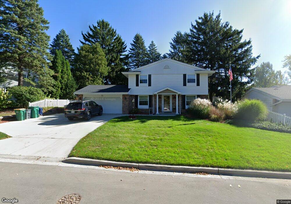
W55N798 Cedar Ridge Dr Cedarburg, WI 53012
Estimated Value: $226,000 - $507,000
--
Bed
--
Bath
--
Sq Ft
8,015
Sq Ft Lot
About This Home
This home is located at W55N798 Cedar Ridge Dr, Cedarburg, WI 53012 and is currently estimated at $405,110. W55N798 Cedar Ridge Dr is a home located in Ozaukee County with nearby schools including Cedarburg High School, First Immanuel Lutheran School, and St Francis Borgia Catholic School.
Ownership History
Date
Name
Owned For
Owner Type
Purchase Details
Closed on
Sep 30, 2011
Sold by
Hoven Timothy T
Bought by
Hoven Patrick T
Current Estimated Value
Home Financials for this Owner
Home Financials are based on the most recent Mortgage that was taken out on this home.
Original Mortgage
$87,754
Interest Rate
4.12%
Mortgage Type
Purchase Money Mortgage
Purchase Details
Closed on
Sep 9, 2011
Sold by
Hoven Timothy T and Estate Of Doris A Hoven
Bought by
Hoven Timothy T and Hoven Supplemental N Patrick T
Home Financials for this Owner
Home Financials are based on the most recent Mortgage that was taken out on this home.
Original Mortgage
$87,754
Interest Rate
4.12%
Mortgage Type
Purchase Money Mortgage
Create a Home Valuation Report for This Property
The Home Valuation Report is an in-depth analysis detailing your home's value as well as a comparison with similar homes in the area
Home Values in the Area
Average Home Value in this Area
Purchase History
| Date | Buyer | Sale Price | Title Company |
|---|---|---|---|
| Hoven Patrick T | $93,200 | None Available | |
| Hoven Timothy T | -- | None Available |
Source: Public Records
Mortgage History
| Date | Status | Borrower | Loan Amount |
|---|---|---|---|
| Previous Owner | Hoven Patrick T | $87,754 |
Source: Public Records
Tax History Compared to Growth
Tax History
| Year | Tax Paid | Tax Assessment Tax Assessment Total Assessment is a certain percentage of the fair market value that is determined by local assessors to be the total taxable value of land and additions on the property. | Land | Improvement |
|---|---|---|---|---|
| 2024 | $5,010 | $342,400 | $70,400 | $272,000 |
| 2023 | $4,623 | $342,400 | $70,400 | $272,000 |
| 2022 | $4,528 | $342,400 | $70,400 | $272,000 |
| 2021 | $4,417 | $253,500 | $64,000 | $189,500 |
| 2020 | $4,694 | $253,500 | $64,000 | $189,500 |
| 2019 | $4,607 | $253,500 | $64,000 | $189,500 |
| 2018 | $4,542 | $253,500 | $64,000 | $189,500 |
| 2017 | $4,487 | $253,500 | $64,000 | $189,500 |
| 2016 | $4,595 | $253,500 | $64,000 | $189,500 |
| 2015 | $4,472 | $253,500 | $64,000 | $189,500 |
| 2014 | -- | $253,500 | $64,000 | $189,500 |
| 2013 | $4,762 | $253,500 | $64,000 | $189,500 |
Source: Public Records
Map
Nearby Homes
- Lt2 Columbia Rd
- 2112 Pine Ridge Ct Unit F
- 2135 Pine Ridge Ct Unit D
- N69W6507 Bridge Rd
- 2057 Chateau Ct
- N104W6262 Susan Ln
- N105W6300 Brenton Ln
- W67N786 Evergreen Blvd
- 331 Juniper Ct
- Lt1 Bridge Rd
- N105W6431 Stone Lake Cir Unit 32
- 1891 Sumac Ct Unit B
- N50W6592 Western Rd
- 1319 Creekside Ct
- W68N921 Washington Ave
- 1311 Dove Ln
- W61N413 Washington Ave
- N39W5483 Wilshire Dr
- N106W6590 Stone Lake Cir Unit 10
- N106W6600 Stone Lake Cir Unit 9
- W55N775 Cedar Ridge Dr
- W55N779 Cedar Ridge Dr
- W55N785 Cedar Ridge Dr
- W55N774 Cedar Ridge Dr
- W55N778 Cedar Ridge Dr
- W55N784 Cedar Ridge Dr
- W55N790 Cedar Ridge Dr
- N77W5600 Bywater Ln
- W55N766 Cedar Ridge Dr
- W56N784 Meadow Ln
- W56N754 Meadow Ln
- N77W5680 Bywater Ln
- N78W5357 Bywater Ln
- N79W5286 Bywater Ln
- W56N748 Meadow Ln
- N77W5385 Bywater Ln
- N77W5411 Bywater Ln
- N76W5427 Bywater Ln
- N76W5449 Bywater Ln
- N76W5473 Bywater Ln