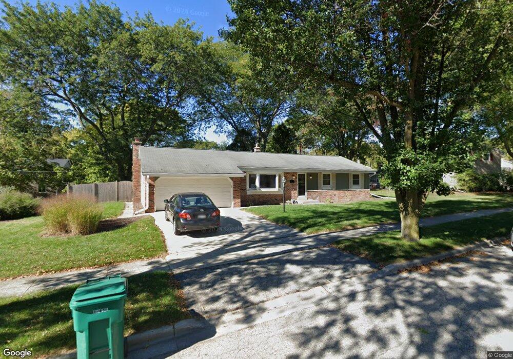
W55N821 Cedar Ridge Dr Cedarburg, WI 53012
Estimated Value: $416,091 - $512,000
--
Bed
--
Bath
--
Sq Ft
9,191
Sq Ft Lot
About This Home
This home is located at W55N821 Cedar Ridge Dr, Cedarburg, WI 53012 and is currently estimated at $446,523. W55N821 Cedar Ridge Dr is a home located in Ozaukee County with nearby schools including Cedarburg High School, First Immanuel Lutheran School, and St Francis Borgia Catholic School.
Ownership History
Date
Name
Owned For
Owner Type
Purchase Details
Closed on
Jul 14, 2012
Sold by
Tabak Jacob M and Redman Jennifer D
Bought by
Tabak Jacob M and Redman Jennifer D
Current Estimated Value
Purchase Details
Closed on
Mar 30, 2012
Sold by
Styduhar Barbara J and Styduhar Marital Trust
Bought by
Tabak Jacob M
Home Financials for this Owner
Home Financials are based on the most recent Mortgage that was taken out on this home.
Original Mortgage
$153,250
Interest Rate
3.9%
Mortgage Type
New Conventional
Purchase Details
Closed on
Jan 8, 2007
Sold by
Styduhar Barbara J
Bought by
Styduhar Barbara J
Purchase Details
Closed on
Feb 4, 1997
Sold by
Styduhar George C and Styduhar Barbara J
Bought by
Styduhar George C and Styduhar Barbara J
Create a Home Valuation Report for This Property
The Home Valuation Report is an in-depth analysis detailing your home's value as well as a comparison with similar homes in the area
Home Values in the Area
Average Home Value in this Area
Purchase History
| Date | Buyer | Sale Price | Title Company |
|---|---|---|---|
| Tabak Jacob M | -- | None Available | |
| Tabak Jacob M | $191,900 | None Available | |
| Styduhar Barbara J | $197,400 | -- | |
| Styduhar George C | -- | None Available |
Source: Public Records
Mortgage History
| Date | Status | Borrower | Loan Amount |
|---|---|---|---|
| Previous Owner | Tabak Jacob M | $153,250 |
Source: Public Records
Tax History Compared to Growth
Tax History
| Year | Tax Paid | Tax Assessment Tax Assessment Total Assessment is a certain percentage of the fair market value that is determined by local assessors to be the total taxable value of land and additions on the property. | Land | Improvement |
|---|---|---|---|---|
| 2024 | $4,240 | $292,300 | $75,500 | $216,800 |
| 2023 | $3,906 | $292,300 | $75,500 | $216,800 |
| 2022 | $3,831 | $292,300 | $75,500 | $216,800 |
| 2021 | $3,505 | $204,000 | $68,600 | $135,400 |
| 2020 | $3,696 | $202,000 | $68,600 | $133,400 |
| 2019 | $3,622 | $202,000 | $68,600 | $133,400 |
| 2018 | $3,575 | $202,000 | $68,600 | $133,400 |
| 2017 | $3,541 | $202,000 | $68,600 | $133,400 |
| 2016 | $3,624 | $202,000 | $68,600 | $133,400 |
| 2015 | $3,530 | $202,000 | $68,600 | $133,400 |
| 2014 | -- | $202,000 | $68,600 | $133,400 |
| 2013 | $3,759 | $202,000 | $68,600 | $133,400 |
Source: Public Records
Map
Nearby Homes
- 2112 Pine Ridge Ct Unit F
- 2135 Pine Ridge Ct Unit D
- Lt2 Columbia Rd
- N104W6262 Susan Ln
- 2057 Chateau Ct
- N69W6507 Bridge Rd
- N105W6300 Brenton Ln
- 331 Juniper Ct
- W67N786 Evergreen Blvd
- N56W6339 Center St
- N105W6431 Stone Lake Cir Unit 32
- Lt1 Bridge Rd
- 1311 Dove Ln
- 1891 Sumac Ct Unit B
- N106W6590 Stone Lake Cir Unit 10
- W68N921 Washington Ave
- N106W6600 Stone Lake Cir Unit 9
- N105W6695 Stone Lake Cir Unit 5
- 171 Maple St
- 329 W Bridge St
- W55N838 Cedar Ridge Dr
- W55N834 Cedar Ridge Dr
- W55N830 Cedar Ridge Dr
- W55N804 Cedar Ridge Dr
- W55N808 Cedar Ridge Dr
- W55N812 Cedar Ridge Dr
- W55N816 Cedar Ridge Dr
- W55N826 Cedar Ridge Dr
- W55N815 Cedar Ridge Dr
- W55N805 Cedar Ridge Dr
- N91W5200 Alpine Dr
- W56N810 Meadow Ln
- W56N818 Meadow Ln
- N82W5593 Orchard Dr
- N79W5589 Woodland Rd
- N80W5590 Woodland Rd
- N82W5838 Orchard Dr
- W55N845 Cedar Ridge Dr
- W54N815 Windsor Ct
- N79W5559 Woodland Rd