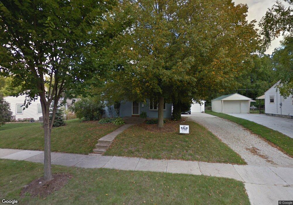
W59N788 Highwood Dr Cedarburg, WI 53012
Estimated Value: $280,000 - $312,102
--
Bed
--
Bath
--
Sq Ft
9,060
Sq Ft Lot
About This Home
This home is located at W59N788 Highwood Dr, Cedarburg, WI 53012 and is currently estimated at $296,276. W59N788 Highwood Dr is a home located in Ozaukee County with nearby schools including Cedarburg High School, First Immanuel Lutheran School, and St Francis Borgia Catholic School.
Ownership History
Date
Name
Owned For
Owner Type
Purchase Details
Closed on
Sep 30, 2014
Sold by
Davila Alma D
Bought by
Peterson William R
Current Estimated Value
Home Financials for this Owner
Home Financials are based on the most recent Mortgage that was taken out on this home.
Original Mortgage
$138,700
Outstanding Balance
$106,216
Interest Rate
4.07%
Mortgage Type
New Conventional
Estimated Equity
$190,060
Create a Home Valuation Report for This Property
The Home Valuation Report is an in-depth analysis detailing your home's value as well as a comparison with similar homes in the area
Home Values in the Area
Average Home Value in this Area
Purchase History
| Date | Buyer | Sale Price | Title Company |
|---|---|---|---|
| Peterson William R | $146,000 | -- |
Source: Public Records
Mortgage History
| Date | Status | Borrower | Loan Amount |
|---|---|---|---|
| Open | Peterson William R | $138,700 |
Source: Public Records
Tax History Compared to Growth
Tax History
| Year | Tax Paid | Tax Assessment Tax Assessment Total Assessment is a certain percentage of the fair market value that is determined by local assessors to be the total taxable value of land and additions on the property. | Land | Improvement |
|---|---|---|---|---|
| 2024 | $3,208 | $225,100 | $75,200 | $149,900 |
| 2023 | $2,945 | $225,100 | $75,200 | $149,900 |
| 2022 | $2,896 | $225,100 | $75,200 | $149,900 |
| 2021 | $2,520 | $150,500 | $68,300 | $82,200 |
| 2020 | $2,699 | $150,500 | $68,300 | $82,200 |
| 2019 | $2,637 | $150,500 | $68,300 | $82,200 |
| 2018 | $2,608 | $150,500 | $68,300 | $82,200 |
| 2017 | $2,595 | $150,500 | $68,300 | $82,200 |
| 2016 | $2,653 | $150,500 | $68,300 | $82,200 |
| 2015 | $2,587 | $150,500 | $68,300 | $82,200 |
| 2014 | $2,626 | $150,500 | $68,300 | $82,200 |
| 2013 | $2,756 | $150,500 | $68,300 | $82,200 |
Source: Public Records
Map
Nearby Homes
- N69W6507 Bridge Rd
- Lt2 Columbia Rd
- W67N786 Evergreen Blvd
- Lt1 Bridge Rd
- N104W6262 Susan Ln
- N105W6300 Brenton Ln
- 2112 Pine Ridge Ct Unit F
- 2135 Pine Ridge Ct Unit D
- N105W6431 Stone Lake Cir Unit 32
- W68N921 Washington Ave
- N105W6695 Stone Lake Cir Unit 5
- N106W6590 Stone Lake Cir Unit 10
- N106W6600 Stone Lake Cir Unit 9
- N50W6592 Western Rd
- 2057 Chateau Ct
- 331 Juniper Ct
- W61N413 Washington Ave
- 1319 Creekside Ct
- 1311 Dove Ln
- N39W5483 Wilshire Dr
- W59N794 Highwood Dr
- W59N783 Highwood Dr
- W59N776 Highwood Dr
- W59N782 Highwood Dr
- W59N789 Highwood Dr
- W59N795 Highwood Dr
- W59N777 Highwood Dr
- W59N770 Highwood Dr
- W59N771 Highwood Dr
- W59N799 Highwood Dr
- N80W5836 Woodland Rd
- N80W5674 Woodland Rd Unit 21
- N80W5704 Woodland Rd
- N80W5740 Woodland Rd
- W59N730 Highwood Dr
- W59N738 Highwood Dr
- W59N744 Highwood Dr
- W60N780 Jefferson Ave
- W60N776 Jefferson Ave
- W59N758 Highwood Dr