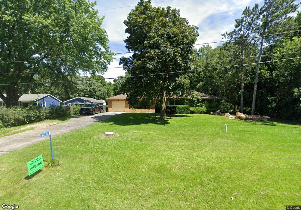
W6138 Hackbarth Rd Fort Atkinson, WI 53538
Estimated Value: $323,000 - $381,000
3
Beds
2
Baths
1,632
Sq Ft
$209/Sq Ft
Est. Value
About This Home
This home is located at W6138 Hackbarth Rd, Fort Atkinson, WI 53538 and is currently estimated at $340,629, approximately $208 per square foot. W6138 Hackbarth Rd is a home located in Jefferson County with nearby schools including Luther Elementary School, Fort Atkinson Middle School, and Fort Atkinson High School.
Ownership History
Date
Name
Owned For
Owner Type
Purchase Details
Closed on
Jul 1, 2005
Sold by
Rimmer Timothy G and Estate Of Shirley M Rimmer
Bought by
Dieter Dianne K
Current Estimated Value
Home Financials for this Owner
Home Financials are based on the most recent Mortgage that was taken out on this home.
Original Mortgage
$134,800
Outstanding Balance
$68,472
Interest Rate
5.74%
Mortgage Type
Purchase Money Mortgage
Estimated Equity
$272,157
Create a Home Valuation Report for This Property
The Home Valuation Report is an in-depth analysis detailing your home's value as well as a comparison with similar homes in the area
Home Values in the Area
Average Home Value in this Area
Purchase History
| Date | Buyer | Sale Price | Title Company |
|---|---|---|---|
| Dieter Dianne K | $171,000 | None Available |
Source: Public Records
Mortgage History
| Date | Status | Borrower | Loan Amount |
|---|---|---|---|
| Open | Dieter Dianne K | $134,800 |
Source: Public Records
Tax History
| Year | Tax Paid | Tax Assessment Tax Assessment Total Assessment is a certain percentage of the fair market value that is determined by local assessors to be the total taxable value of land and additions on the property. | Land | Improvement |
|---|---|---|---|---|
| 2025 | $4,200 | $205,000 | $36,800 | $168,200 |
| 2024 | $3,762 | $205,000 | $36,800 | $168,200 |
| 2023 | $3,484 | $205,000 | $36,800 | $168,200 |
| 2022 | $3,623 | $205,000 | $36,800 | $168,200 |
| 2021 | $3,372 | $205,000 | $36,800 | $168,200 |
| 2020 | $3,002 | $205,000 | $36,800 | $168,200 |
| 2019 | $2,764 | $151,900 | $38,200 | $113,700 |
| 2018 | $2,572 | $151,900 | $38,200 | $113,700 |
| 2017 | $2,547 | $151,900 | $38,200 | $113,700 |
| 2016 | $2,639 | $151,900 | $38,200 | $113,700 |
| 2015 | $2,708 | $151,900 | $38,200 | $113,700 |
| 2014 | $2,634 | $151,900 | $38,200 | $113,700 |
| 2013 | $2,720 | $151,900 | $38,200 | $113,700 |
Source: Public Records
Map
Nearby Homes
- 1626 Stacy Ln
- 1510 Agnes Rd
- 213 Wollet Dr
- 217 Wollet Dr
- 1227 S Main St
- N1810 U S 12
- W5879 Arbor Rd
- N1617 Carlin Rd
- 602 Hilltop Trail W
- N1475 County Road K Rd
- 206 Hilltop Trail
- 1220 Janesville Ave
- 910 S Main St
- 1000 Whitetail Dr
- Lot #6 Commerce Pkwy
- Lot #10 Commerce Pkwy
- Lot #7 Commerce Pkwy
- Lot #9 Commerce Pkwy
- Lot #1 Commerce Pkwy
- 11 S 4th St E
- W6144 Hackbarth Rd
- W5064 Hackbarth Rd
- W6126 Hackbarth Rd
- W6154 Hackbarth Rd
- W6140 N Thornapple Ct
- N1712 Maple St
- W6130 N Thornapple Ct
- W6148 N Thornapple Ct
- N1728 Maple St
- N1717 S Main St
- W6120 N Thornapple Ct
- N1729 S Main St
- N1734 Maple St
- W6133 Radloff St
- W6168 Hackbarth Rd
- W6156 N Thornapple Ct
- N1693 S Main St
- W6121 Radloff St
- W6131 N Thornapple Ct
- W6143 N Thornapple Ct
Your Personal Tour Guide
Ask me questions while you tour the home.