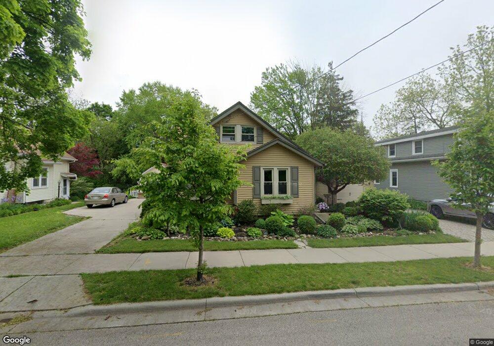
W66N670 Madison Ave Cedarburg, WI 53012
Estimated Value: $479,000 - $574,000
3
Beds
2
Baths
2,076
Sq Ft
$254/Sq Ft
Est. Value
About This Home
This home is located at W66N670 Madison Ave, Cedarburg, WI 53012 and is currently estimated at $526,317, approximately $253 per square foot. W66N670 Madison Ave is a home located in Ozaukee County with nearby schools including Cedarburg High School, First Immanuel Lutheran School, and St Francis Borgia Catholic School.
Ownership History
Date
Name
Owned For
Owner Type
Purchase Details
Closed on
Nov 9, 2022
Sold by
Jacobs Lynne M
Bought by
Bublitz Michael and Bublitz Sherry
Current Estimated Value
Purchase Details
Closed on
Dec 29, 2017
Sold by
Dols Catherine M
Bought by
Jacobs Lynne M
Home Financials for this Owner
Home Financials are based on the most recent Mortgage that was taken out on this home.
Original Mortgage
$258,300
Interest Rate
3.9%
Mortgage Type
New Conventional
Purchase Details
Closed on
May 20, 2006
Sold by
Pope Terry A and Pope Christine L
Bought by
Dols Cahterine M
Home Financials for this Owner
Home Financials are based on the most recent Mortgage that was taken out on this home.
Original Mortgage
$176,000
Interest Rate
6.66%
Mortgage Type
New Conventional
Create a Home Valuation Report for This Property
The Home Valuation Report is an in-depth analysis detailing your home's value as well as a comparison with similar homes in the area
Home Values in the Area
Average Home Value in this Area
Purchase History
| Date | Buyer | Sale Price | Title Company |
|---|---|---|---|
| Bublitz Michael | $450,000 | Burnet Title (Lh) | |
| Jacobs Lynne M | $287,000 | -- | |
| Dols Cahterine M | $228,900 | None Available |
Source: Public Records
Mortgage History
| Date | Status | Borrower | Loan Amount |
|---|---|---|---|
| Previous Owner | Jacobs Lynne M | $258,300 | |
| Previous Owner | Dols Cahterine M | $176,000 |
Source: Public Records
Tax History Compared to Growth
Tax History
| Year | Tax Paid | Tax Assessment Tax Assessment Total Assessment is a certain percentage of the fair market value that is determined by local assessors to be the total taxable value of land and additions on the property. | Land | Improvement |
|---|---|---|---|---|
| 2024 | $4,794 | $328,300 | $68,100 | $260,200 |
| 2023 | $4,422 | $328,300 | $68,100 | $260,200 |
| 2022 | $4,332 | $328,300 | $68,100 | $260,200 |
| 2021 | $4,194 | $241,400 | $61,900 | $179,500 |
| 2020 | $4,459 | $241,400 | $61,900 | $179,500 |
| 2019 | $4,376 | $241,400 | $61,900 | $179,500 |
| 2018 | $4,314 | $241,400 | $61,900 | $179,500 |
| 2017 | $3,931 | $223,200 | $61,900 | $161,300 |
| 2016 | $4,024 | $223,200 | $61,900 | $161,300 |
| 2015 | $3,918 | $223,200 | $61,900 | $161,300 |
| 2014 | $3,979 | $223,200 | $61,900 | $161,300 |
| 2013 | $4,172 | $223,200 | $61,900 | $161,300 |
Source: Public Records
Map
Nearby Homes
- N69W6507 Bridge Rd
- Lt1 Bridge Rd
- W67N786 Evergreen Blvd
- N56W6339 Center St
- N50W6592 Western Rd
- Lt2 Columbia Rd
- N50W7228 Western Rd
- W61N413 Washington Ave
- W68N921 Washington Ave
- N30W6880 Lincoln Blvd
- N104W6262 Susan Ln
- N105W6695 Stone Lake Cir Unit 5
- N105W6431 Stone Lake Cir Unit 32
- N106W6600 Stone Lake Cir Unit 9
- N28W6642 Alyce St Unit 7
- N106W6590 Stone Lake Cir Unit 10
- N105W6300 Brenton Ln
- N39W5483 Wilshire Dr
- W72N1047 Hampton Ave
- W77N380 Prairie View Rd
- W66N670 Madison Ave
- W66N666 Madison Ave
- W66N665 Madison Ave
- W66N679 Madison Ave
- W65N669 Saint John Ave
- W65N665 Saint John Ave
- N66W6684 Cleveland St
- W66N678 Madison Ave
- W66N669 Madison Ave
- W66N689 Madison Ave
- W66N682 Madison Ave
- W65N673 Saint John Ave
- W65N663 Saint John Ave
- W66N685 Madison Ave
- W66N688 Madison Ave
- W65N679 Saint John Ave
- W65N691 Saint John Ave
- W67N668 Cleveland Ct
- W67N678 Cleveland Ct
- N66W6580 Cleveland St