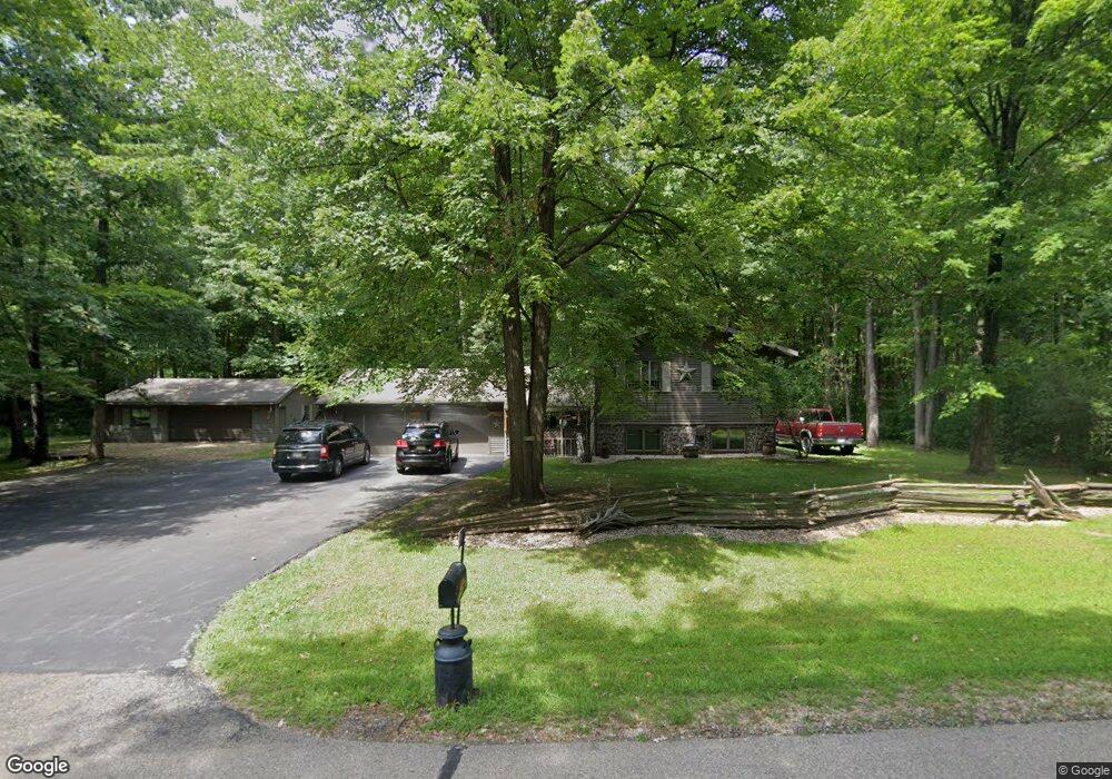
W7384 Maple Ave Shawano, WI 54166
Estimated Value: $262,000 - $313,000
2
Beds
1
Bath
1,838
Sq Ft
$162/Sq Ft
Est. Value
About This Home
This home is located at W7384 Maple Ave, Shawano, WI 54166 and is currently estimated at $297,562, approximately $161 per square foot. W7384 Maple Ave is a home located in Shawano County with nearby schools including Hillcrest Primary School, Brener Elementary School, and Shawano Community Middle School.
Ownership History
Date
Name
Owned For
Owner Type
Purchase Details
Closed on
Feb 15, 2024
Sold by
Estate Of Wayne S Peterson
Bought by
Peterson Cherie L
Current Estimated Value
Purchase Details
Closed on
Aug 11, 2016
Sold by
Peterson Ward R and Peterson ,
Bought by
Peterson and Peterson Ward R
Create a Home Valuation Report for This Property
The Home Valuation Report is an in-depth analysis detailing your home's value as well as a comparison with similar homes in the area
Purchase History
| Date | Buyer | Sale Price | Title Company |
|---|---|---|---|
| Peterson Cherie L | $184,600 | Heritage Law Firm, Llc | |
| Peterson | $146,000 | -- |
Source: Public Records
Tax History
| Year | Tax Paid | Tax Assessment Tax Assessment Total Assessment is a certain percentage of the fair market value that is determined by local assessors to be the total taxable value of land and additions on the property. | Land | Improvement |
|---|---|---|---|---|
| 2025 | $2,771 | $184,600 | $12,800 | $171,800 |
| 2024 | $2,605 | $184,600 | $12,800 | $171,800 |
| 2023 | $2,553 | $184,600 | $12,800 | $171,800 |
| 2022 | $2,272 | $184,600 | $12,800 | $171,800 |
| 2021 | $2,556 | $146,000 | $12,800 | $133,200 |
| 2020 | $2,451 | $146,000 | $12,800 | $133,200 |
| 2019 | $2,419 | $146,000 | $12,800 | $133,200 |
| 2018 | $2,350 | $146,000 | $12,800 | $133,200 |
| 2017 | $2,317 | $146,000 | $12,800 | $133,200 |
| 2016 | $2,332 | $146,000 | $12,800 | $133,200 |
| 2015 | $2,383 | $146,000 | $12,800 | $133,200 |
| 2014 | $239,576 | $146,000 | $12,800 | $133,200 |
| 2013 | $2,554 | $146,000 | $12,800 | $133,200 |
Source: Public Records
Map
Nearby Homes
- N5619 Riverside Dr
- 513 N Lafayette St
- 0 Buss Ct
- 250 Alpine Dr
- 130 S Andrews St
- 308 Fairview Way
- 108 S Humphrey Cir
- 217 E Center St
- 618 E Division St
- 231 E Center St
- 313 E Center St
- 331 S Main St
- 505 S Union St
- 127 Channel Trace
- 203 Channel Trace
- W7618 Poplar Rd
- 0 Willow Wood St Unit 50316603
- 0 Willow Wood St Unit 50316593
- 0 Willow Wood St Unit 50316590
- 213 W Wescott Ave
- N5750 Riverside Dr
- W7383 Maple Ave
- W7393 Maple Ave
- N5770 Riverside Dr
- 0 Maple Ave Unit 50036036
- 0 Maple Ave Unit 50031377
- W7365 Maple Ave
- w 7365 Maple Ave
- N5738 Riverside Dr
- W7339 Maple Ave
- N5788 Riverside Dr
- N5757 Riverside Dr
- N5749 Riverside Dr
- N5714 N Smalley St
- N5777 Riverside Dr
- N5743 Riverside Dr
- N5250 Maple Ave
- W7335 Maple Ave
- W7388 Elm Ave
- N5715 N Smalley St
Your Personal Tour Guide
Ask me questions while you tour the home.