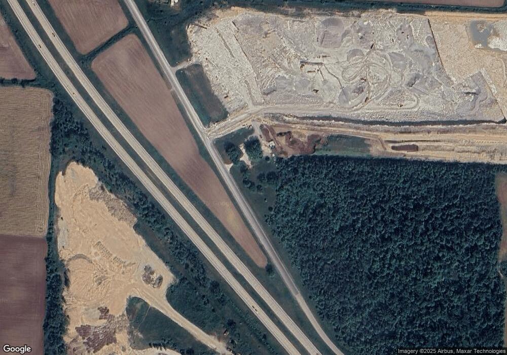
W788 Main Laney Dr Pulaski, WI 54162
Estimated Value: $325,000 - $523,000
Studio
--
Bath
--
Sq Ft
1.5
Acres
About This Home
This home is located at W788 Main Laney Dr, Pulaski, WI 54162 and is currently estimated at $424,000. W788 Main Laney Dr is a home located in Shawano County with nearby schools including Glenbrook Elementary School, Pulaski Community Middle School, and Pulaski High School.
Ownership History
Date
Name
Owned For
Owner Type
Purchase Details
Closed on
Jun 20, 2014
Sold by
James James
Bought by
Mckeefry Real Estate Llc
Current Estimated Value
Home Financials for this Owner
Home Financials are based on the most recent Mortgage that was taken out on this home.
Original Mortgage
$296,000
Interest Rate
4.12%
Mortgage Type
Commercial
Create a Home Valuation Report for This Property
The Home Valuation Report is an in-depth analysis detailing your home's value as well as a comparison with similar homes in the area
Home Values in the Area
Average Home Value in this Area
Purchase History
| Date | Buyer | Sale Price | Title Company |
|---|---|---|---|
| Mckeefry Real Estate Llc | -- | -- |
Source: Public Records
Mortgage History
| Date | Status | Borrower | Loan Amount |
|---|---|---|---|
| Closed | Mckeefry Real Estate Llc | $296,000 |
Source: Public Records
Tax History Compared to Growth
Tax History
| Year | Tax Paid | Tax Assessment Tax Assessment Total Assessment is a certain percentage of the fair market value that is determined by local assessors to be the total taxable value of land and additions on the property. | Land | Improvement |
|---|---|---|---|---|
| 2024 | $250 | $20,500 | $14,000 | $6,500 |
| 2023 | $248 | $20,500 | $14,000 | $6,500 |
| 2022 | $163 | $14,300 | $10,500 | $3,800 |
| 2021 | $158 | $14,300 | $10,500 | $3,800 |
| 2020 | $169 | $14,300 | $10,500 | $3,800 |
| 2019 | $192 | $14,300 | $10,500 | $3,800 |
| 2018 | $2,148 | $124,500 | $10,500 | $114,000 |
| 2017 | $2,073 | $124,500 | $10,500 | $114,000 |
| 2016 | $2,050 | $124,500 | $10,500 | $114,000 |
| 2015 | $1,978 | $124,500 | $10,500 | $114,000 |
| 2014 | $195,518 | $124,500 | $10,500 | $114,000 |
| 2013 | $2,372 | $124,500 | $10,500 | $114,000 |
Source: Public Records
Map
Nearby Homes
- 192 Whimbrel Ct
- 332 Rosemary Dr
- 1235 Putnam Dr
- 315 Johnson St
- 838 Sharon Ln
- 421 S Saint Augustine St
- 323 Front St
- 702 Carol Ln
- 0 Hwy 32 Unit 50298587
- 843 Redhawk Dr
- 163 Summit St
- N3879 Wisconsin 32
- N2636 Sumac Rd
- 0 E Pulaski St
- W2227 Redwood Dr
- 5637 Town Hall Dr
- Lt0 Deer Dr
- 5910 Old Hwy 29
- 5696 School Dr
- W1878 Hillside Dr
- W794 Main Laney Dr
- W796 Main Laney Dr
- W830 Main Laney Dr
- W863 Main Laney Dr
- W620 Main Laney Dr
- W1031 Main Laney Dr
- W926 Main Laney Dr
- W956 Main Laney Dr
- W959 Main Laney Dr
- W1370 Hwy E
- N1512 Laney Rd
- N1402 Green Valley Rd
- W981 Main Laney Dr
- W863 Hofa Park Dr
- W612 Hofa Park Dr
- W988 Hofa Park Dr
- W645 Hofa Park Dr
- W598 Hofa Park Dr
- N1598 Green Valley Rd
- W596 Hofa Park Dr
