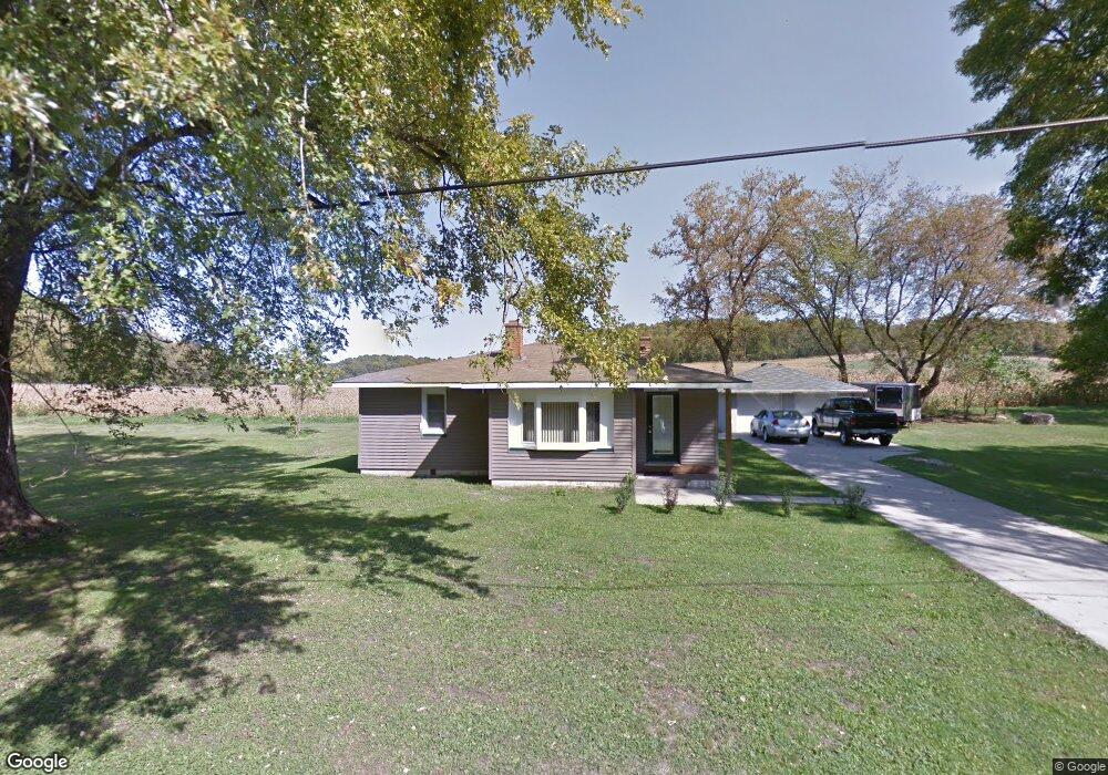
W8004 High Ridge Rd Fort Atkinson, WI 53538
Estimated Value: $214,000 - $549,000
--
Bed
--
Bath
--
Sq Ft
10,454
Sq Ft Lot
About This Home
This home is located at W8004 High Ridge Rd, Fort Atkinson, WI 53538 and is currently estimated at $347,278. W8004 High Ridge Rd is a home located in Jefferson County with nearby schools including Barrie Elementary School, Fort Atkinson Middle School, and Fort Atkinson High School.
Ownership History
Date
Name
Owned For
Owner Type
Purchase Details
Closed on
Apr 1, 2025
Sold by
Vos Kenneth J
Bought by
Vos Kenneth J and Vos Tammy M
Current Estimated Value
Purchase Details
Closed on
Dec 19, 2007
Sold by
Fort Community Cu
Bought by
Johnson Eugene I and Johnson Khristy L
Home Financials for this Owner
Home Financials are based on the most recent Mortgage that was taken out on this home.
Original Mortgage
$125,253
Interest Rate
6.17%
Mortgage Type
Purchase Money Mortgage
Purchase Details
Closed on
Nov 26, 2007
Sold by
Sullivan Todd J and Unknown Spouse Of Todd J Sullv
Bought by
Fort Commuity Cu
Home Financials for this Owner
Home Financials are based on the most recent Mortgage that was taken out on this home.
Original Mortgage
$125,253
Interest Rate
6.17%
Mortgage Type
Purchase Money Mortgage
Create a Home Valuation Report for This Property
The Home Valuation Report is an in-depth analysis detailing your home's value as well as a comparison with similar homes in the area
Home Values in the Area
Average Home Value in this Area
Purchase History
| Date | Buyer | Sale Price | Title Company |
|---|---|---|---|
| Vos Kenneth J | -- | None Listed On Document | |
| Johnson Eugene I | $125,000 | None Available | |
| Fort Commuity Cu | $142,802 | None Available |
Source: Public Records
Mortgage History
| Date | Status | Borrower | Loan Amount |
|---|---|---|---|
| Previous Owner | Johnson Eugene I | $125,253 |
Source: Public Records
Tax History Compared to Growth
Tax History
| Year | Tax Paid | Tax Assessment Tax Assessment Total Assessment is a certain percentage of the fair market value that is determined by local assessors to be the total taxable value of land and additions on the property. | Land | Improvement |
|---|---|---|---|---|
| 2024 | $2,754 | $125,500 | $35,200 | $90,300 |
| 2023 | $2,700 | $125,500 | $35,200 | $90,300 |
| 2022 | $2,900 | $125,500 | $35,200 | $90,300 |
| 2021 | $2,648 | $125,500 | $35,200 | $90,300 |
| 2020 | $2,513 | $125,500 | $35,200 | $90,300 |
| 2019 | $2,326 | $125,500 | $35,200 | $90,300 |
| 2018 | $2,281 | $125,500 | $35,200 | $90,300 |
| 2017 | $2,084 | $125,500 | $35,200 | $90,300 |
| 2016 | $2,250 | $125,500 | $35,200 | $90,300 |
| 2015 | $2,146 | $125,500 | $35,200 | $90,300 |
| 2014 | $2,205 | $125,500 | $35,200 | $90,300 |
| 2013 | $2,443 | $125,500 | $35,200 | $90,300 |
Source: Public Records
Map
Nearby Homes
- W7742 Lamp Rd
- W8738 White Crow Rd
- N799 Waubunsee Trail Unit 1
- N875 Eagle Ridge Dr
- N878 Eagle Ridge Dr
- N874 Eagle Ridge Dr
- N888 Eagle Ridge Dr
- N884 Eagle Ridge Dr
- N856 Eagle Ridge Dr
- N867 Eagle Ridge Dr
- N862 Eagle Ridge Dr
- N835 Eagle Ridge Dr
- 1709 Montclair Place
- N557 Cowpath Ln
- Lt40 Montclair Place
- Lot #1 Commerce Pkwy
- Lot #7 Commerce Pkwy
- Lot #10 Commerce Pkwy
- Lot #6 Commerce Pkwy
- 1612 Commonwealth Dr Unit 3
- W7999 High Ridge Rd
- W7990 High Ridge Rd
- W8005 High Ridge Rd
- W8019 High Ridge Rd
- W7989 High Ridge Rd
- W7986 High Ridge Rd
- W8023 High Ridge Rd
- W8027 High Ridge Rd
- W7980 High Ridge Rd
- W7981 High Ridge Rd
- W7970 High Ridge Rd
- W7969 High Ridge Rd
- W7963 High Ridge Rd
- W8045 High Ridge Rd
- N7952 High Ridge Rd
- W7959 High Ridge Rd
- W8049 High Ridge Rd
- W7952 High Ridge Rd
- W7953 High Ridge Rd
- W7948 High Ridge Rd