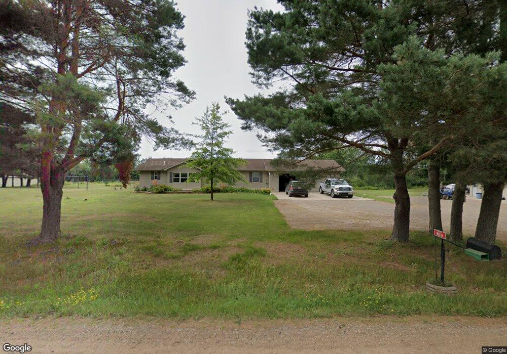
W8136 Cemetary Rd Ladysmith, WI 54848
Estimated Value: $301,000 - $437,000
--
Bed
--
Bath
--
Sq Ft
10
Acres
About This Home
This home is located at W8136 Cemetary Rd, Ladysmith, WI 54848 and is currently estimated at $347,851. W8136 Cemetary Rd is a home located in Rusk County with nearby schools including Ladysmith Elementary School, Ladysmith Middle School, and Ladysmith High School.
Ownership History
Date
Name
Owned For
Owner Type
Purchase Details
Closed on
Oct 26, 2018
Sold by
Diels Richard J and Diels Katherine R
Bought by
Effertz Jeffrey G and Effertz Janet L
Current Estimated Value
Home Financials for this Owner
Home Financials are based on the most recent Mortgage that was taken out on this home.
Original Mortgage
$152,000
Outstanding Balance
$133,380
Interest Rate
4.7%
Mortgage Type
New Conventional
Estimated Equity
$214,471
Purchase Details
Closed on
Jan 17, 2005
Sold by
Parker Robert L and Parker Shirley R
Bought by
Diels Richard A and Diels Katherine R
Create a Home Valuation Report for This Property
The Home Valuation Report is an in-depth analysis detailing your home's value as well as a comparison with similar homes in the area
Home Values in the Area
Average Home Value in this Area
Purchase History
| Date | Buyer | Sale Price | Title Company |
|---|---|---|---|
| Effertz Jeffrey G | $190,000 | None Available | |
| Diels Richard A | $10,000 | -- |
Source: Public Records
Mortgage History
| Date | Status | Borrower | Loan Amount |
|---|---|---|---|
| Open | Effertz Jeffrey G | $152,000 | |
| Closed | Diels Richard A | $0 |
Source: Public Records
Tax History Compared to Growth
Tax History
| Year | Tax Paid | Tax Assessment Tax Assessment Total Assessment is a certain percentage of the fair market value that is determined by local assessors to be the total taxable value of land and additions on the property. | Land | Improvement |
|---|---|---|---|---|
| 2024 | $2,902 | $163,900 | $17,000 | $146,900 |
| 2023 | $2,863 | $163,900 | $17,000 | $146,900 |
| 2022 | $2,850 | $163,900 | $17,000 | $146,900 |
| 2021 | $2,707 | $163,900 | $17,000 | $146,900 |
| 2020 | $2,874 | $163,900 | $17,000 | $146,900 |
| 2019 | $2,820 | $163,900 | $17,000 | $146,900 |
| 2018 | $2,707 | $125,800 | $14,800 | $111,000 |
| 2017 | $2,723 | $125,800 | $14,800 | $111,000 |
| 2016 | $2,700 | $125,800 | $14,800 | $111,000 |
| 2015 | $3,216 | $125,800 | $14,800 | $111,000 |
| 2014 | $2,291 | $125,800 | $14,800 | $111,000 |
| 2013 | $2,077 | $125,800 | $14,800 | $111,000 |
Source: Public Records
Map
Nearby Homes
- 1403 Aspen Ct
- 1005 E Bruno
- 9636 W Port Arthur Rd
- N5381 State Highway 27
- Lot 4 Bruno Ave
- 720 Summit Ave
- 1 State Highway 27
- 1229 Eagle Ct
- 814 E 4th St N
- 000 E 10th St N
- 600 Park Ave E
- 0 W 5th St N
- 8+ Acres On Thornapple River
- 719 E 11th St N
- 500 Menasha Ave E
- 1108 and 1108.5 Menasha Ave E Unit 2
- N6527 Timber Trail
- 304 River Ave E
- 711 Cleveland Ave W
- 301 E 15th St N
- W8136 Cemetary Rd
- W8136 Cemetary Rd
- W8156 Cemetery Rd
- W8156 Cemetary Rd
- w 8156 Cemetery Rd
- W8164 Cemetary Rd
- W8164 Cemetary Rd
- W8164 Cemetary Rd
- W8124 Cemetery Rd
- W8124 Cemetary Rd
- 814 E 4th Street St
- N1897 E River Run Road Rd
- 0 Knapp Road Rd Unit 1565207
- 000 W Fairway Drive Dr
- 80 Acres On Thornapple Road Rd
- 80 Acres Ducommun Road Rd
- 211 Corbett Avenue Ave
- 80 Acres Ducommun Rd
- XXX Candee Ln
- XXX Flambeau Rd