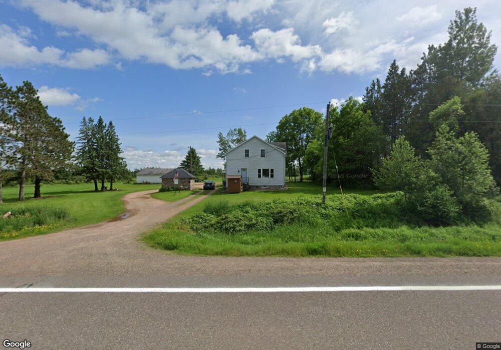
W8337 State Highway 64 Medford, WI 54451
Estimated Value: $159,000 - $278,000
--
Bed
--
Bath
--
Sq Ft
3.22
Acres
About This Home
This home is located at W8337 State Highway 64, Medford, WI 54451 and is currently estimated at $208,689. W8337 State Highway 64 is a home located in Taylor County with nearby schools including Medford High School.
Ownership History
Date
Name
Owned For
Owner Type
Purchase Details
Closed on
Dec 19, 2005
Sold by
Kohn David J and Kohn Jaymi S
Bought by
Kohn Neal D
Current Estimated Value
Home Financials for this Owner
Home Financials are based on the most recent Mortgage that was taken out on this home.
Original Mortgage
$102,600
Outstanding Balance
$58,051
Interest Rate
6.48%
Estimated Equity
$150,638
Create a Home Valuation Report for This Property
The Home Valuation Report is an in-depth analysis detailing your home's value as well as a comparison with similar homes in the area
Home Values in the Area
Average Home Value in this Area
Purchase History
| Date | Buyer | Sale Price | Title Company |
|---|---|---|---|
| Kohn Neal D | $108,000 | Gowey Abstract And Title Co |
Source: Public Records
Mortgage History
| Date | Status | Borrower | Loan Amount |
|---|---|---|---|
| Open | Kohn Neal D | $102,600 |
Source: Public Records
Tax History Compared to Growth
Tax History
| Year | Tax Paid | Tax Assessment Tax Assessment Total Assessment is a certain percentage of the fair market value that is determined by local assessors to be the total taxable value of land and additions on the property. | Land | Improvement |
|---|---|---|---|---|
| 2024 | $2,089 | $122,200 | $12,700 | $109,500 |
| 2023 | $1,967 | $122,200 | $12,700 | $109,500 |
| 2022 | $1,732 | $122,200 | $12,700 | $109,500 |
| 2021 | $2,007 | $126,100 | $10,800 | $115,300 |
| 2020 | $2,350 | $126,100 | $10,800 | $115,300 |
| 2019 | $2,355 | $126,100 | $10,800 | $115,300 |
| 2018 | $2,289 | $126,100 | $10,800 | $115,300 |
| 2017 | $2,295 | $126,100 | $10,800 | $115,300 |
| 2016 | $2,237 | $126,100 | $10,800 | $115,300 |
| 2015 | $2,261 | $126,100 | $10,800 | $115,300 |
| 2014 | $2,181 | $126,100 | $10,800 | $115,300 |
| 2013 | $2,221 | $126,100 | $10,800 | $115,300 |
Source: Public Records
Map
Nearby Homes
- N3315 Brook Dr
- +/-79.03 Acres Center Ave
- +/-17.8 Acres Division Dr
- W6945 County Road O
- W6880 Maplewood Ln
- 1114 W Broadway Ave
- 1600 E Main St
- N4443 Crappie Rd
- 00 Oak Dr
- N896 County Rd E
- W7544 Buckets Ln
- N3282 Woodland Rd
- N5044 Lang Farm Dr
- +/- 56.37 Acres County Highway O
- 652 N 2nd St
- 227 S Park Ave
- 529 N 2nd St
- 0 Perkinstown Ave Unit 50305963
- N5178 Sackett Dr
- 210 N Main St
- W8405 State Highway 64
- W8433 State Highway 64
- W8497 State Highway 64
- W8155 State Highway 64
- W8122 State Highway 64
- W8579 State Highway 64
- W8093 State Highway 64
- W8065 State Highway 64
- W8054 State Highway 64
- W8637 State Highway 64
- W8637 State Highway 64
- W8637 State Highway 64
- W8658 State Highway 64
- N2761 Wren Dr
- N2789 Wren Dr
- W8585 State Highway 64
- N2691 Wren Dr
- W7984 State Highway 64
- W7987 State Highway 64
- N2850 Howard Dr