
Seller's Agent in 2024
Raymond Ingebretsen
RE/MAX
(218) 780-3007
257 Total Sales
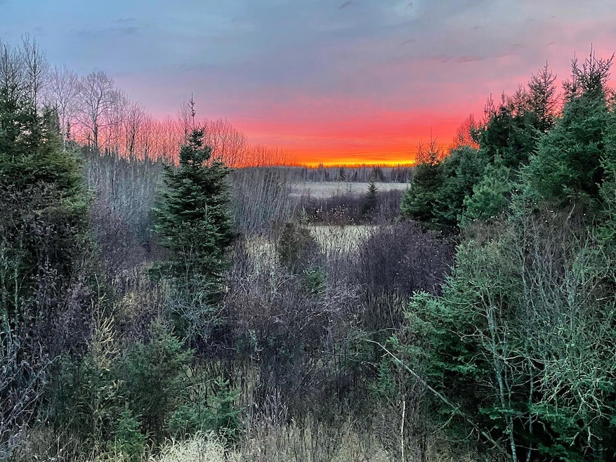

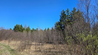
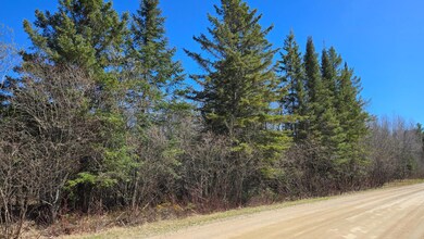
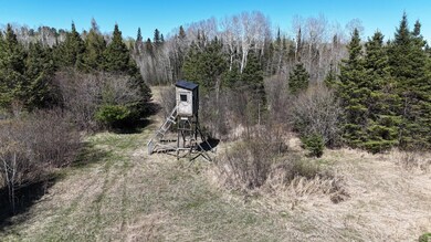
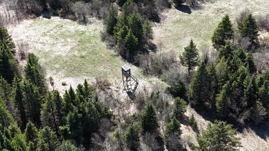
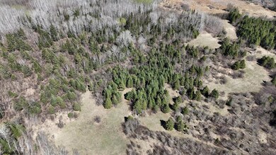
Enjoy privacy, relaxation, wildlife viewing, or hunting on these remote 34.67 rolling acres of mixed elevation and tree cover. Property has trail system throughout with a few deer stands that will stay with the sale. A few low areas to bring in wildlife. Adjoins state land to the West and East. Short 9-mile drive to the Pelican boat landing and 24 miles to the Cook end of Lake Vermilion to fish, two of the best area fishing lakes. This recreational property is near the Arrowhead Snowmobile trail system. Gated driveway.
| Date | Buyer | Sale Price | Title Company |
|---|---|---|---|
| Seba Jeffrey | $63,000 | None Listed On Document | |
| Haslam Charles J | -- | None Available | |
| Haslam Charles J | -- | None Available | |
| Haslam Charles James | $30,000 | Northeast Title Company | |
| Carlson Duane W | $37,000 | None Available |
| Date | Event | Price | List to Sale | Price per Sq Ft |
|---|---|---|---|---|
| 08/09/2024 08/09/24 | Sold | $63,000 | -6.7% | -- |
| 07/29/2024 07/29/24 | Pending | -- | -- | -- |
| 05/13/2024 05/13/24 | For Sale | $67,500 | -- | -- |
| Year | Tax Paid | Tax Assessment Tax Assessment Total Assessment is a certain percentage of the fair market value that is determined by local assessors to be the total taxable value of land and additions on the property. | Land | Improvement |
|---|---|---|---|---|
| 2024 | $512 | $63,500 | $63,500 | $0 |
| 2023 | $512 | $58,700 | $58,700 | $0 |
| 2022 | $478 | $48,100 | $48,100 | $0 |
| 2021 | $352 | $39,100 | $39,100 | $0 |
| 2020 | $330 | $35,500 | $35,500 | $0 |
| 2019 | $322 | $32,200 | $32,200 | $0 |
| 2018 | $326 | $32,200 | $32,200 | $0 |
| 2017 | $354 | $32,100 | $32,100 | $0 |
| 2016 | $216 | $32,900 | $32,100 | $800 |
| 2015 | $225 | $20,100 | $20,100 | $0 |
| 2014 | $225 | $20,100 | $20,100 | $0 |
Seller's Agent in 2024
Raymond Ingebretsen
RE/MAX
(218) 780-3007
257 Total Sales
Buyer's Agent in 2024
Riley Lind
eXp Realty
(218) 535-5325
109 Total Sales
Source: NorthstarMLS
MLS Number: 6535438
APN: 425003003900
Disclaimer: Certain information contained herein is derived from information provided by parties other than Homes.com. All information provided is deemed reliable, but is not guaranteed to be accurate and should be independently verified.
![]() Based on information submitted to the MLS GRID. All data is obtained from various sources and may not have been verified by broker or MLS GRID. Supplied Open House Information is subject to change without notice. All information should be independently reviewed and verified for accuracy. Properties may or may not be listed by the office/agent presenting the information. Some IDX listings have been excluded from this website.
Based on information submitted to the MLS GRID. All data is obtained from various sources and may not have been verified by broker or MLS GRID. Supplied Open House Information is subject to change without notice. All information should be independently reviewed and verified for accuracy. Properties may or may not be listed by the office/agent presenting the information. Some IDX listings have been excluded from this website.
Based on information submitted to the MLS GRID
Ask me questions while you tour the home.