$326,502Average Value$138Average Price per Sq Ft5Homes For Sale
The South End builds back
The history of La Fiorentina Pastry Shop tells the ups and downs of the historic South End neighborhood. Thousands of Italians immigrated to Springfield and settled in the South End in the early 1900s. Wealthy Springfield residents lived on the bluff on the neighborhood’s north end, while the newly arrived immigrants in the heart of the South End opened bakeries, restaurants and delis, including La Fiorentina, which debuted in 1946. “They had their own businesses they developed,” says Bill Fiore, an agent with William Raveis Real Estate who grew up in Springfield. “Some are still in business today as different generations have taken over.” In the following decades, many residents left South End. Some families were forced to leave in the ‘60s when the construction of Interstate 91 through the neighborhood destroyed 400 homes. More trouble followed in 2011 when a tornado ripped through the South End. In 2012, La Fiorentina opened another location in East Longmeadow, a small city south of Springfield, as the bakery followed its customers to the suburbs, Fiore says.
Still, the neighborhood south of Springfield’s downtown has persisted, thanks in part to the core of longstanding businesses, such as La Fiorentina, that line Main Street in the center of the South End. The neighborhood around that commercial strip is resurging, with amenities destroyed by the tornado being replaced and new homes being built.
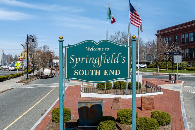
Welcome To Springfield's South End Neighborhood
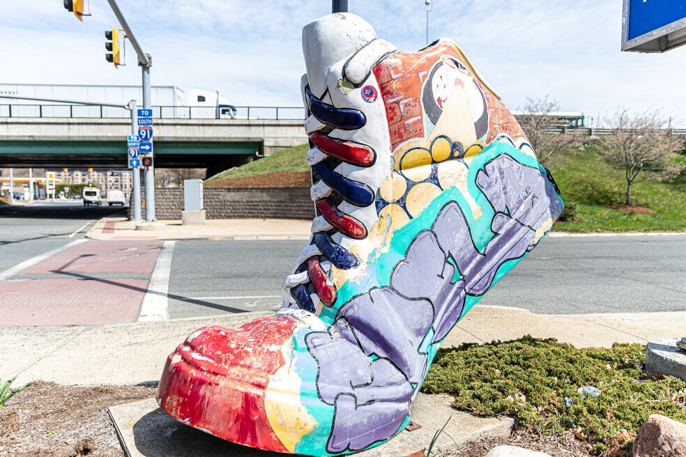
Every Home In The South End Is Only A Few Minutes Drive From An Entrance To I-91
1/2
Longstanding Italian businesses
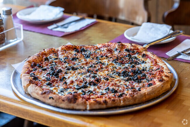
Along Main Street, Zonin’s Gourmet Market makes its Italian sausage using the same recipe it used when the shop opened in 1927. A few blocks up Main Street, Red Rose Pizzeria serves many of the same recipes founder Edda Caputo brought with her from Naples in the early ‘60s. The neighborhood has evolved from an Italian enclave to a multiethnic community, with small markets selling Hispanic groceries opening over the years. The largest nearby grocery store is Food Zone International Supermarket about a mile southeast of the neighborhood.
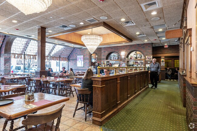
Red Rose Pizzeria Has Several Dining Rooms With Seating Capacity For As Many As 400 Hungry Customers
Red Rose Has A Full Menu Of Italian Favorites But The Award Winning Pizza Is Their Specialty
1/2
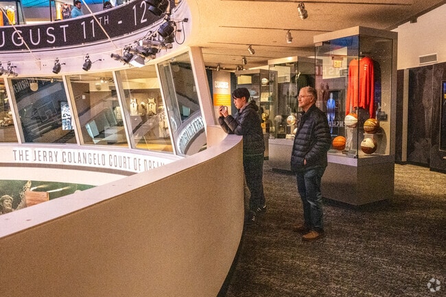
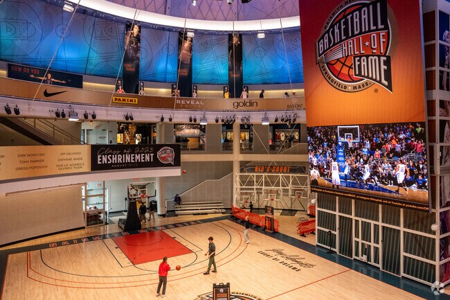
Home of the Basketball Hall of Fame
A three-story silver sphere rising along the Connecticut River houses the Naismith Memorial Basketball Hall of Fame. James Naismith is credited with inventing basketball in 1891 while teaching at Springfield College. Every year, a new class of players and coaches travel to Springfield to be inducted and join more than 450 others who are enshrined in the Hall of Fame. The institution’s museum portion recounts basketball’s history and displays artifacts, such as the jersey Wilt Chamberlain wore when he scored a record 100 points in a 1962 game. The Hall of Fame completed a $25 million renovation in 2021, adding interactive elements to exhibits, so visitors can test their knowledge about famous basketball plays or virtually appear alongside Shaquille O’Neal in an episode of “Inside the NBA.” A full-size basketball court in the center of the Hall of Fame is typically open to visitors who want to shoot around, but it also hosts high school tournaments and charity games.
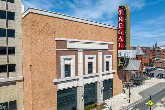
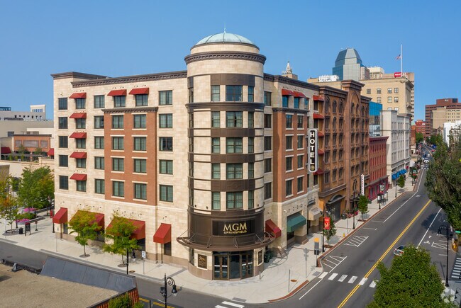
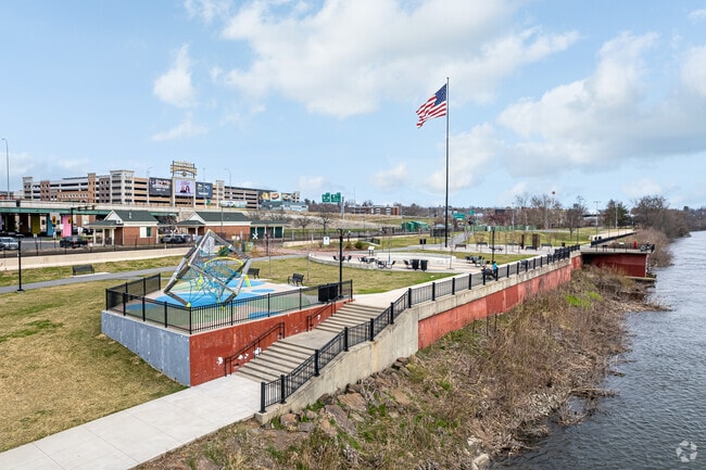
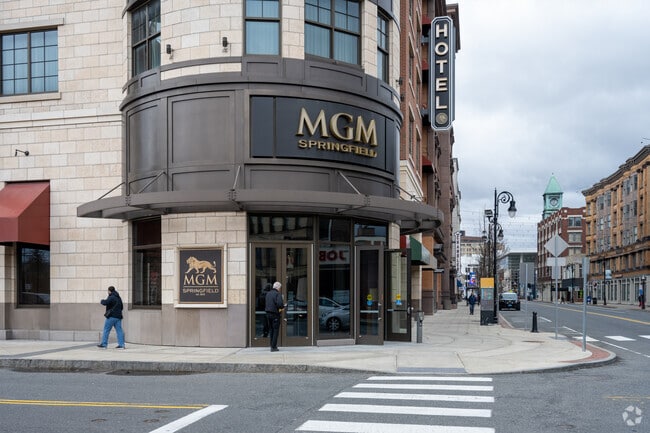
The MGM Springfield opened on the neighborhood’s northwest end in 2018. The 125,000-square-foot gaming floor features slot machines, table games and a sportsbook. In addition to gaming, the casino brought a comedy club, restaurants and Topgolf. There’s a free garage where people can park and walk downtown, even if they’re not visiting the casino.
The MGM Casino Stretches Between Downtown Springfield And The South End
Some kids play on the court in the Naismith Memorial Basketball Hall of Fame in South End.
1/2
Neighborhood layout dates to the 17th century
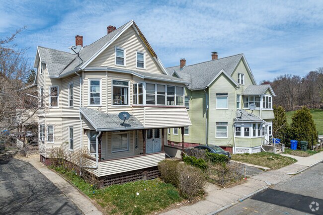
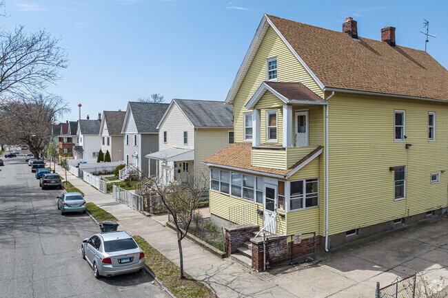
When the English arrived in South End starting in the 1600s, each family received two narrow lots of land. One would stretch from the main road to the Connecticut River, and that’s the lot they would build their homes on. The other lot extended east of the road, and the family used it for harvesting firewood and building lumber. South End has the same layout today, with Main Street in the center of the neighborhood and side streets built over those lots. Today those side streets are lined with homes, their front porches bordering sidewalks and leaving no room for front yards. However, they typically have small backyards. Most South End residents rent, some living in one of the Queen Anne-style multifamily houses. Multifamily prices range from $200,000 to $430,000. Small single-family Victorians are on the south end; single-family homes are priced in the $200,000s. Home City Development built 40 townhouses in 2024 on the former site of a burned-down textile mill. The townhouses, priced between $170,000 and $230,000, are only available to first-time buyers. The neighborhood’s CAP Index Crime Score is 8 out of 10, with 10 indicating highest crime. That’s much higher than the national average of 4.
Two Family Homes Can Be Found On Many Of The South End's Residential Streets
Housing In The South End Is Mostly A Mix OF Single And Two Family Homes
1/2
Exploring the riverfront
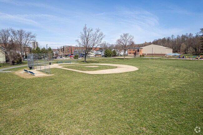
A portion of the nearly 4-mile Connecticut River Walk and Bikeway stretches through South End. Pedestrians and cyclists on the paved path get views of the river to the west and occasional glimpses of the Springfield skyline to the east. Users can exit the trail on its north end and walk less than half a mile to reach the heart of Metro Center, Springfield’s downtown. Meanwhile, children have played at Emerson Wright Playground for more than a century. The park’s splash pad is open during the summer, the same time of year when an inflatable projector screen pops up to show a kid-friendly film as part of the city’s Movies in the Park series. The 2011 tornado destroyed the original South End Community Center, but a new center opened at Emerson Wight Playground in 2017. The center organizes after-school programs and basketball leagues for kids from toddlers to teens.
The Ball Fields And Playground At Emerson Wight Park Provide South End Residents With Recreation Opportunities
Walk Along The Connecticut River in South End.
1/2
Career pathways at High School of Commerce
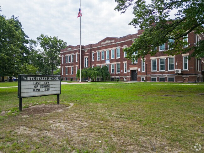
Children can go to White Street School, a public elementary school that receives a Niche grade of C, and after fifth grade attend C-minus-rated South End Middle School. When students reach eighth grade, Springfield Public Schools allows families to select their preferred high schools in January and February. A lottery in March and April determines what high school children attend. One of the closest is C-scored High School of Commerce. Ninth graders at the high school can choose from one of three career pathways — advanced manufacturing, health & human services and information technology — that will influence their courses for the next four years.
White Street Elementary School keeps kids minds intact.
South End Middle School Serves Students Grades Six Through Eight
1/2
Taste of Italy at Our Lady of Mount Carmel
Since 1992, Our Lady of Mount Carmel has put together a feast of pasta, pastries and wine during Taste of Italy every October. Following Mass at the Catholic church, dozens dine at long tables inside South End Middle School. Our Lady of Mount Carmel founded the event nearly 90 years after Italian immigrants started the parish in 1907. On the other side of Main Street from the church, the Italian Cultural Center of Western Mass hosts Italian language classes and cooking classes. Members pay discounted fees, but non-members can join the cultural center’s programs.
Walking and bussing to downtown Springfield
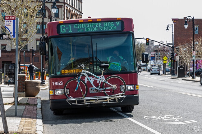
Most homes are within a third of a mile of Main Street, so residents can walk to one of the restaurants or stores along the road in as little as five minutes. Main Street is lined with Pioneer Valley Transit Authority stops, where buses pick up passengers on their way to Metro Center and Mercy Medical Center, one of Springfield’s largest hospitals. In Metro Center, Union Station serves as an Amtrak stop for trains headed to Boston, Albany and New York. Interstate 91 cuts through the west side of the neighborhood, routing to cities north of Springfield, such as Chicopee and Holyoke. Drivers can also take the interstate 20 miles south to Bradley International Airport and 12 miles farther to Hartford.
Public Transit Is Plentiful In The South End With Bus Routes Connecting To Nearby Towns Or Union Station
This is an entrance of the MGM Casino on Main St in South End.
GreatSchools:
The GreatSchools Rating helps parents compare schools within a state based on a variety of school quality indicators and provides a helpful picture of how effectively each school serves all of its students. Ratings are on a scale of 1 (below average) to 10 (above average) and can include test scores, college readiness, academic progress, advanced courses, equity, discipline and attendance data. We also advise parents to visit schools, consider other information on school performance and programs, and consider family needs as part of the school selection process.
View GreatSchools Rating Methodology
Are you familiar with the South End neighborhood?
to let others know what life in this neighborhood is like.
Crime and Safety
1 - Low Crime, 10 - High Crime
South End
US
Homicide
8
4
Sexual Assault
8
4
Assault with Weapon
9
4
Robbery
8
4
Burglary
5
4
Motor Vehicle Theft
5
4
Larceny
6
4
Crime Score
7
4
Source: WhatIsMyCrimeRisk.com
South End Demographics and Home Trends
On average, homes in South End, Springfield sell after 353 days on the market compared to the national average of 54 days. The median sale price for homes in South End, Springfield over the last 12 months is $206,000, up 9% from the median home sale price over the previous 12 months.
Prime Investment Opportunity in a Cul-de-Sac Location! This generously sized 2-family home offers strong income potential, with a delead-certified first-floor unit (3 bed, 1 bath—not shown in floor plans) and recent updates including newer air handlers and a newer roof, 2025 full exterior paint job. The property features a fenced-in back and side yard, perfect for tenants or outdoor storage. The
Matthew LangloisKeller Williams Realty Signature Properties
Presenting Springfield's newest affordable condominium community! The Gemini Townhomes features 2- and 3-bedroom (including handicap accessible), new construction, units. Each unit will feature new vinyl plank and ceramic flooring, shaker-style cabinets, granite countertops, stainless steel, energy efficient appliances, and modern fixtures and finishes throughout. These condominiums are
Presenting Springfield's newest affordable condominium community! The Gemini Townhomes features 2- and 3-bedroom (including handicap accessible), new construction, units. Each unit will feature new vinyl plank and ceramic flooring, shaker-style cabinets, granite countertops, stainless steel, energy efficient appliances, and modern fixtures and finishes throughout. These condominiums are
Presenting Springfield's newest affordable condominium community! The Gemini Townhomes features 2- and 3-bedroom (including handicap accessible), new construction, units. Each unit will feature new vinyl plank and ceramic flooring, shaker-style cabinets, granite countertops, stainless steel, energy efficient appliances, and modern fixtures and finishes throughout. These condominiums are
Built in 1879, 270 Maple Street—historically known as the Frederick Harris House and more recently as Valentine Mansion—is a remarkable 30-room historic estate spanning 11,102 square feet. The largest single-family home in Springfield’s “City of Homes,” it features a 40-foot grand ballroom, ornate floor-to-ceiling hand-carved fireplaces, 12 bedrooms, 6.5 bathrooms, and what may be the city’s
Attention Investors! This property Located on main st, Springfield. This is mixed use commercial and residential use. There are three front stores open to each other and they use it as a church, second floor has two residential units, one has 3 bedrooms and 2 bathrooms, a living room, and a kitchen. The second unit has 2 bedrooms and 2 bathrooms, living room and kitchen. Third floor has 4 units,
Income-Producing 2-Family Home – Spacious, Versatile & Ideally Located!Unlock incredible potential with this oversized 2-family property featuring 9 total bedrooms and 3 bathrooms. Whether you’re an investor or an owner-occupant, this home offers a rare opportunity:• Turnkey income from the first-floor unit already rented month-to-month• Second-floor unit delivered vacant at closing – perfect for
Presenting Springfield's newest affordable condominium community! The Gemini Townhomes features 2- and 3-bedroom (including handicap accessible), new construction, units. Each unit will feature new vinyl plank and ceramic flooring, shaker-style cabinets, granite countertops, stainless steel, energy efficient appliances, and modern fixtures and finishes throughout. These condominiums are
Welcome home to this first floor 3-bedroom, 1-bath rental tucked away on a quiet residential street, while still offering easy access to major highways and everyday conveniences. The Unit features an open floor concept that is both comfortable and functional with a bright living space and well-sized bedrooms. Enjoy the rare bonus of a large backyard and private parking adding to the ease to your
New Colony Court Apartment homes is among the city of Springfield's largest apartments with spacious floor plans, nine foot ceilings and hardwood floors. Many homes include full size dining rooms often used as an office. At New Colony Court you will enjoy plush landscaped community. The convenience of an on-site bus stop. Plus just minutes from down town Springfield, Major Highways. Convenient to
Welcome home to this freshly updated and newly painted second-floor apartment in the heart of Downtown Springfield. This move-in-ready unit offers three bedrooms plus a bonus room with endless possibilities, filled with natural light, and an eat-in kitchen with brand-new stainless-steel appliances. Conveniently located near downtown dining, shopping, entertainment, and major highways. Book your
Welcome home to this freshly updated and newly painted first-floor apartment in the heart of Downtown Springfield. This move-in-ready unit features three bedrooms, abundant natural light, and an eat-in kitchen with a black refrigerator and stainless-steel range and microwave. Conveniently located near downtown dining, shopping, entertainment, and major highways. Book your showings today! This
Welcome home to this freshly updated and newly painted first-floor apartment in the heart of Downtown Springfield. This move-in-ready unit features three bedrooms, abundant natural light, and an eat-in kitchen with brand-new stainless-steel appliances. Conveniently located near downtown dining, shopping, entertainment, and major highways. Book your showings Today! This unit has a Certificate of
Welcome home to this freshly updated and newly painted second-floor apartment in the heart of Downtown Springfield. This move-in-ready unit features three bedrooms, abundant natural light, and an eat-in kitchen with a white electric range and microwave. Conveniently located near downtown dining, shopping, entertainment, and major highways. Book your showings today! This unit has a Certificate of
Local Logic measures the walkability, access to public transit and bikeability of any address. CAP Index provides objective, accurate, and consistent data to help measure, compare, and mitigate crime risks.
Disclaimer: Certain information contained herein is derived from information provided by parties other than Homes.com. Our sources include: Accuweather, Public Records and Neustar. All information provided is deemed reliable, but is not guaranteed to be accurate and should be independently verified.